2020. I can anticipate “2020” being using in the future as some defeatist adjective to describe missed opportunities, cancelled activities, or general dysfunction. “That’s so 2020”, all the kids will say.
Every race was cancelled in the 2020 season. I had hit the virtual bike trainer all winter and registered for swim lessons in the spring to hopefully participate in my first triathlon this year, but as with everyone, Covid-19 had other plans. So with no formal races to keep me motivated I wanted to at least get out for a few long trails runs. I had always wanted to run the Assiniboine trail, but due to logistics ended up mapping out a route much longer than originally intended. Being a point to point run, and going solo, I had planned on leaving my car out in the mountains for a week until I could come back and get it.
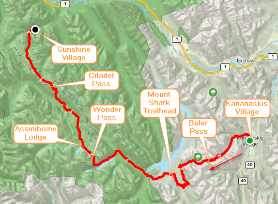
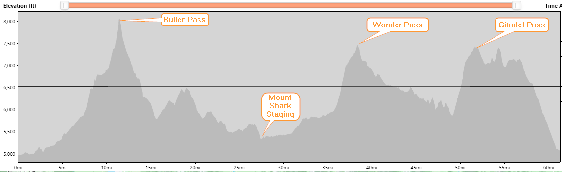
The plan was to park at Kananaskis Village, run Ribbon Creek through Buller Pass, down Buller trail, along High Rockies to Mount Shark staging area, over Wonder Pass to Assiniboine Lodge, then up Citadel Pass through Sunshine Meadows to Sunshine Village and finally down to Sunshine Gondola parking lot:
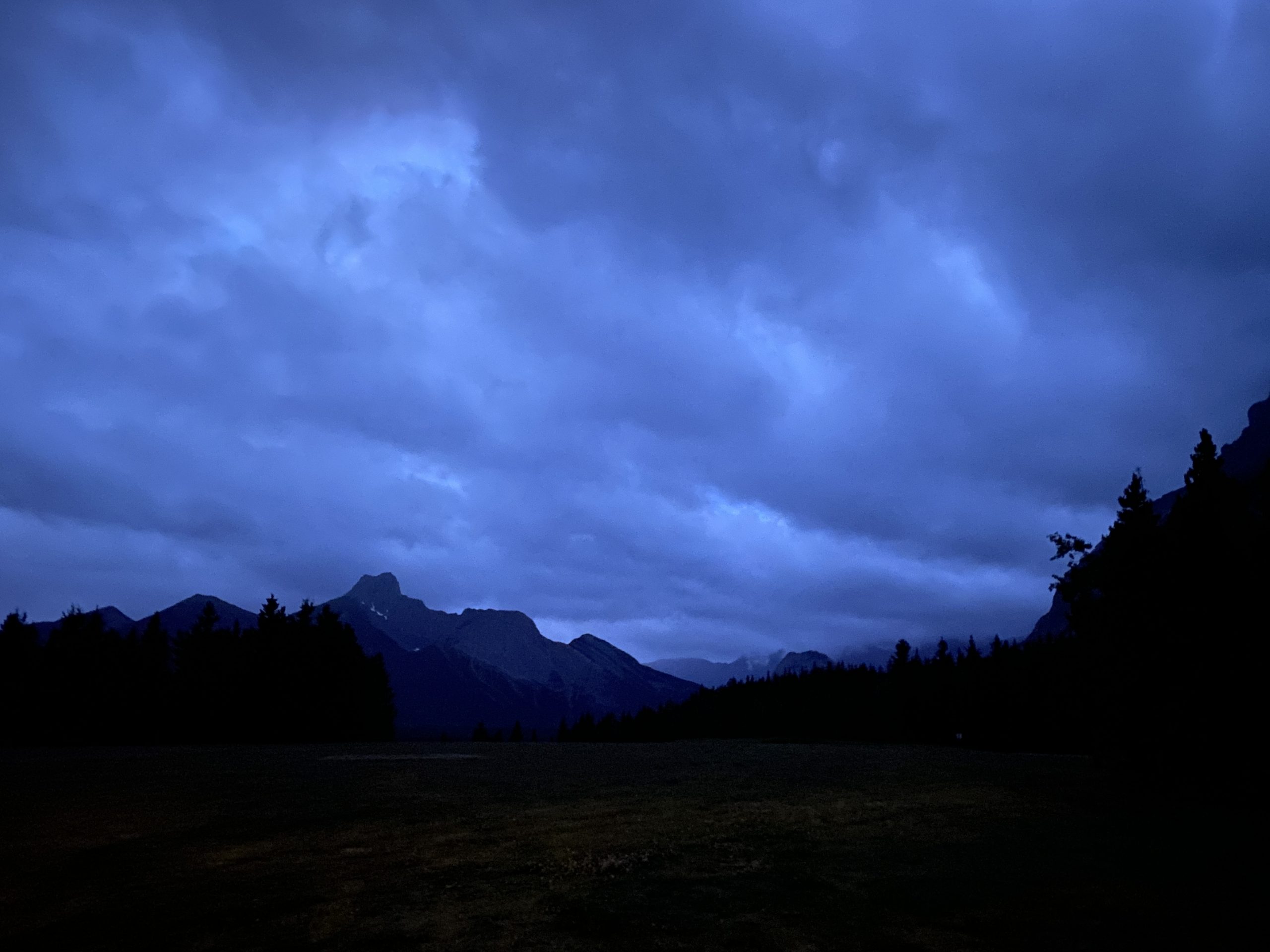
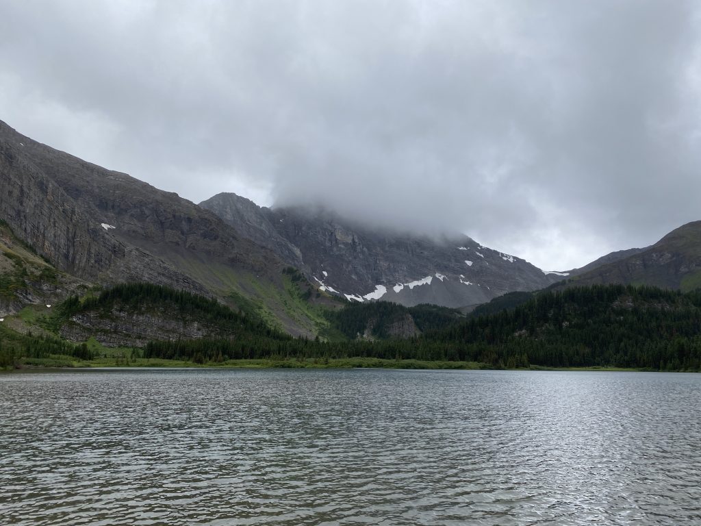
I mapped it out and it came in an estimated 90km. I had done Mount Shark to Sunshine Village section on a hike a few years back, so I felt there were enough knowns to be able to accurately predict my pace and completion time. The forecast was cool and misty which makes for great trail running, but not so great for pictures or scenic value. After a few weeks of hot dry weather it seemed like fate to have a cooler day to crunch out a long run.
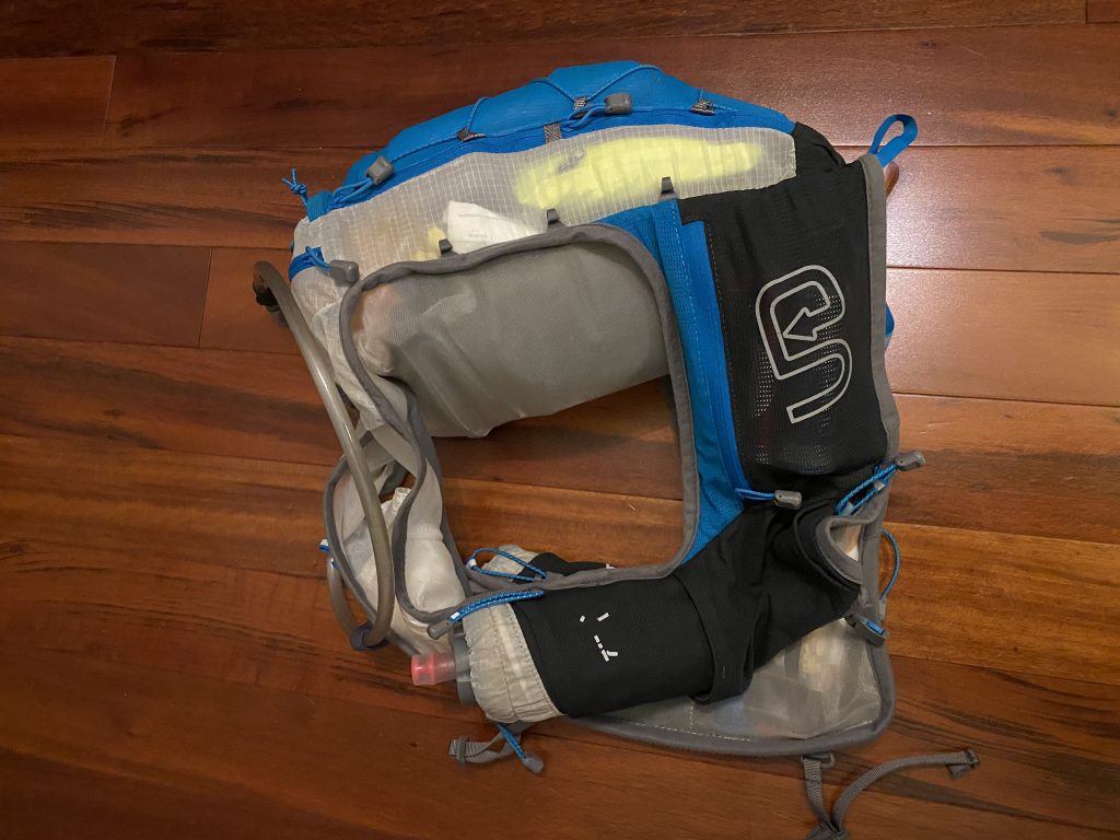
I really tried to travel as light as I could, but there are some common sense items which I just couldn’t leave behind:
- Garmin InReach – proves communication ability while in the mountains
- Bear Spray w/ Scat Holder – it’s no good if you cant get to it quickly
- Headlamp – will be dark when I start, hopefully not when I finish
- Katadyn BeFree filter – amazing inline water purification bottle
- 3L of water – one 2L bladder and 2x500ml soft bags
- Food – I always bring more food than I need just to be prepared
- Windbreaker
- Emergency blanket, first aid kit, battery pack
- Lots of pre-applied chafe lube!
Everything else was just nice to haves that made the cut.
I was hoping to go as light as possible, however once fully loaded the pack still came in at 6kg (with all the water).
My alarm went off at 3:45, giving me enough time to finish packing, eat breakfast and get out to the trail by 5am. It was raining for much of the drive out, but once I arrived at the Kananaskis Lodge parking lot it had dissipated to light mist.
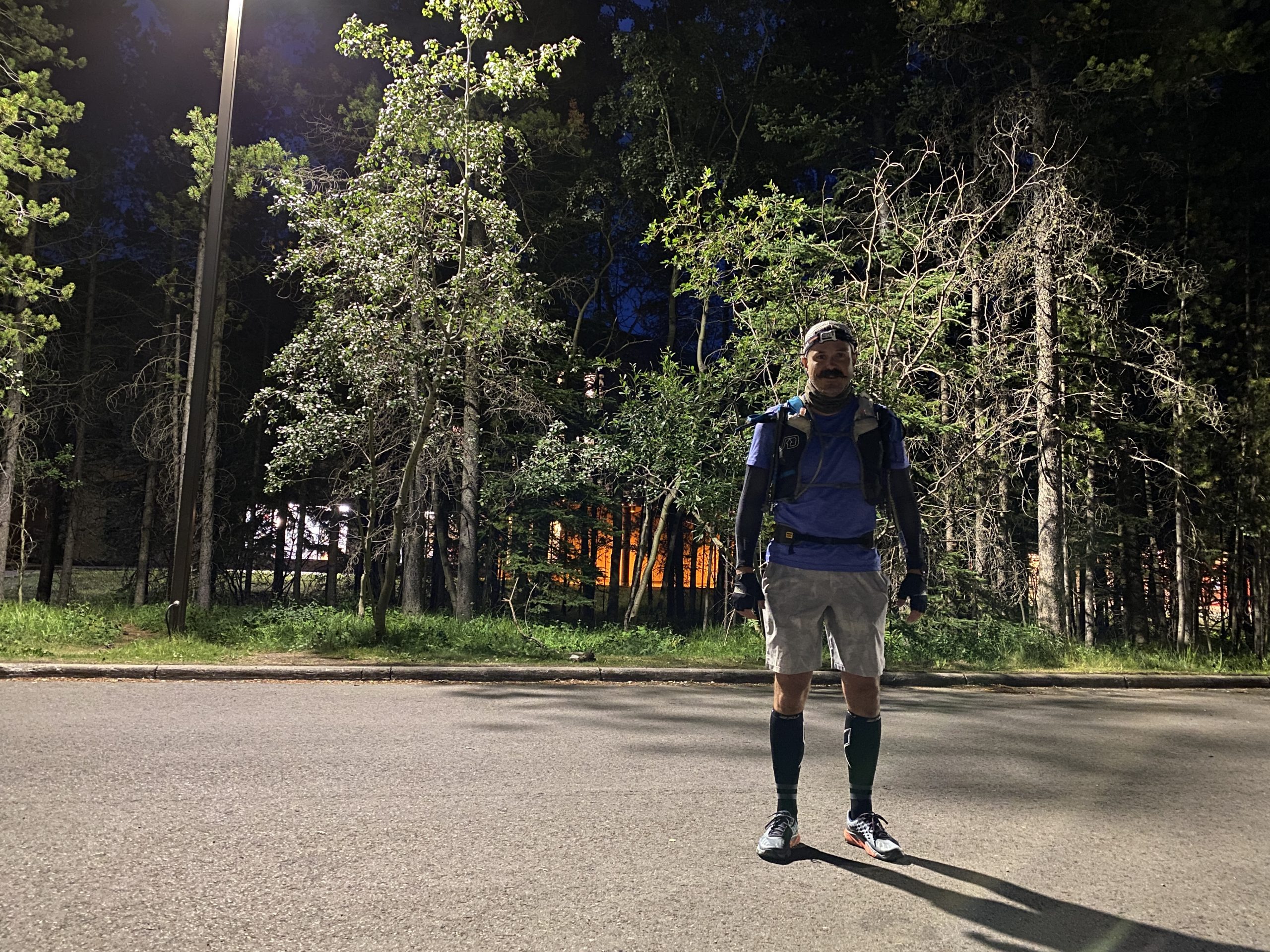
I hit the trail which immediately brought me into the darkest of dark. My only concern on this adventure was running into Bears. This time of year they come down from the mountains to gorge on the plentiful berries that are ripe and juicy. Plunging into the dark silence gave me an overwhelming feeling of trepidation that I would stumble into Grizzly. As the path narrowed and the brush got thicker, my trepidation turned into a bit of fear and agitation, enough so that I had my bear spray out and white nuckled in one hand. As trails forked I was really happy to have loaded my route on to Gaia GPS, an app running on my phone. Its an awesome app and replaced my old Garmin handheld that bounced out of my bag last year during a trail run (if anyone finds an eTrex in Kananaskis let me know!)

As I reached Ribbon creek dawn was providing enough light that I could remove my headlamp. The trail here was significantly impacted by the flood of 2013, many parts were washed away and have since been re-routed further up the hillside. With the sun about to rise and the rain having stopped I was feeling great.


My feet were drenched and I wasnt thrilled to have wet feet, with no extra socks this early in the day knowing that i was going to have the rest of the day with soaking feet.
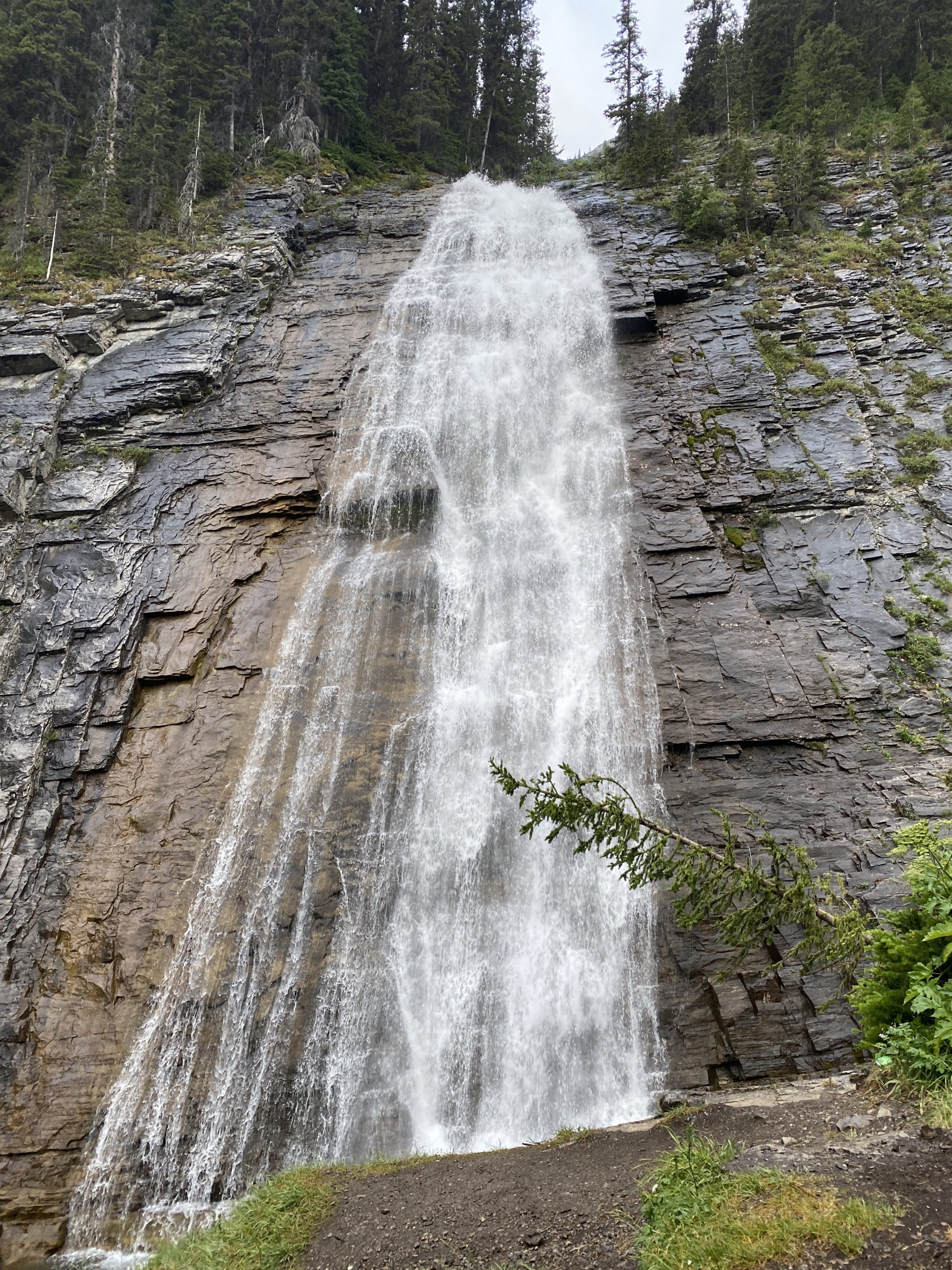
I reached Ribbon Falls ahead of my anticipated schedule and scramble up the wet chains. They were pretty easy especially with no large pack, but I never like the feeling of slips having consequences. I got a pretty good cell signal at the top of the falls and it was right about the time my boys would be eating breakfast so I made a facetime call and said good morning from the top of the falls.
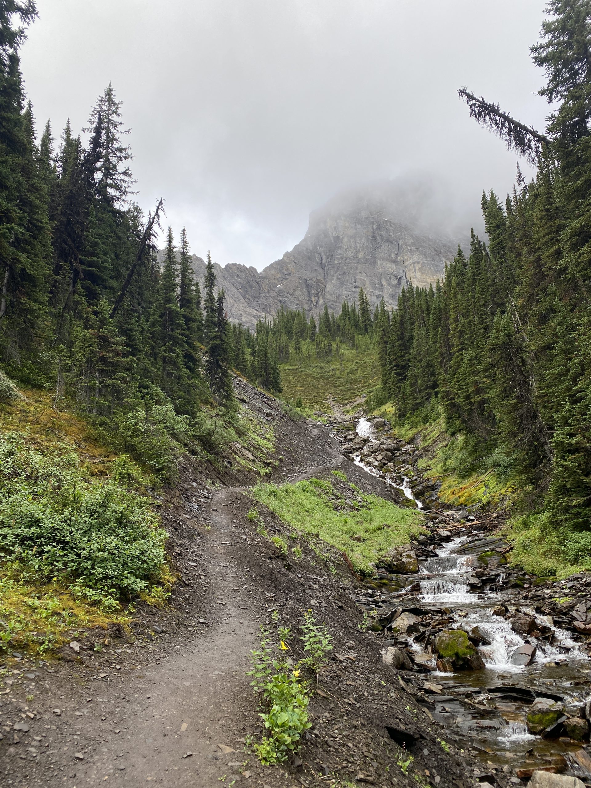
I refilled my bottles at Ribbon Lake before climbing up Buller Pass. The wind was tearing through the pass and my hands quickly became frozen.
The top of the pass was stunning, right out of Lord of the Rings. Without the wind, and the desire to keep moving, I could have stayed up there much longer.

Coming down Buller Pass was great: nice single track and an easy grade to just open it up. At this point my voice was starting to fade from all the bear warning yelps. Bear scat was plentiful, and with no sightings I can only assume the constant hollering was working.
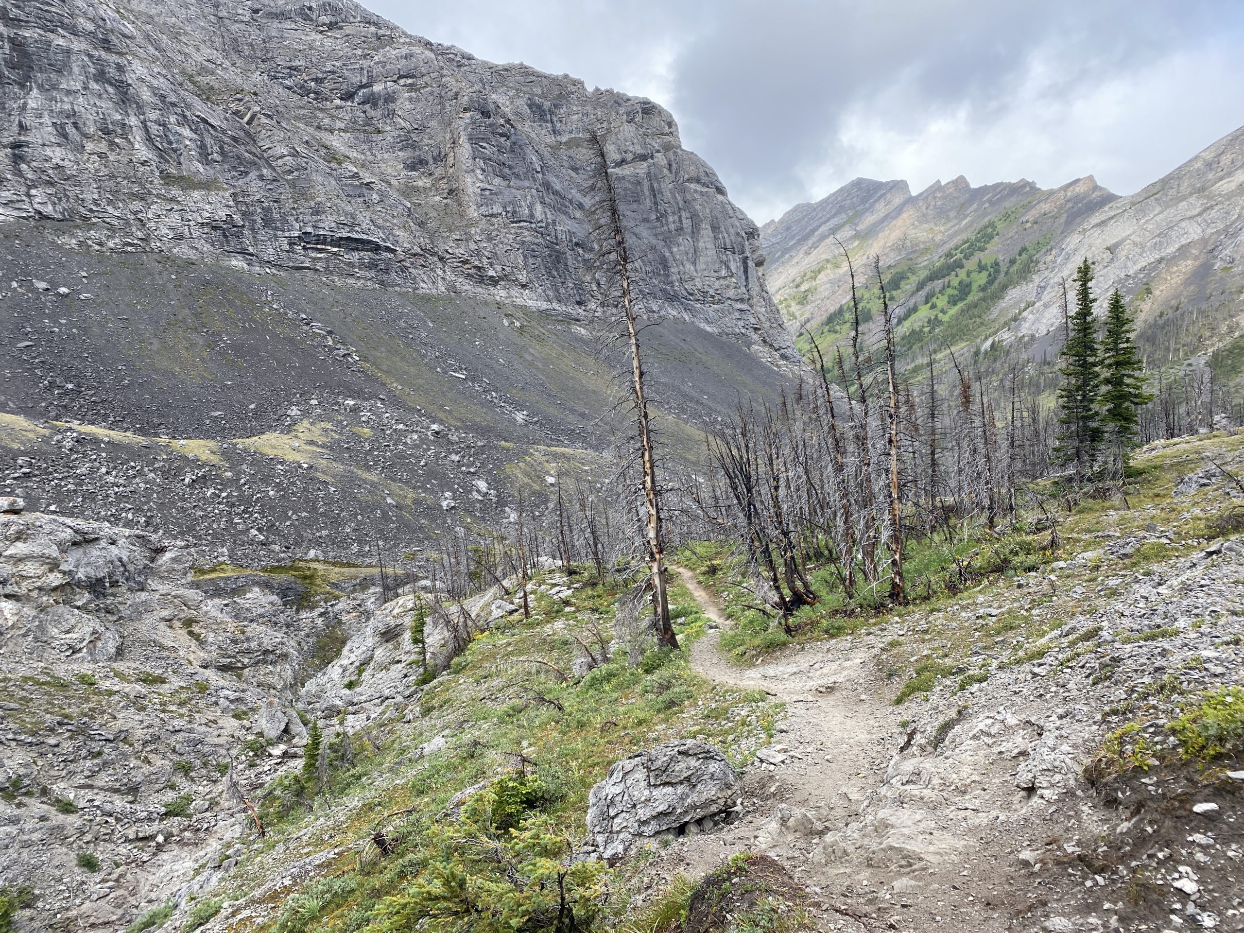
At the bottom of Buller I met the first humans of the day. It was great to see people on the trails after a morning of solitude, and it gave me newfound energy. From here a junction connected me with High Rockies trail which took me in a 10km detour to get to the Mount Shark parking lot. You can actually see the parking lot just over the highway, but I wanted to stick to trails, avoiding bushwhacking and crossing roadways.
Reaching Mount Shark parking lot was a good feeling. I was 44km into the day and in need of both a discharge and a recharge and the staging area lot. Luckily facilities for both were available and a short break was in order. I ate some food from my pack as rain dizzled down on me. Not wanting for my muscles to realize it was break time throw out in rebellion I jumped back on the trail finishing the last snack in motion.

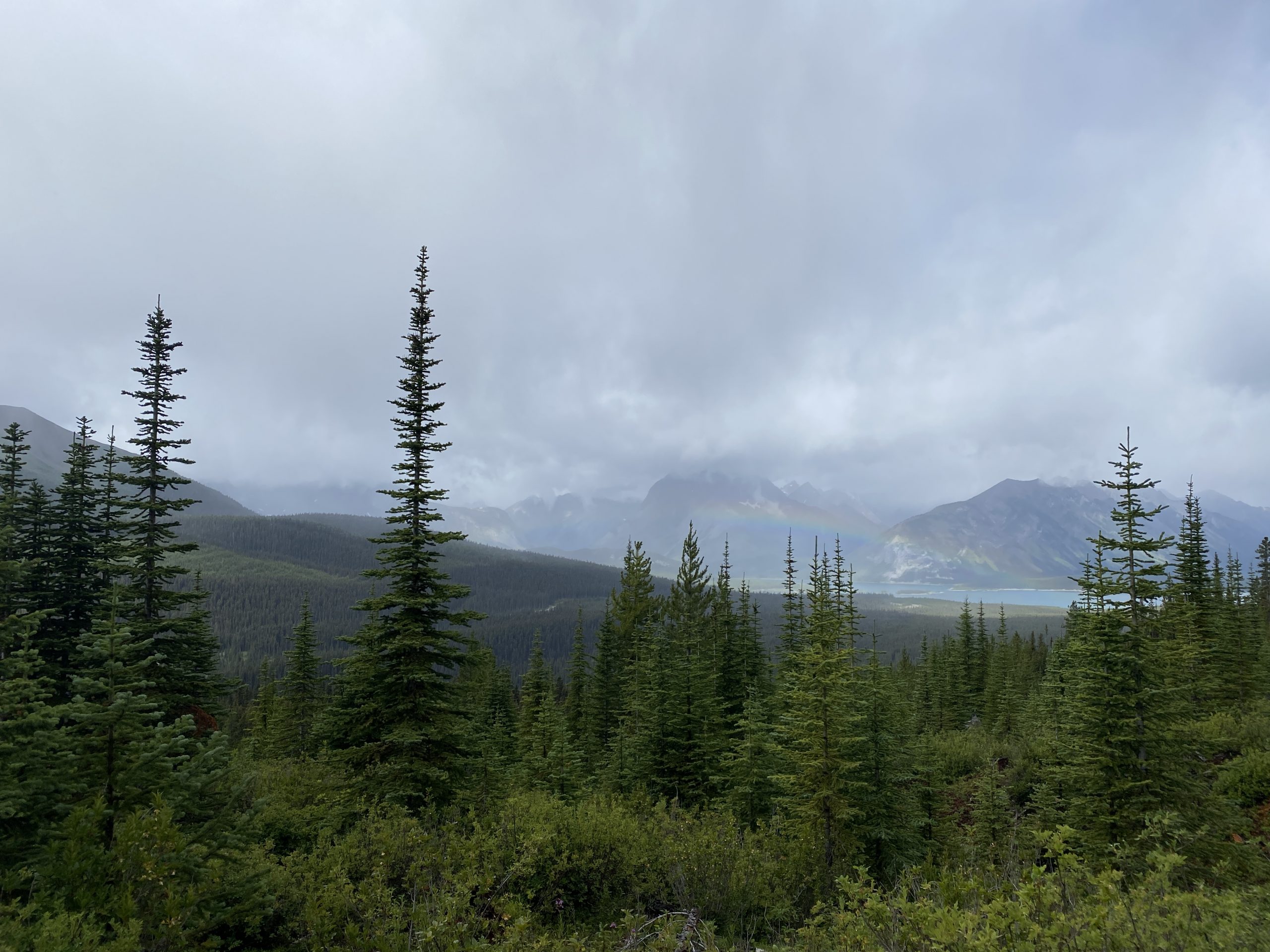
Not long after leaving Shark, the low cloud cover started to break and I was even getting a bit of sunshine to warm my body and mind. Going forward it was all trails I had hiked and it was nice to know what to expect for the remainder of the day. The start from Mount Shark follows a cross country ski trail which is nice gradual incline towards Bryant Creek.
This section has plenty of clear cold streams to fill up on water. Because of the coolness of the day, I was not going through much water. However, I did take the opportunity to fill up my small soft bottles.

I was using a Katadyn BeFree water filter which makes quick work of filtering water and filling my bottles. Much better tasting than any store purchased water and amazing to think about the volume of crystal clear glacier fed water that flows out of these mountains.

The trail continues in a constant climb and although its a perfect running trail in ideal weather conditions I started to feel fatigue settle in for first time in the day. I even caught myself looking at the GPS map, a sign I wanted to see, not just feel my progress. Trail running often goes like this, in one moment you body aches, you feel exhausted and mentally done, the next you catch a second wind and tear off in an escalated pace. Sometimes its caused by reaching a milestone, words of encouragement, food or scenery. Other times its completely unexplained and likely due to biological process ongoing in the stressed body.

The section from Shark to Bryant Creek was sprinkled with the occasional group going in or coming back from camping. I was nice to pass people, smile and wave, but with time not on my side didn’t really stop to chat.
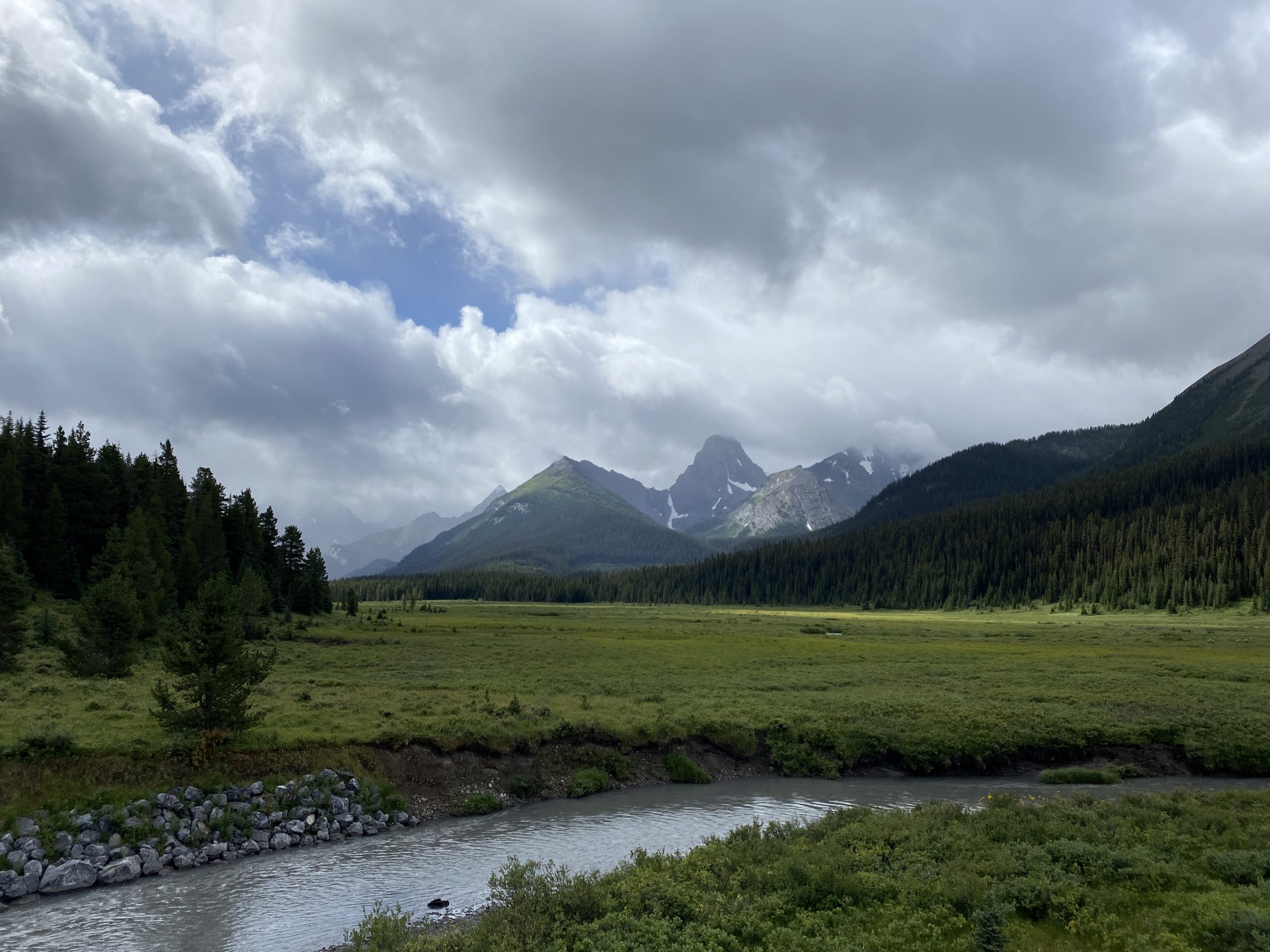
Reaching Bryant Creek signified the start of the real climb up Wonder Pass.

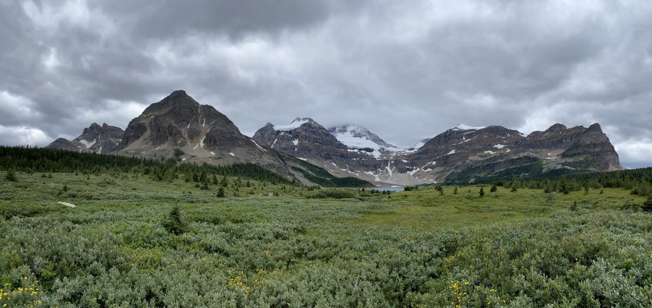
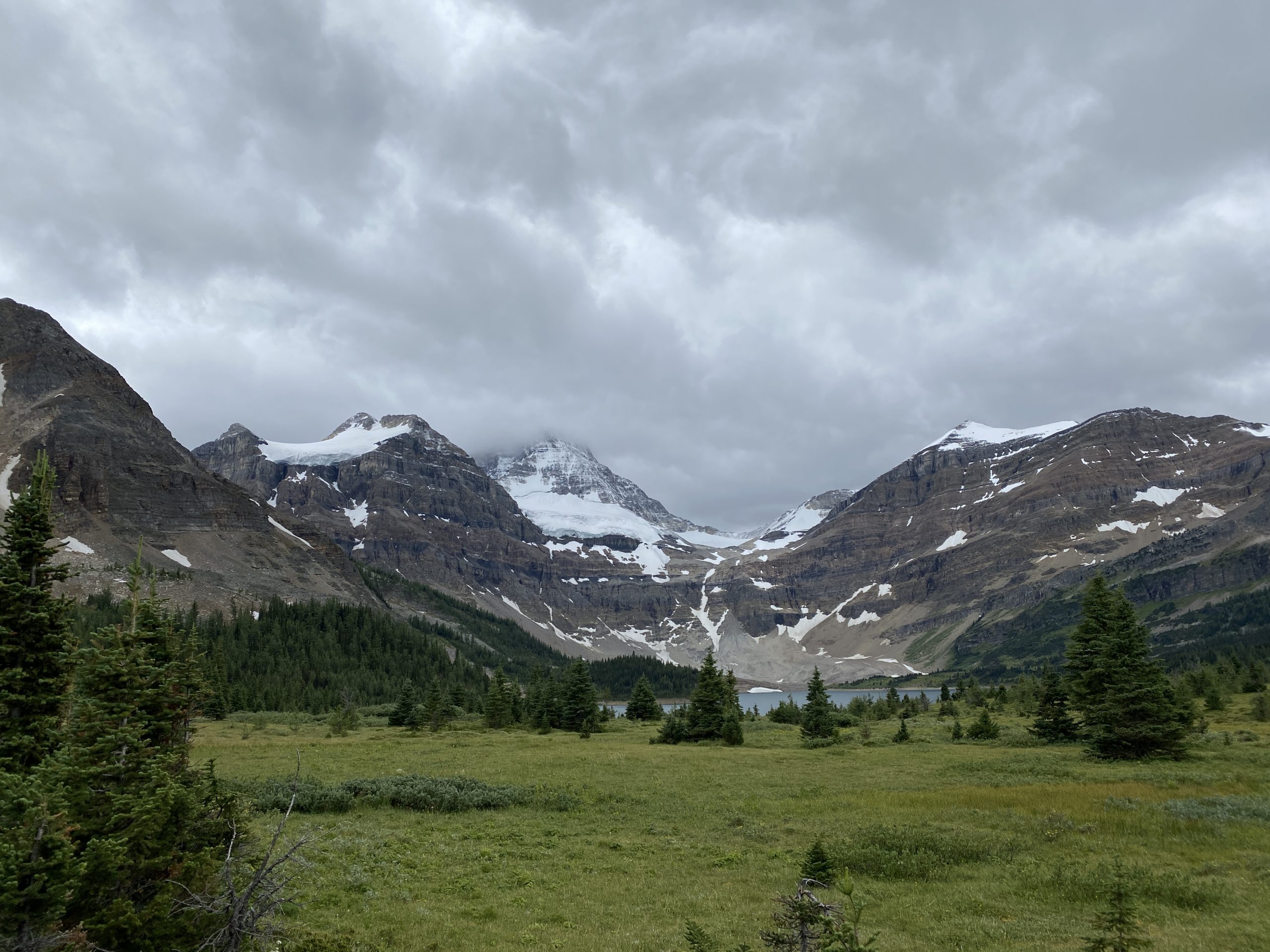
I was looking forward to reaching Marvel lake, what in my opinion is on of the most beautiful underrated lakes in the region. It has light blue water (reflection) similar to what your would see in Lake Louise and is surrounded by tree covered mountains with exposed rocky peaks on all sides. Because its long and narrow it was hard to get a picture to do any justice to the beauty of the valley.
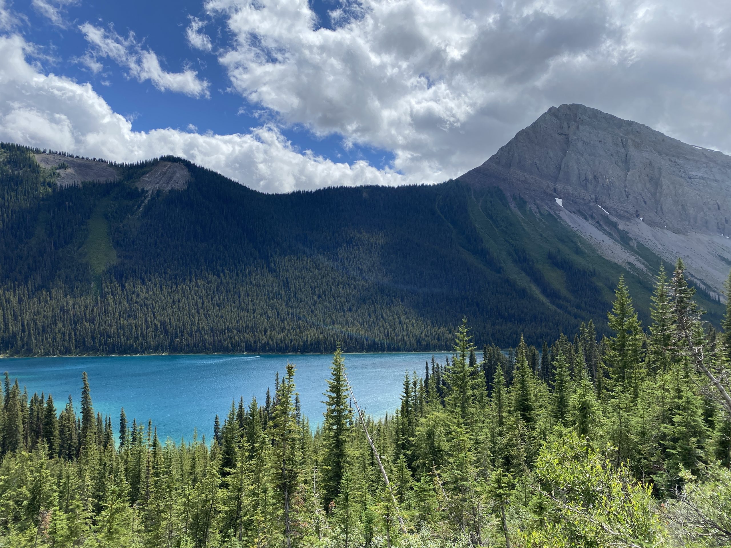
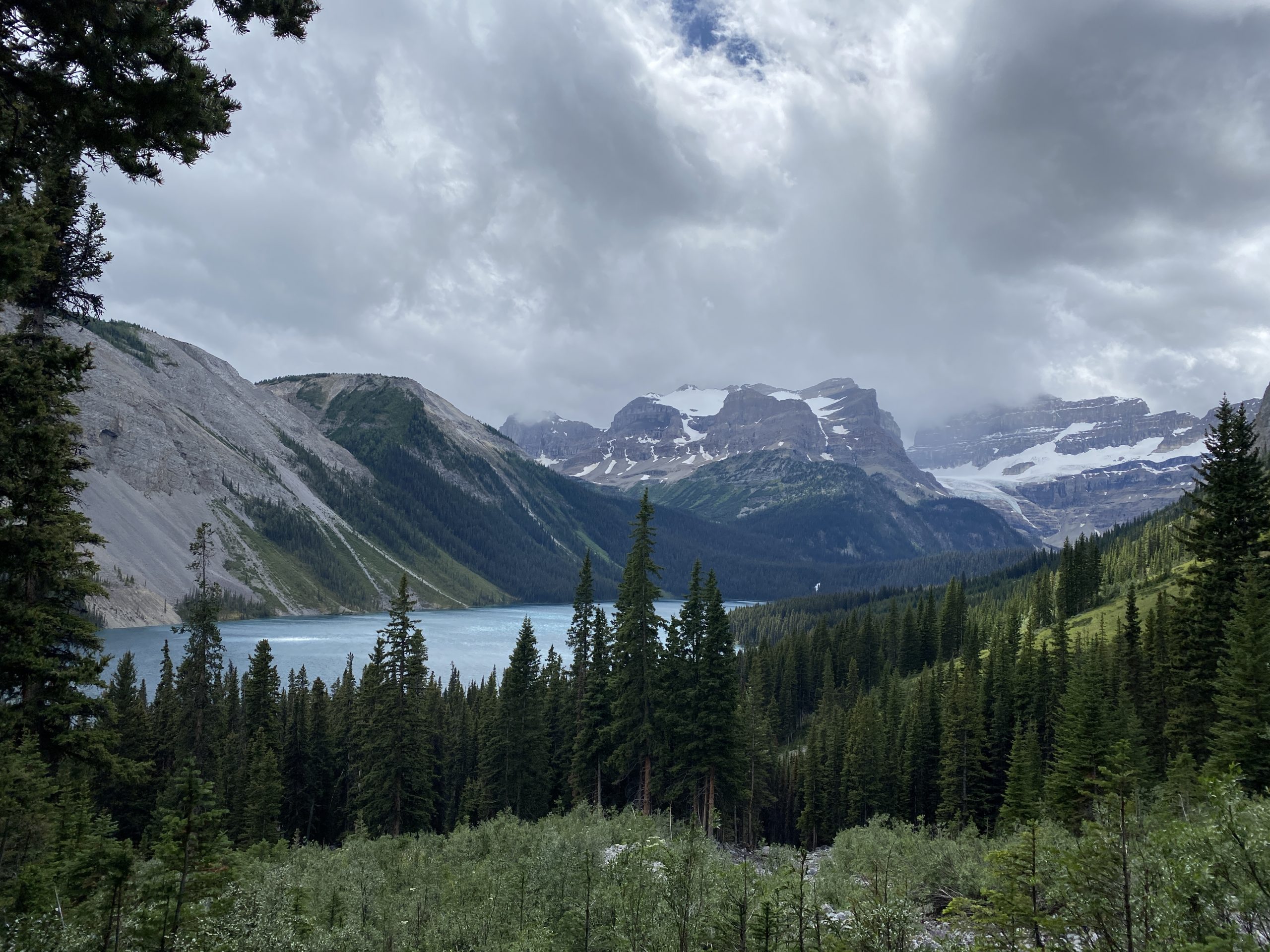

At the end of the lake you get a clear view of the glaciers feeding the lake, unfortunately the cloud cover was obfuscating the majority of it. There is another route to this point which goes south of the lake, behind the mountains and around Owl lake that climbs over Marvel Pass. Next time I plan on taking that route, but today I felt like mitigating the unknowns to ensure some sanity in my eventual arrival time.
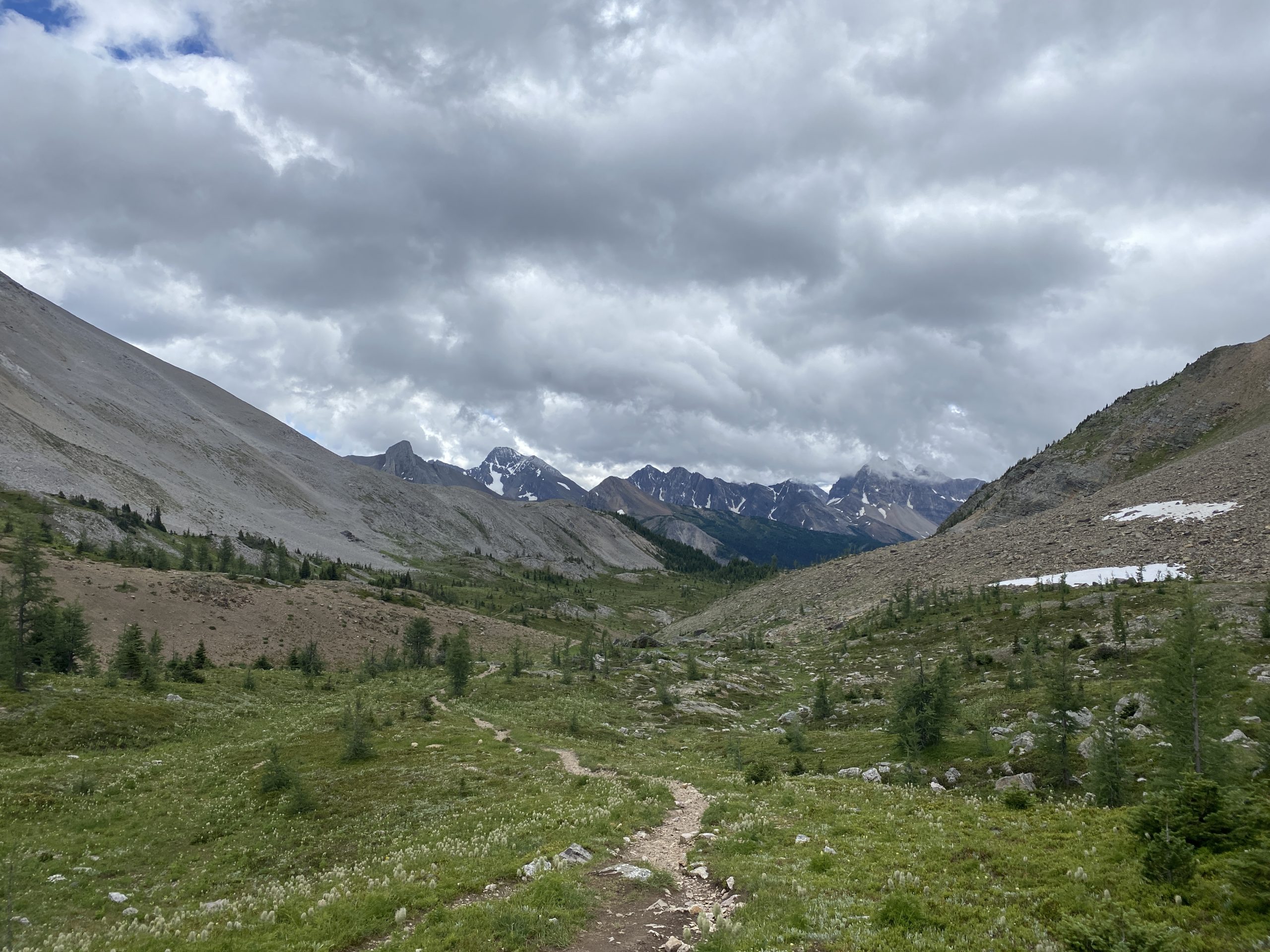
The running along Marvel may have spectacular scenery, but the trail itself is not ideal being off camber and traversing sections of baseball size rocks. This creates the desire to look around but the need to constantly look down at foot placement and avoid rolling an ankle.
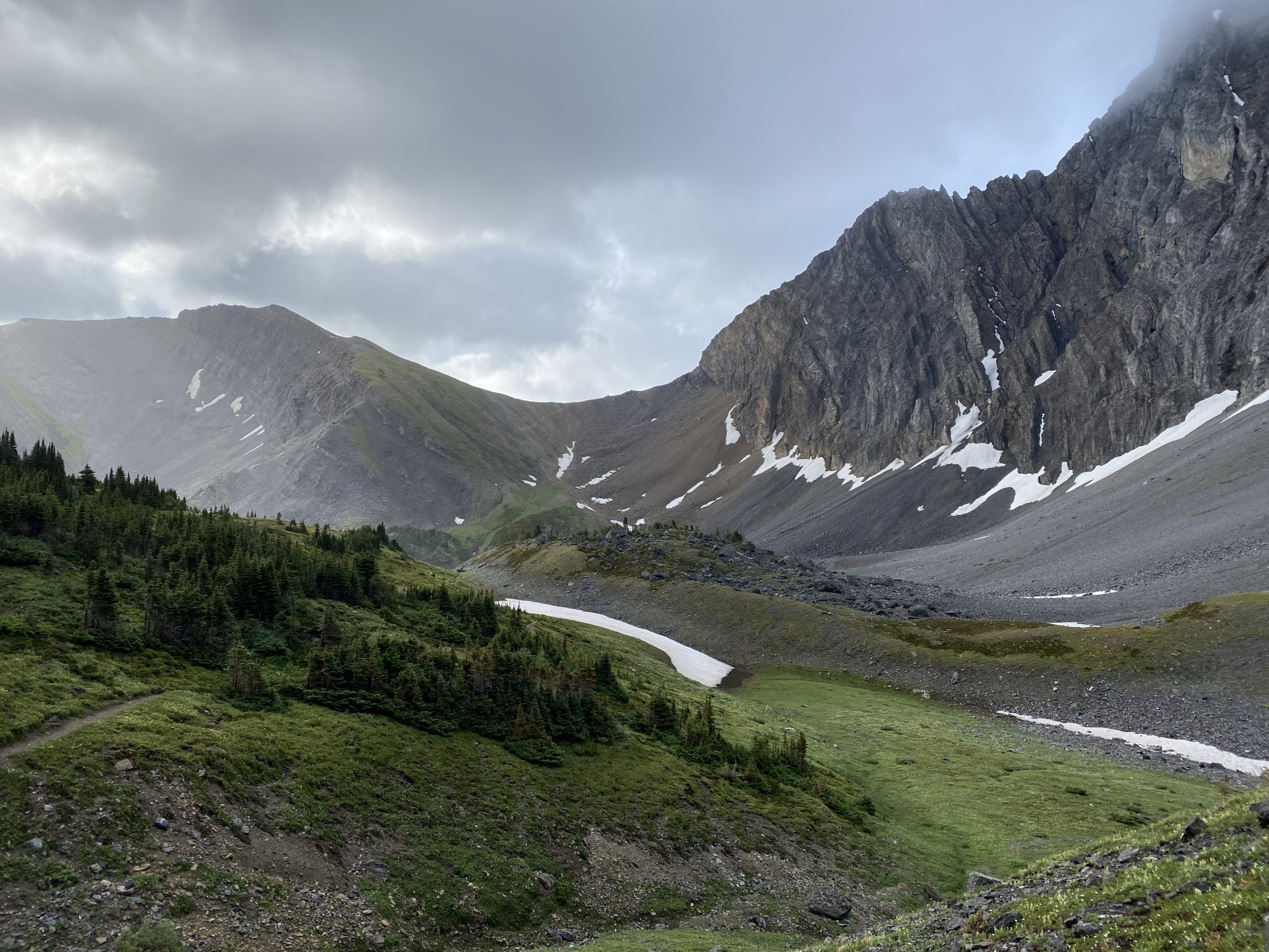
At the end of Marvel Lake I reached the bottom of the switchback that takes you up to Wonder Pass. From memory this would be a grind up a long winding switchback to the top of Wonder Pass. As luck would have it I caught a second wind and felt great running up the approximately 3km to the top.
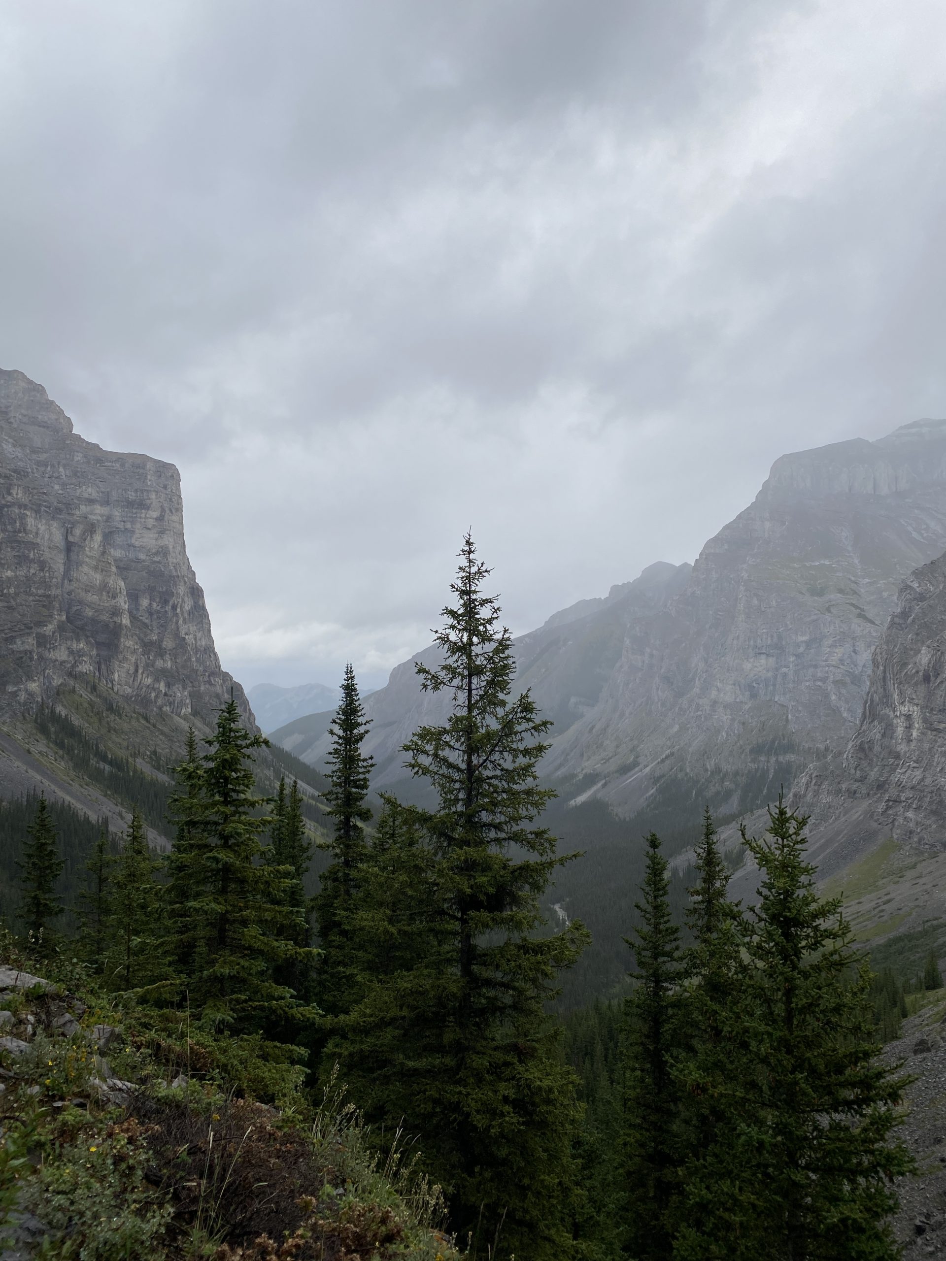
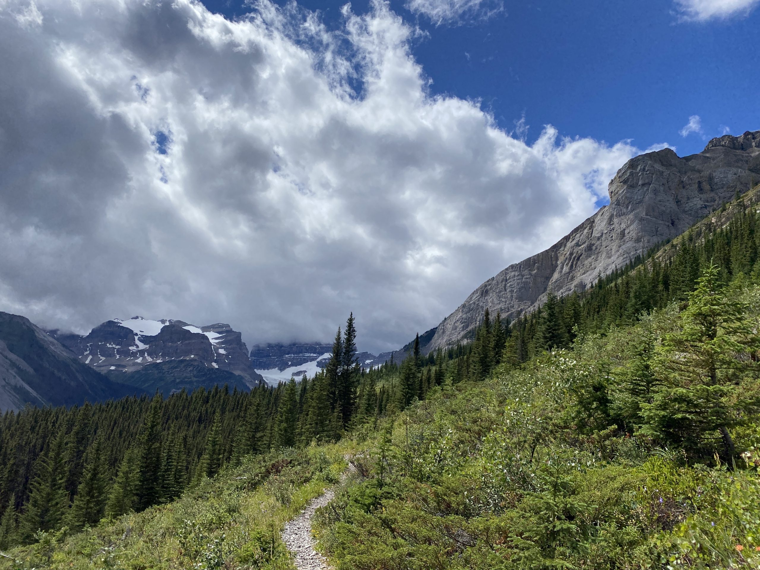
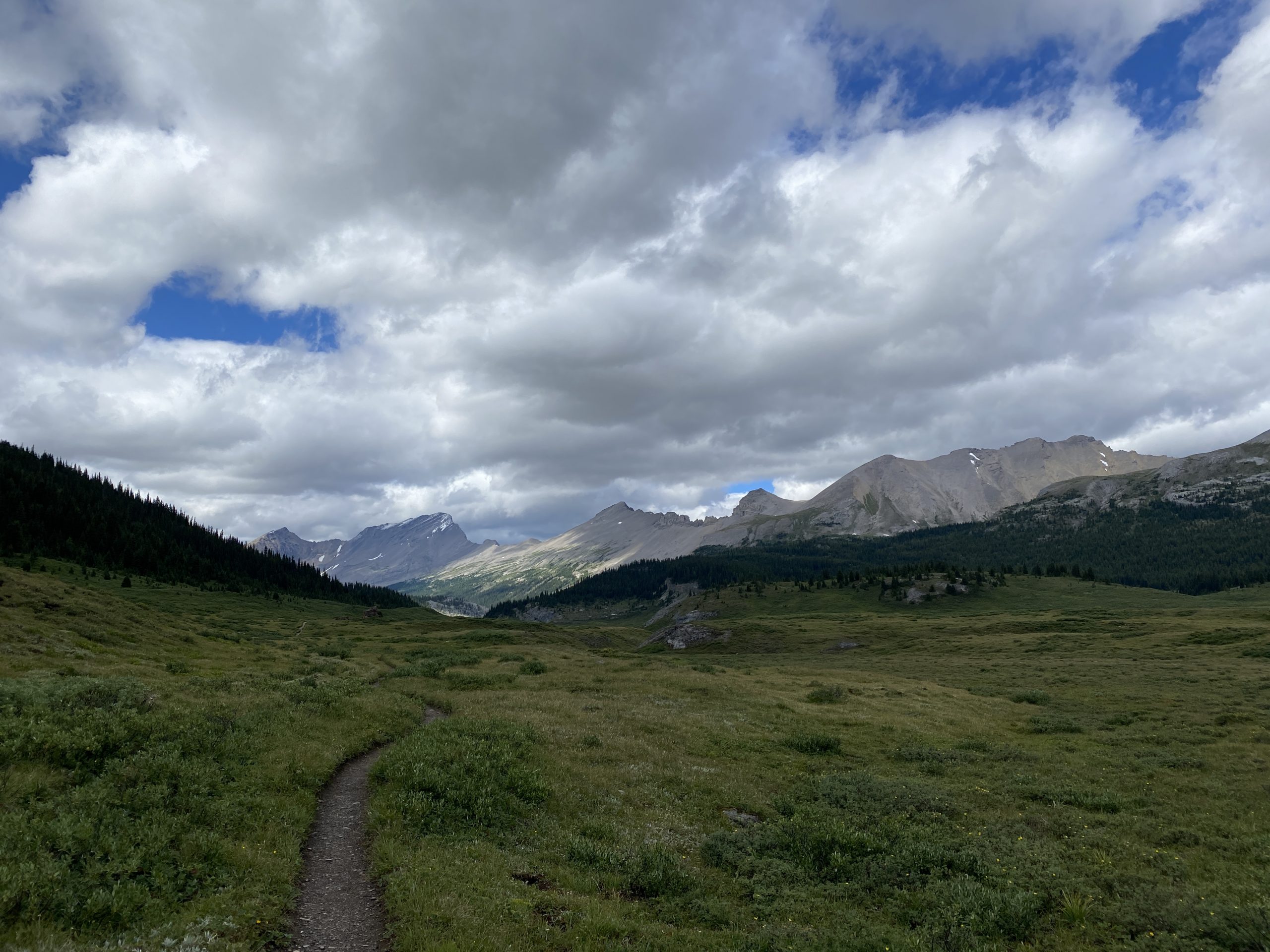
At the top there is still about 4km of alpine meadow to reach the pass. The valley was scenic with a great single track that traversed through the middle.
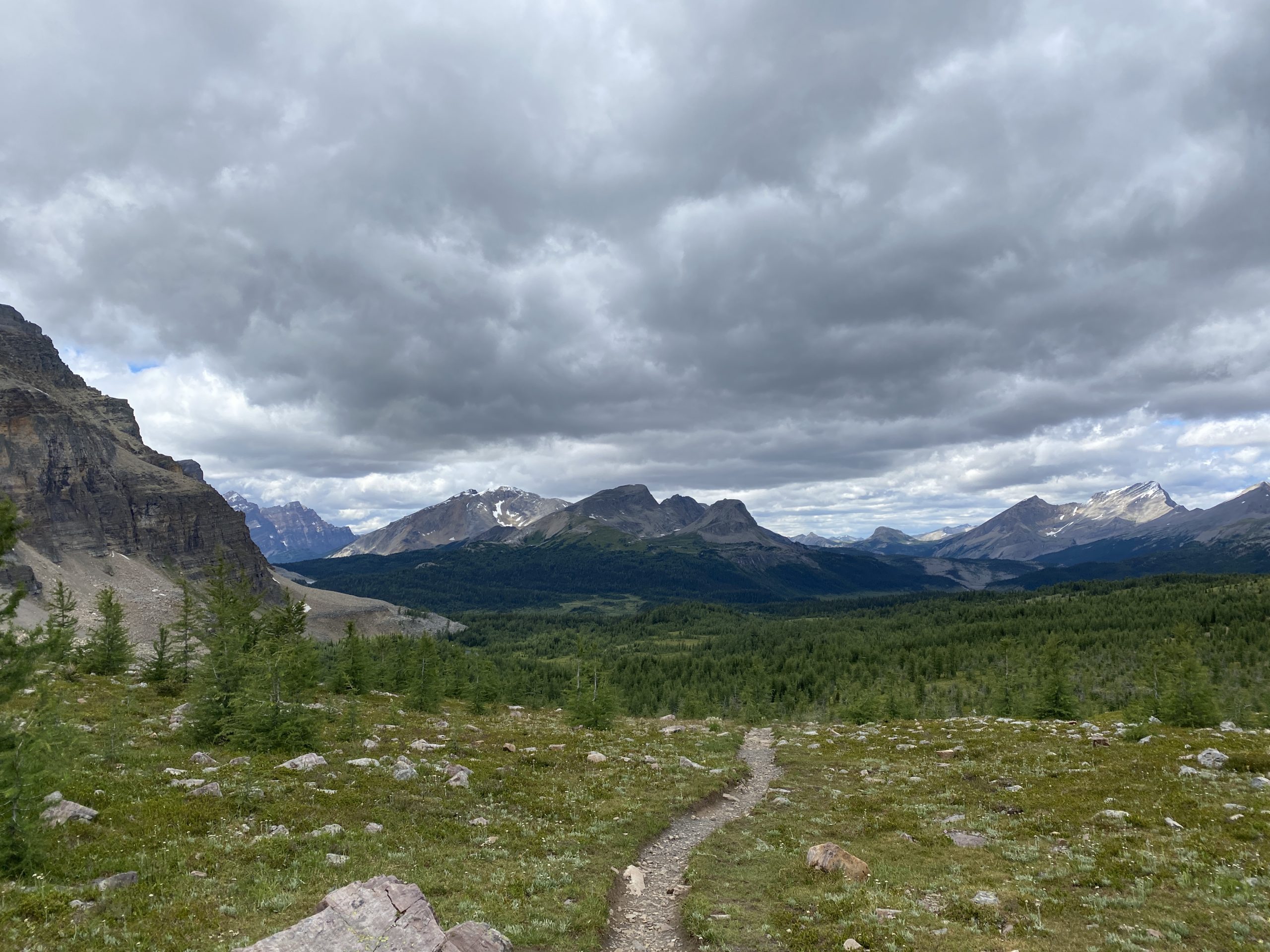
The pass was cool and windy, but not nearly as cold as Buller Pass earlier in the day. After crossing the meadow, I reached the Alberta / BC border.

Looking down from the pass I could see the route to Assiniboine.
The decent down to Lake Magog and the Assiniboine lodge, is a great cruise and upon arrival I took the opportunity to fill my water at the first creek crossing right at the bottom of the decent.
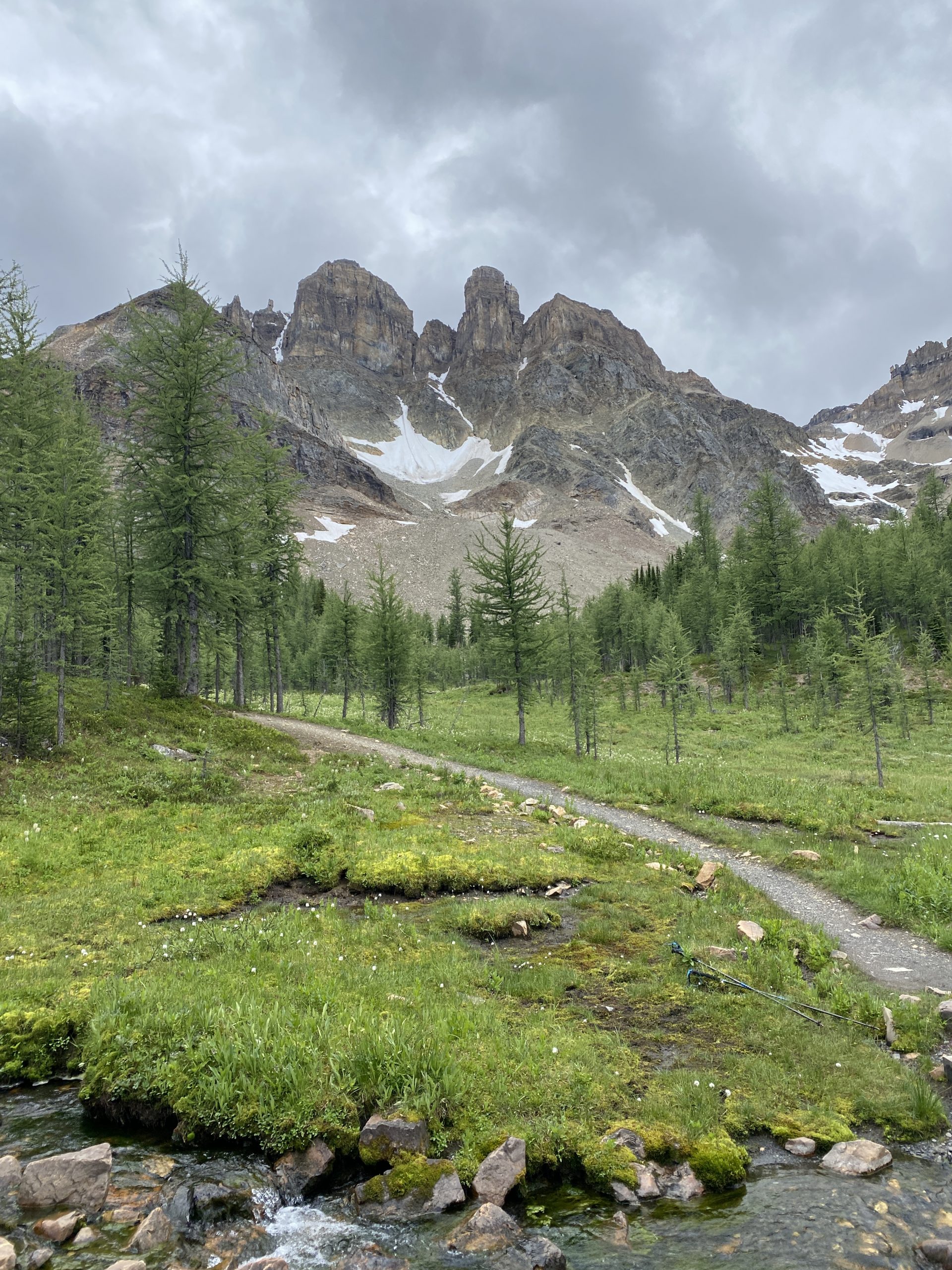
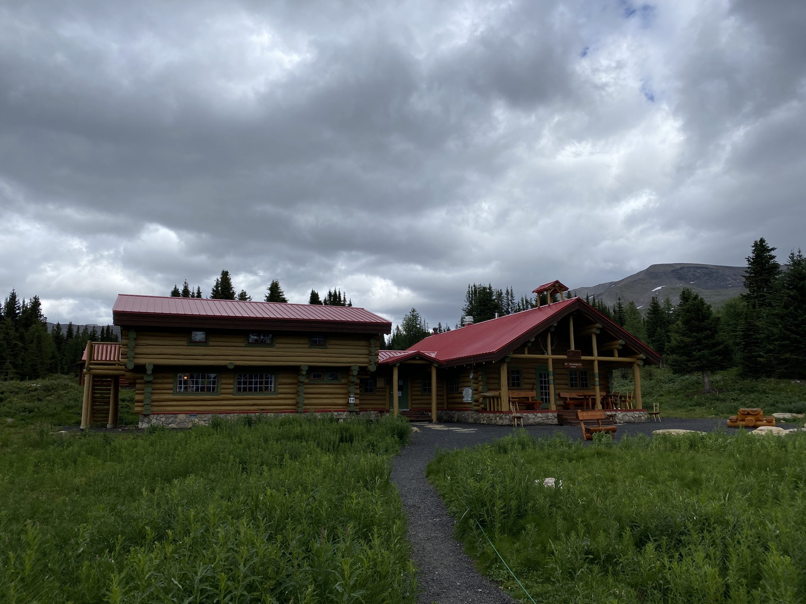
I took a detour to the lake and caught my first glimpse of Mount Assiniboine. The unfortunate part was that it was cloudy, and therefore the tooth-like summit was covered in clouds. Back in 2017 when I hiked up here I was fortunate to have 3 glorious days in the sun hiking in this area. Today I was blasting right through.
The lodge was closed to non-guests and I was glad I brought my own full day supply of food. One option I had looked at was going even lighter and filling up with water and food at the lodge. With that not being an option I took my only break of the day off my feet to sit down on the side of the trail and eat.
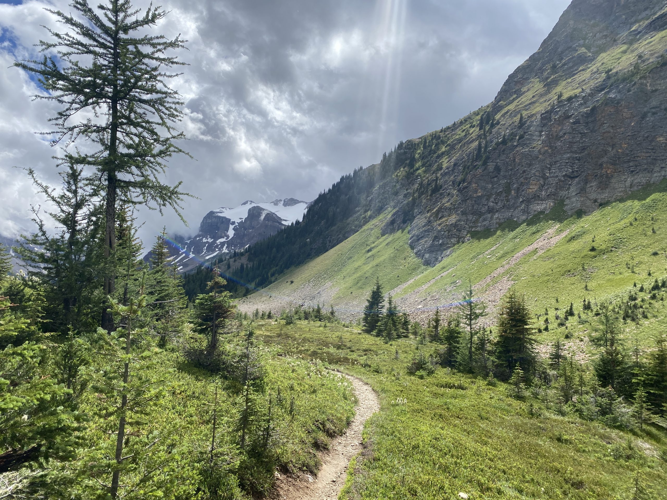
The section out from the lodge towards Citadel Pass is one of my favorite sections. The trail passes through a valley with stunning views in all directions. The single track is smooth and easy to pickup the pace and make some distance. I turned on some music for the first time and picked up the pace on my way to Lake Og.
Eventually I arrived at Lake Og, visited the Banjo for another needed break and continued on through the Valley of Rocks.

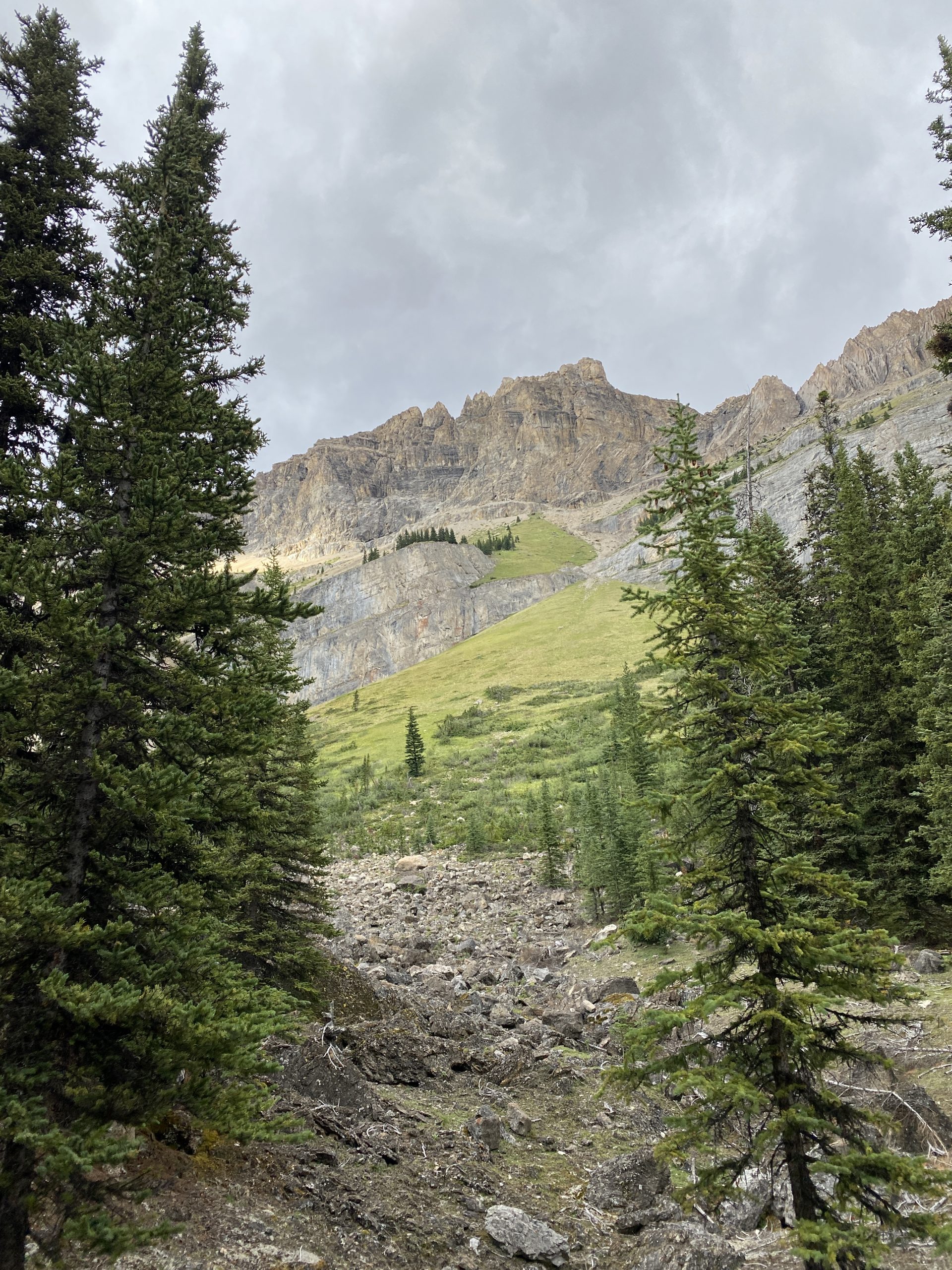
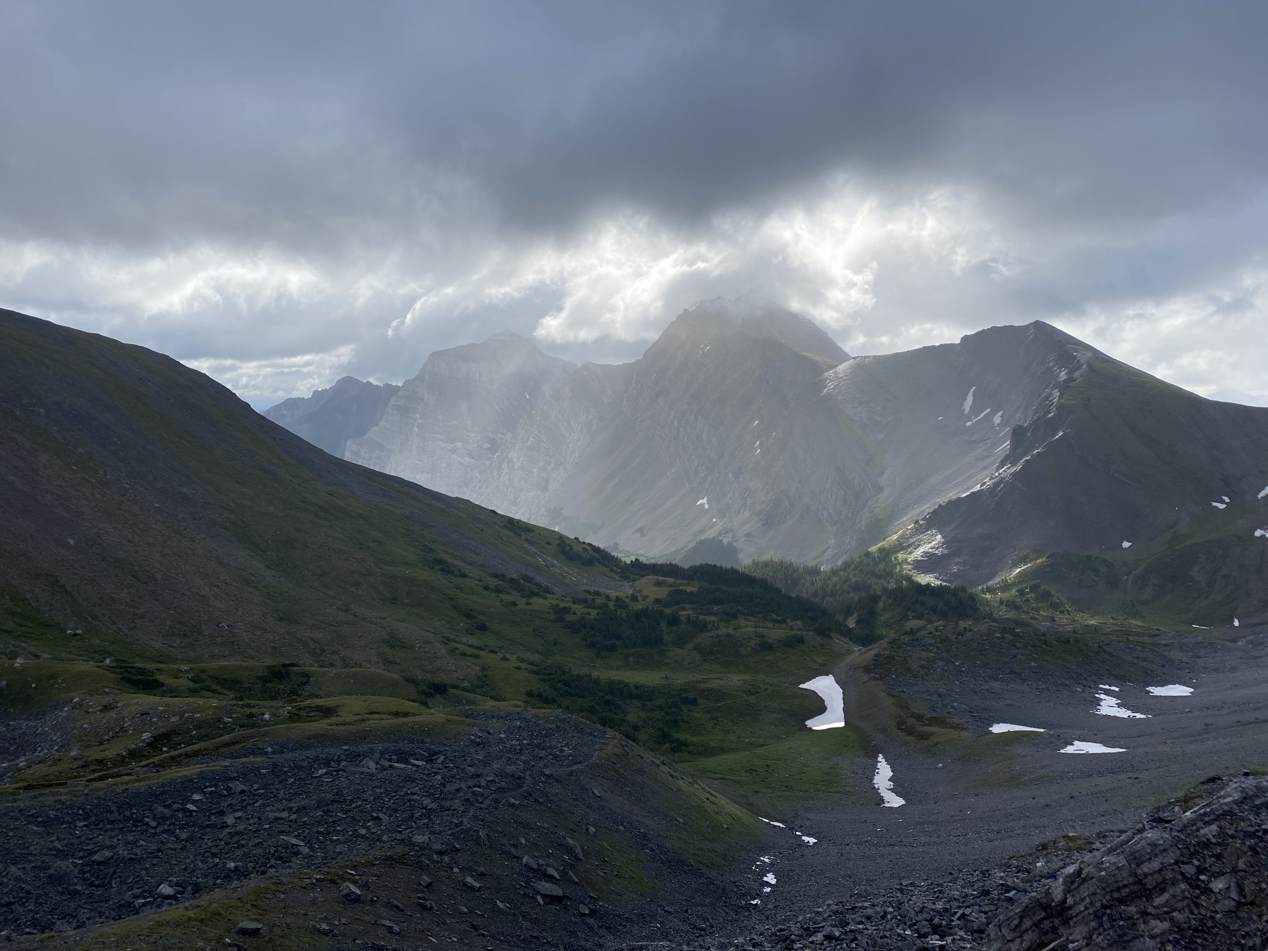
After the Valley of Rocks I hit what turned out to be by far the hardest grind of the day – the climb up Citadel Pass. In hindsight its only around 600-800 meters of climbing, but because of my exhaustion and desire to keep pushing to finish on time, I began to bonk. The climb is steep and a rugged trail. I should have stopped to hydrate and eat, but just kept pushing up the trail. By this point I was exhausted, one foot after the other…

As I reach to top of Citadel Pass and arrive back at the Alberta border I get a renewed sense of energy. By this time the sun was low in the horizon, shining through and making for a beautiful evening.

The run through Sunshine Meadow is great and highly recommended for anyone who wants to do some high elevation alpine running or hiking. I could start to see the Continental Divide chairlift in the distance. It gave me another burst of energy, although I didnt realize just how for the Sunshine Meadow trail stretched before dropping down to Sunshine Village ski hill.

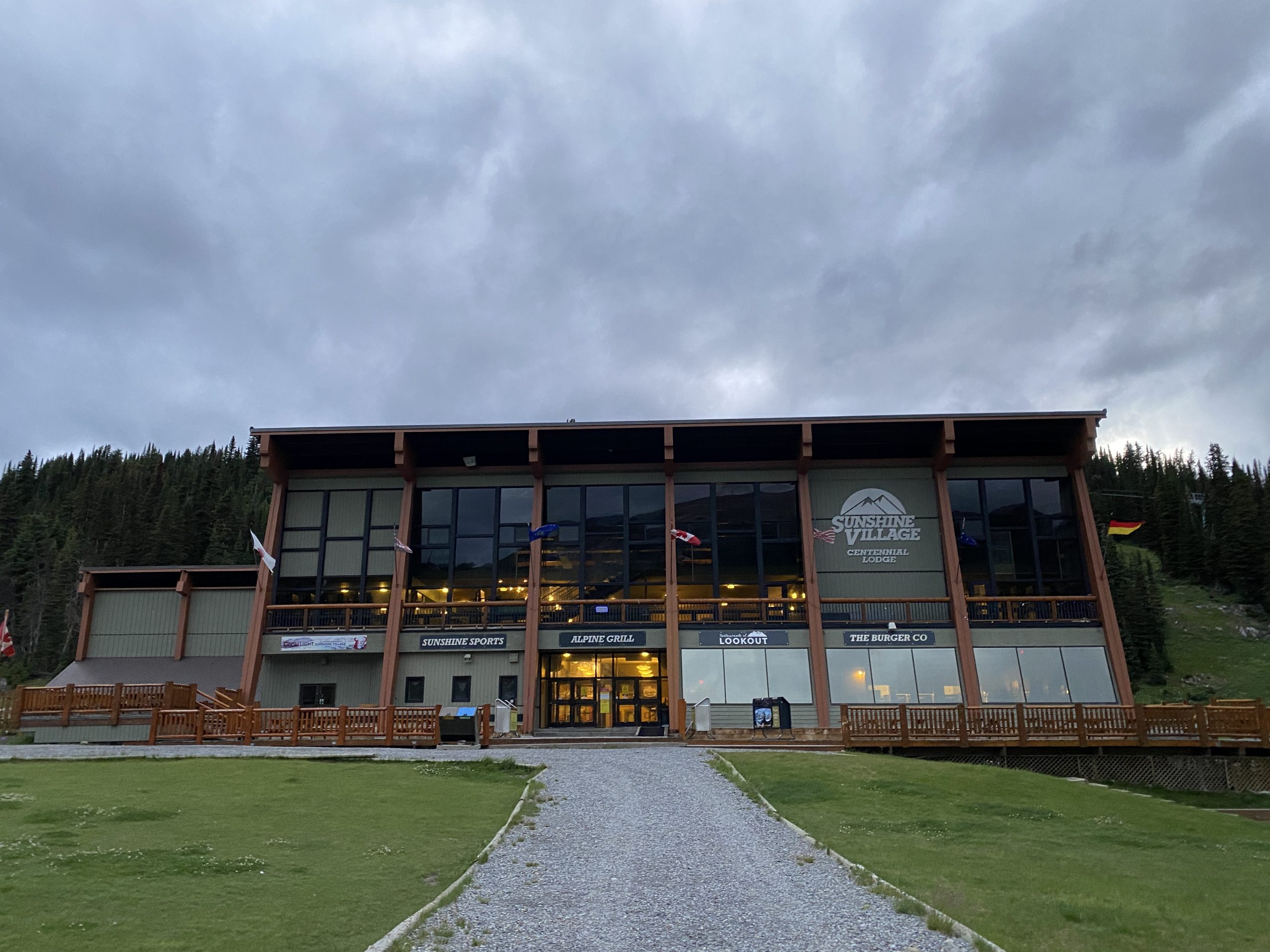
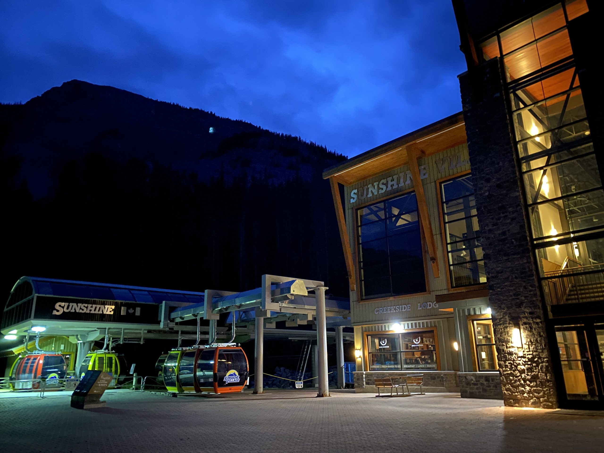
It was a glorious feeling to come over the last hill and see Sunshine Village. It was my first glimpse of real civilization since leaving in the morning.

Dropping into the village I eagerly tried my cell phone to see I now had full coverage. Although I had been using my Garmin InReach to communicate when not in cell coverage, I wanted to let my parents (who were my pickup ride) know that I was finally close. My dad responded that they were at the bottom waiting.
The last section was the Sunshine Skiout, which consisted of a gravel switchback down to the bottom of the gondola. I’ve skied this many many times in the winter and its always a quick blast down to the parking lot. With this being my first decent on feet, I under estimated the distance and it took me much longer to arrive at the bottom. The sun had gone behind the mountains and it was starting to get pretty dark out. Knowing I was so close I didnt bother to dig my headlamp out of my bag, I just took out my cell phone and used the light off my phone to bring me to the finish.
I arrived at the bottom with a totally empty tank only to realize the lodge was closed due to covid, and the parking lot was totally empty. I ran around the lodge to try to find where my parents had parked. I got a sinking feeling that maybe they were waiting at the wrong location, but received another text from my dad that the front gates were closed and they were parked outside the gates. On one sense I was relieved, but there was one last 800meters to run to the gates. I was so close to 100km that I contemplated doing a few laps around the parking lot to hit the mark, but after my delayed caused my parents to wait around an extra hour for me (stuck in a car no less), I quickly decided against it and was fine calling it a day.
It was totally dark by the time I spilled into the back of the car. I was spent, but felt great, only feeling bad for leaving my parents waiting at the bottom of the hill for me. They had food for me and it was nice to have a ride home. My feet felt a bit beat up as I was wearing relatively new shoes, but not blisters or hot spots.
Its amazing how your body will scream to stop, but if you can just mentally force yourself to keep going the body will respond. I feel like outside of some base conditioning, much of of the challenge is overcoming those mentally low spots of the day. Ignoring those times when you just feel like walking, or sitting down, and focusing on keeping forward momentum. Hundreds of thousands of years of evolutionary refinement have created a machine that is so well suited long distance travel, and its a joy to be fortunate enough to use it as it was intended.
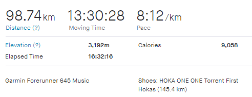
Overall I was just shy of 100km, and a little beyond my target time that I mostly attribute to the logistics of filling water bottles, stopping for photos, and boking a bit over the last pass. That being said it was a fantastic day out in the mountains.
Summary Thoughts
Much of my knowledge from long distance running comes from experience, but also from reading feedback and blogs from other runners. In that spirit I thought I would share a few things that I thought worked really well, and other things I would change for my next undertaking. Since this was a full day point to point solo run, I really had to be self sufficient.
- Gaia GPS App – having a detailed reliable GPS eliminated the stress of route finding and helped give me confidence that I was on the right trail. I studied paper maps ahead of time, but relied on my phone GPS while on the trail. There are a number of GPS devices and apps on the market, all will work great, for me having the route pre-plotted on my phone using Gaia GPS was perfect – super slick app.
- Katadyn BeFree – amazingly small and effective water purification bottle. Much faster and lighter than a traditional pump filter.
- Spare Socks – argh, feet got wet in the morning and stayed that way for much of the day. Having at least one pair of dry socks would have been a so rewarding to put on halfway through.
- Bear Spray and Scat Holder – its a pain always having to carry bear spray, but such a necessity.
- Warm clothes and emergency blanket – although the weather forecast wasn’t too bad, the conditions in the mountains can change fast and turn severe. I brought more warm clothes than I needed, but if I were to get injured the body will cool quickly and help may take a long time.
- Not run solo – all the recommendations to alpine travel recommend never going solo. Unfortunately my last minute scheduling didn’t make it conducive to trying to coordinate with friends or clubs. I did find it a long day with few people on the trails due to weather and not having time to stop and chat with many people. This can be a nice escape, or in my case make it a bit lonely on the trail by the end of the day.