Alpine Adventures

Living close to the Rockies affords me access to some of the best alpine adventures around.

My buddy Danny organized a cat skiing trip to K-Pow, the old Fortress ski resort that is now closed and use solely for cat skiing.  It was a perfect day with tons of fresh powder and a great crew.

It was my first time cat skiing and although you prepare for avalanches, the day was uneventful in a good way: everyone left uninjured and safe.  There wasn’t a cloud in the sky and the skiing was epic.


Unloading the cat:

Fresh tracks:

Cutting across an avalanche chute:

Fat skis recommended:

The cozy ‘lodge’ to suit up before the day:

Three years ago (in 2012), I sent out an email to a group of friends about hiking to Mount Assiniboine.  Its a mountain that sits just over the Alberta border in British Columbia.  Growing up skiing at Sunshine Village, I’ve always wondered where the vast meadows around the ski resort lead.  After reading a hiking blog that claimed it was one of the most outstanding hikes in the world I had to do it. 

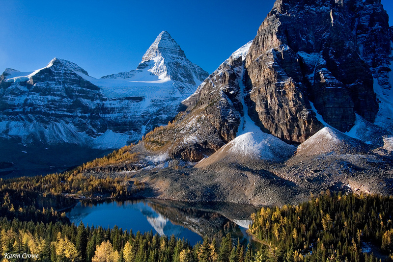
The above picture is not mine, but was referenced here.

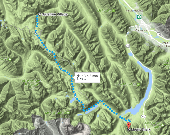
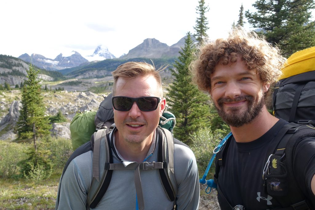
Considering I was born and raised within the vicinity of this range, yet never ventured out made we want to hike this segment.  As normally occurs peoples lives get busy and I found myself without anyone willing to go.  In the last minute my buddy Ryan, who always seems up for adventure, committed and it was on.  We only had 3 days, and it planned to be about 60-70km of hiking.

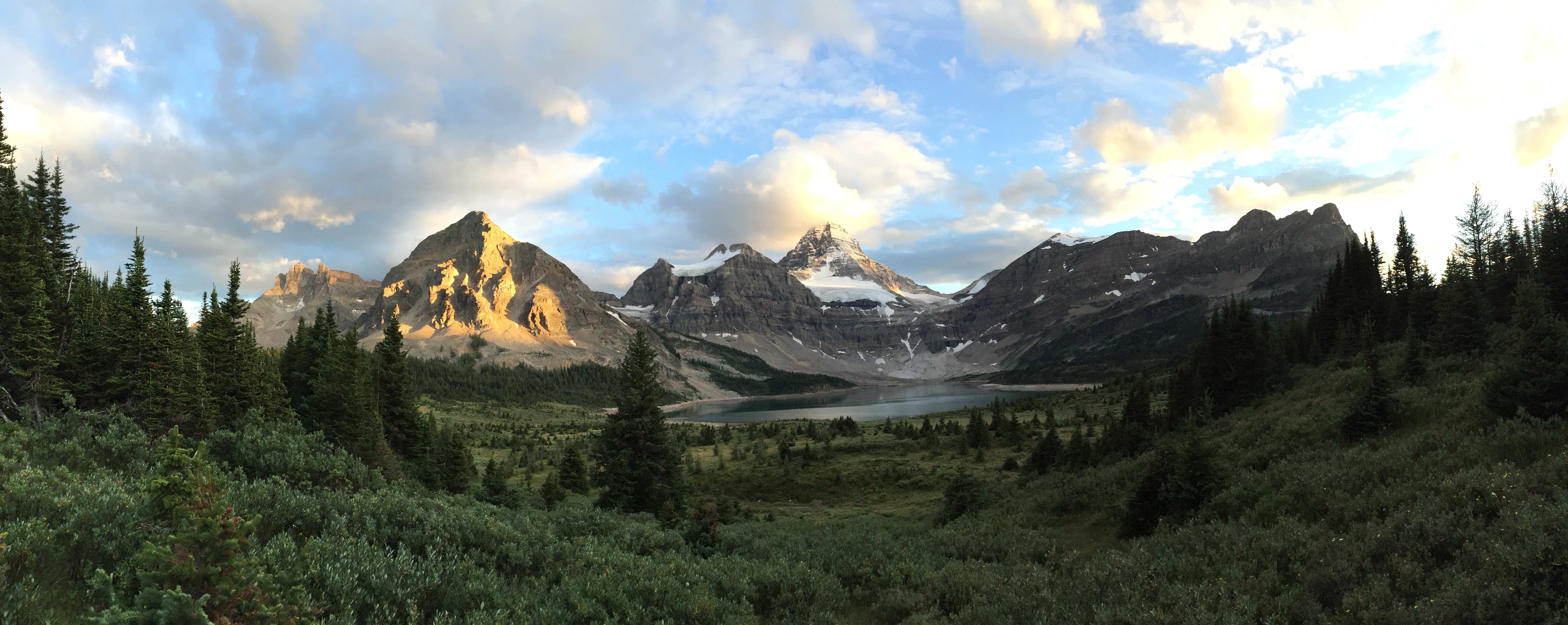
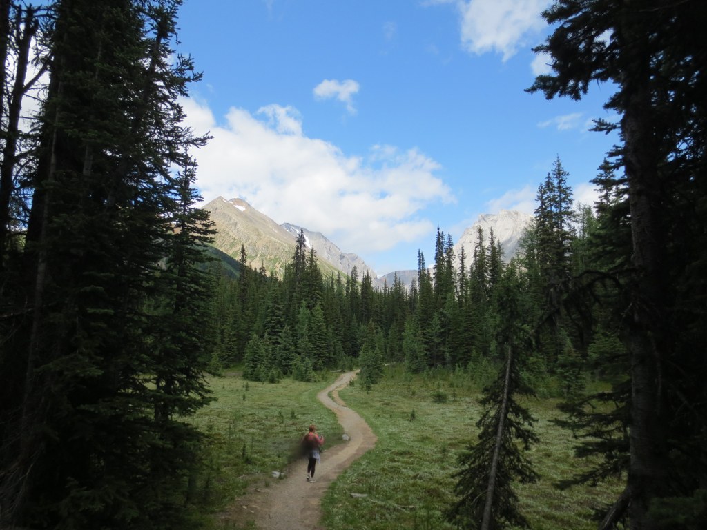
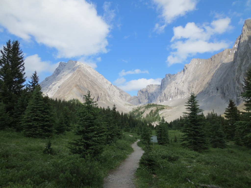
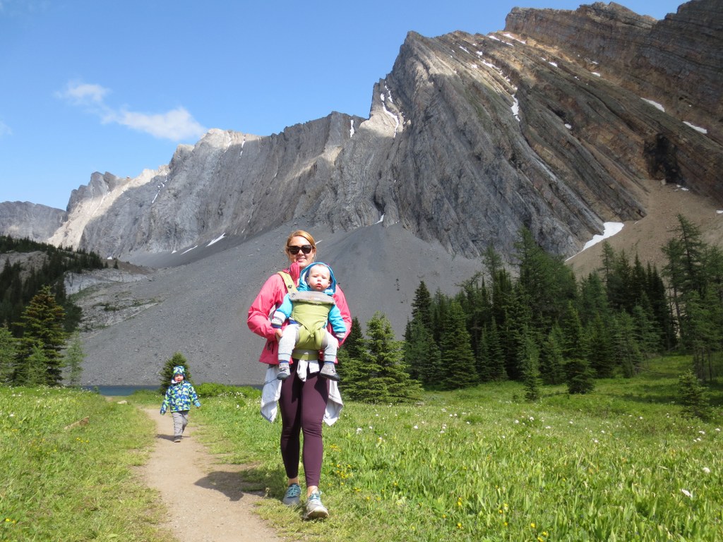
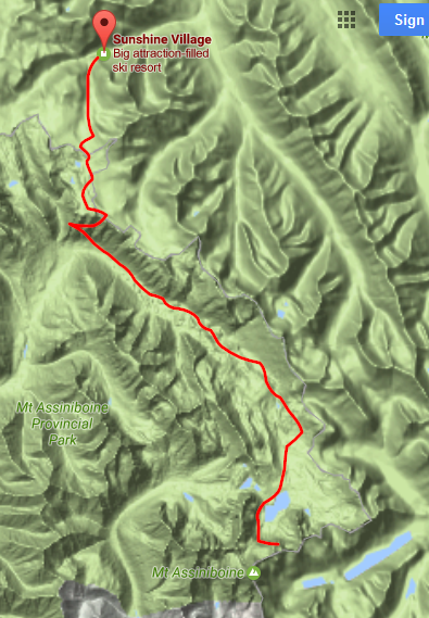
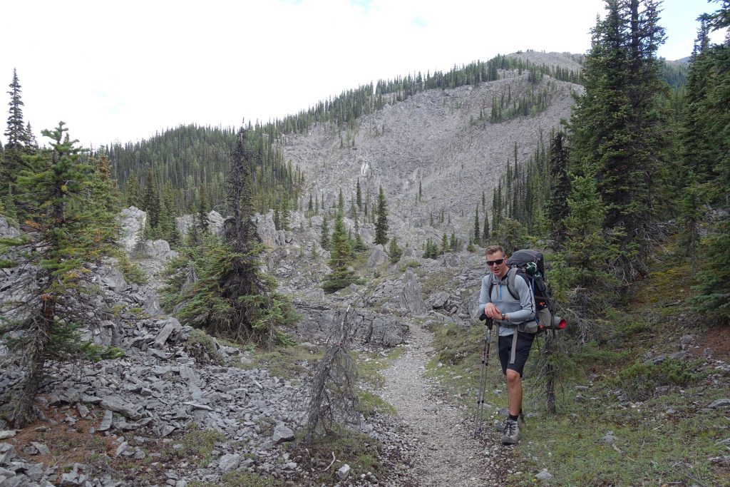
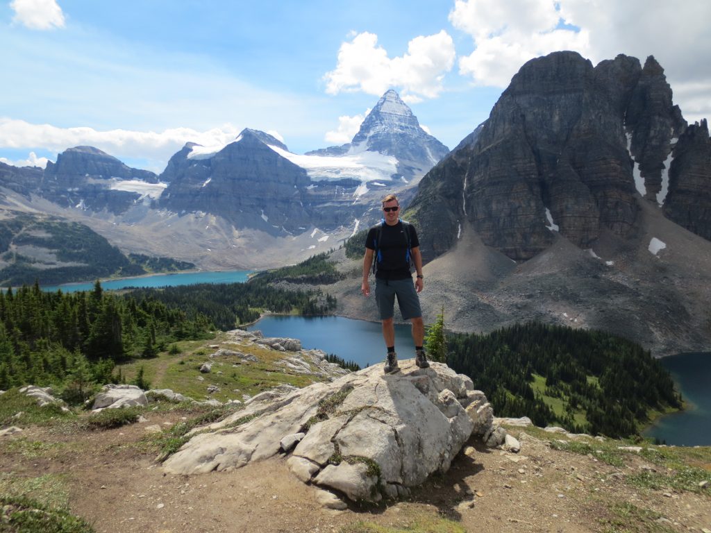
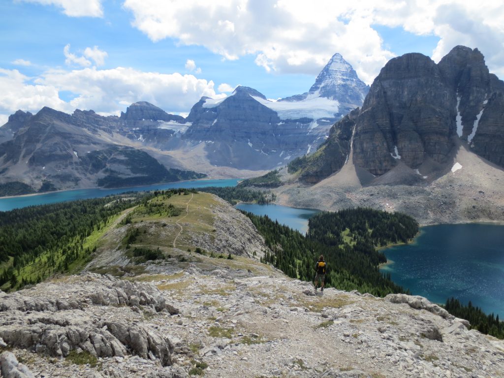
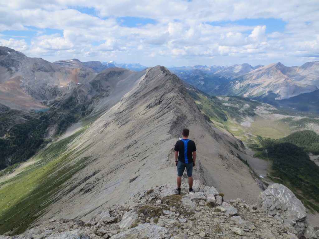
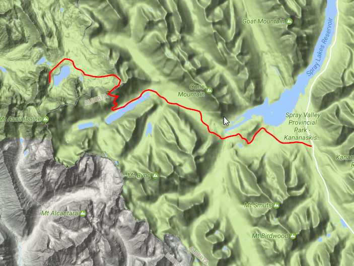
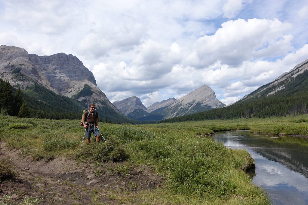
Below is the main trail.  We spent a day hiking around Mount Assiniboine and up to Nub Peak.  It would be easy to spend a week in this area exploring.

overall-assiniboine-trip

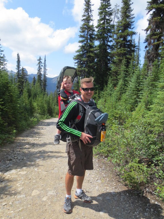
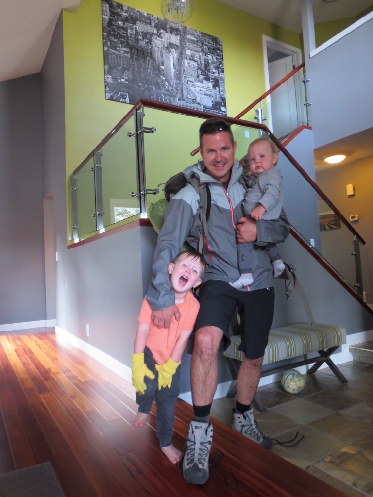
The night before I weighed my bag – 57lbs.  Fifty pounds is easy to carry for a few hours, but after a few days i didn’t think it would be bearable.  I did replace my 1990 backpack with a new bag from MEC.  Its amazing how much lighter and how much better the material is in new gear.  Lesson 1: if you are serious about doing back country hiking, invest in some decent gear.  I managed to shed about 5 pounds from by bag before leaving, but I did sneak 4 can of 500ml beers in the bag before finalizing the load.  I didn’t tell Ryan, but thought we could use a couple cold pints of beer when we made it to Assiniboine.  The morning of I said bye to my new family and took off for a few days of adventure.

Day Before:

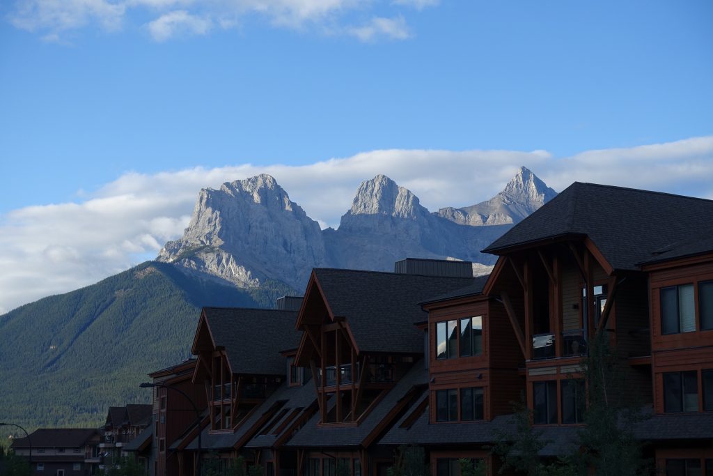
The day before we dropped Ryan’s car off at Mount Shark then took my car together to Canmore.  We crashed in Canmore staying in luxury, knowing we had a few days of roughing it ahead.  I had free hotel points, otherwise we would have slept in the parking lot.


We dropped out gear off and went out for a good meal.  On the way back we picked up a bottle of scotch to fill our flasks.  At the end of a long day its nice to have drink, and the weight to benefit ratio of a good Scotch cant be beat.  I had not told Ryan about the 4 beers i had stacked in my bag.

Day 1: Sunshine Village to Assiniboine (Magog Lake Campground) – 30km

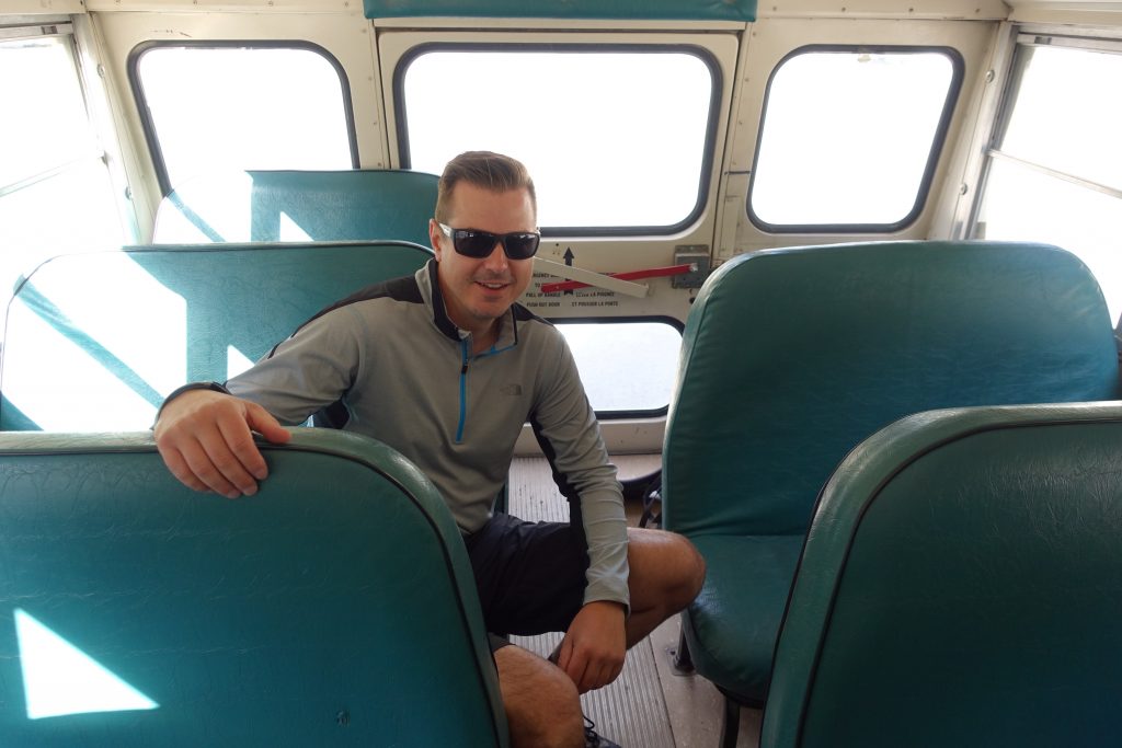
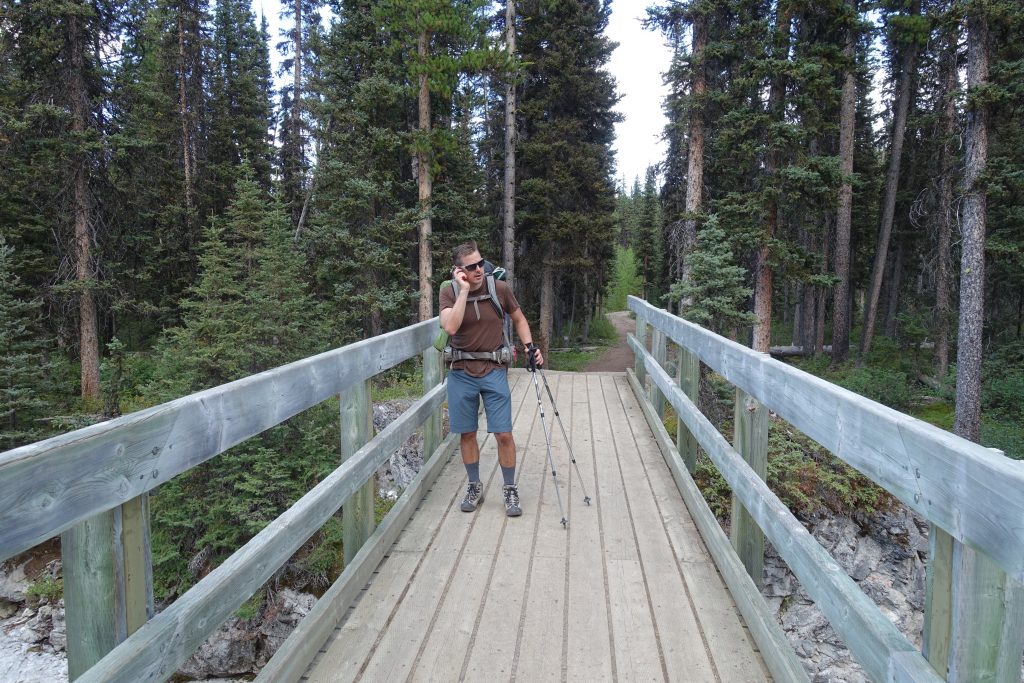
Our plan was to park a car at the Sunshine Skihill parking lot, then take the bus up to the starting point at Sunshine Village.  The first bus leaves at 8am, but after staying up late and one scotch too many we opted to make the 9am bus.

The weather was perfect.  Our destination for the day was Magog Lake Campground, but if we got tired or the day got late there were a few stops we could pitch tents along the way.  The starting location in Sunshine Village, a ski resort in the winter.  The area had a number of day hikers starting out, but we were the only overnights.  In total 30km day we only passed 2 other hiking groups plus a runner who was going the same direction.

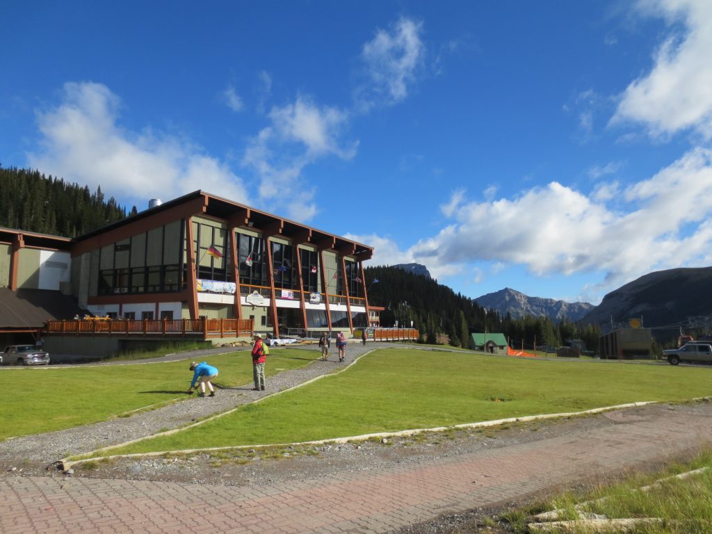
The hike to the top of the ski hill is gradual and marked with a wide pea gravel path.  Families and even a few young kids were hiking this segment.  Once you reach the top you are rewarded by the Sunshine Meadow:


Looking back you can see the trail leading back to Sunshine including the charlift station at the top of the hill.  

This hiking was easy and rewarding, something that would make a great family day hike.


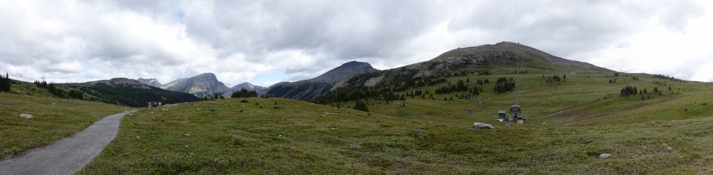
Once you get to the end of the meadow, you reach Citadel Pass which has a drop leading down into Golden Valley.  There is a campgroup here (Porcupine), but the day was early and we kept going.

Getting to the bottom of the pass you finally reach Valley of the Rocks, and amazing place where we saw Mountain Goats climbing around.

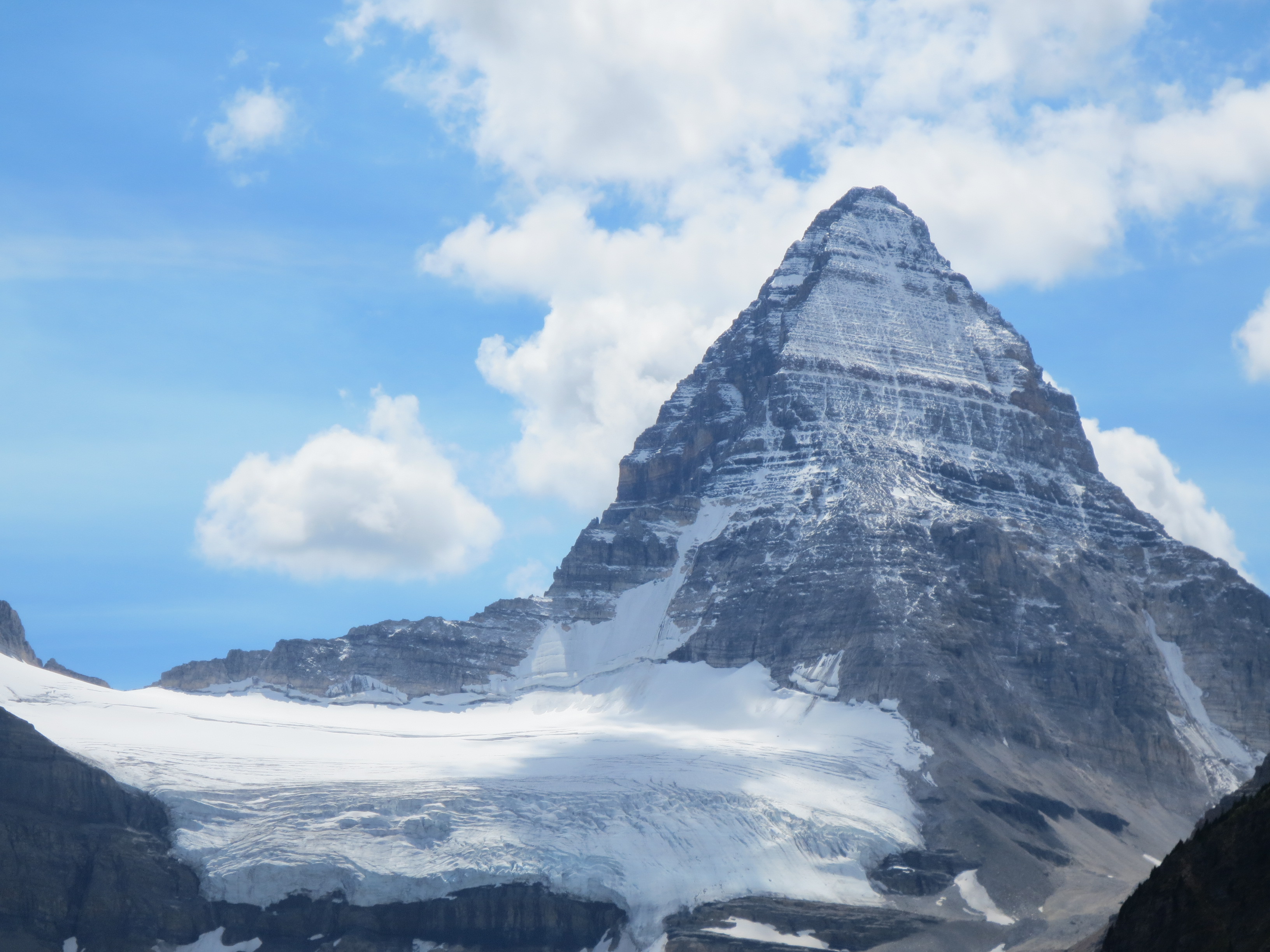
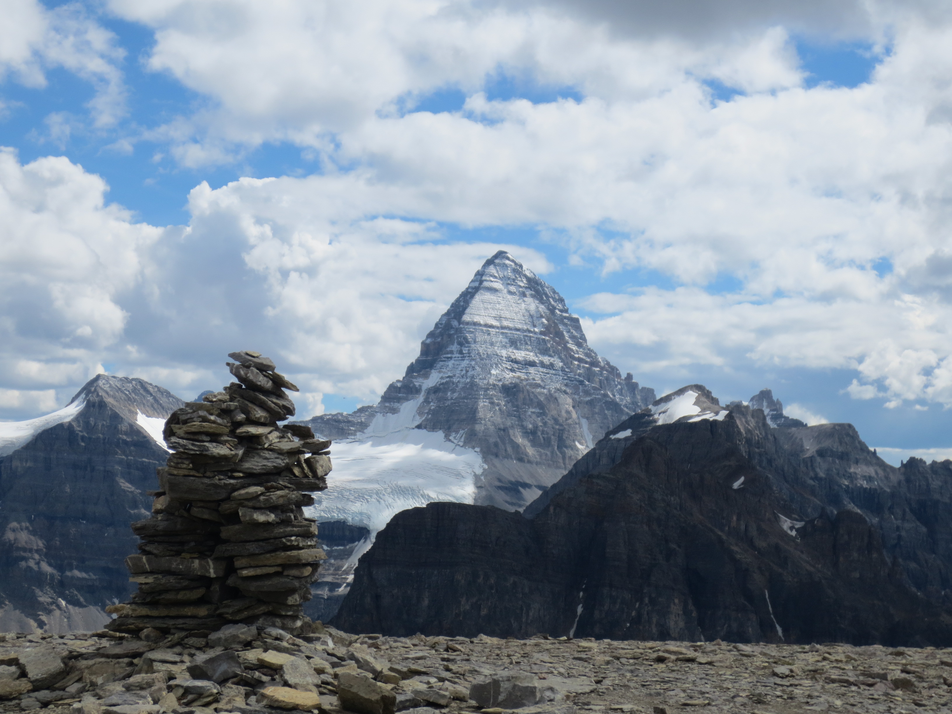
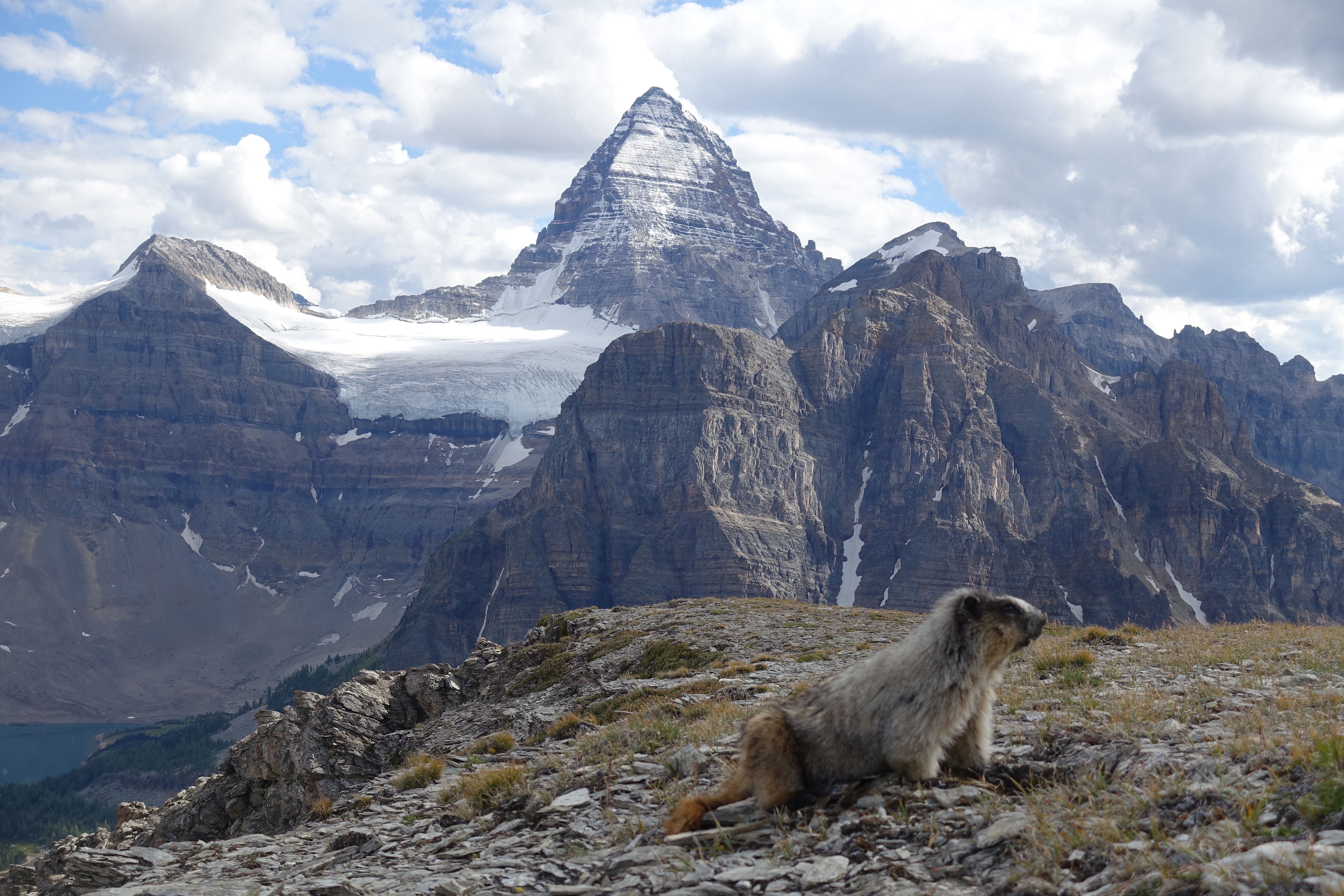
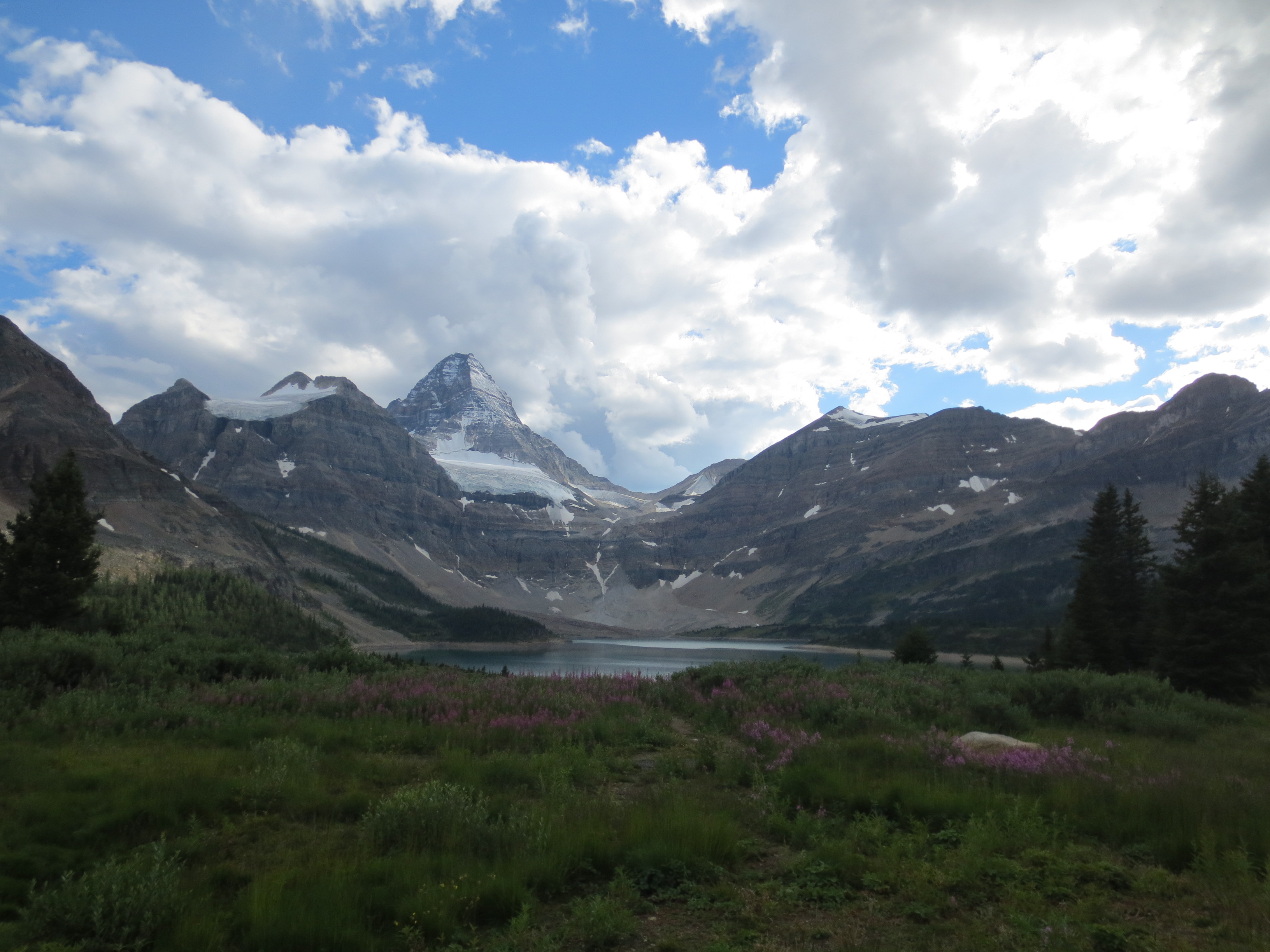
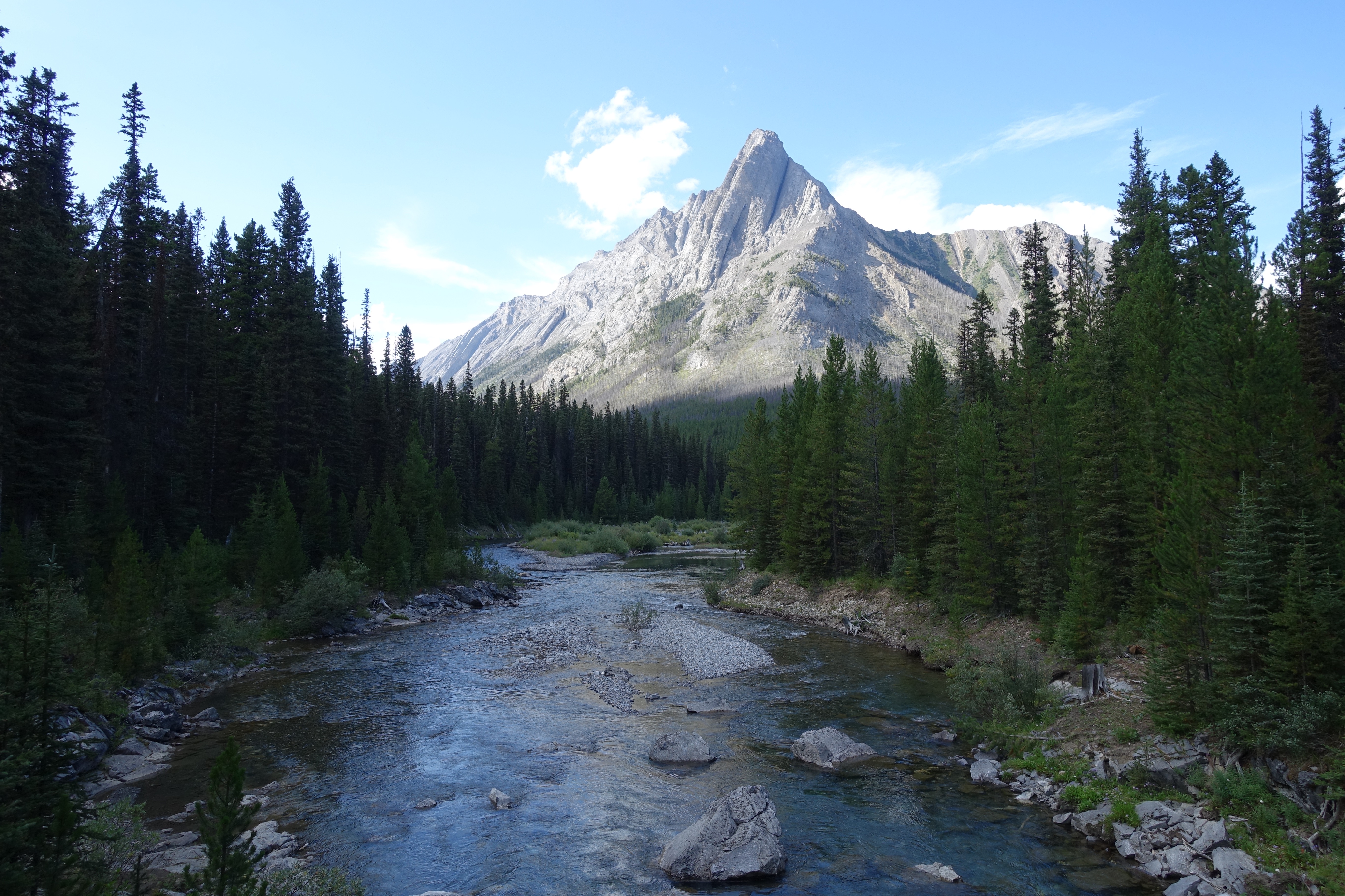
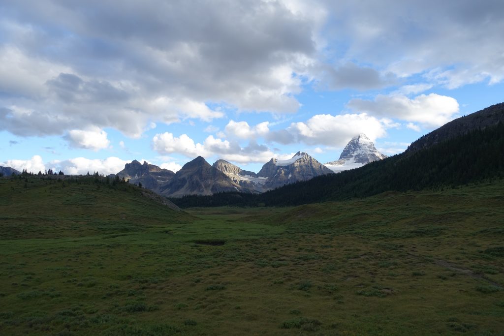
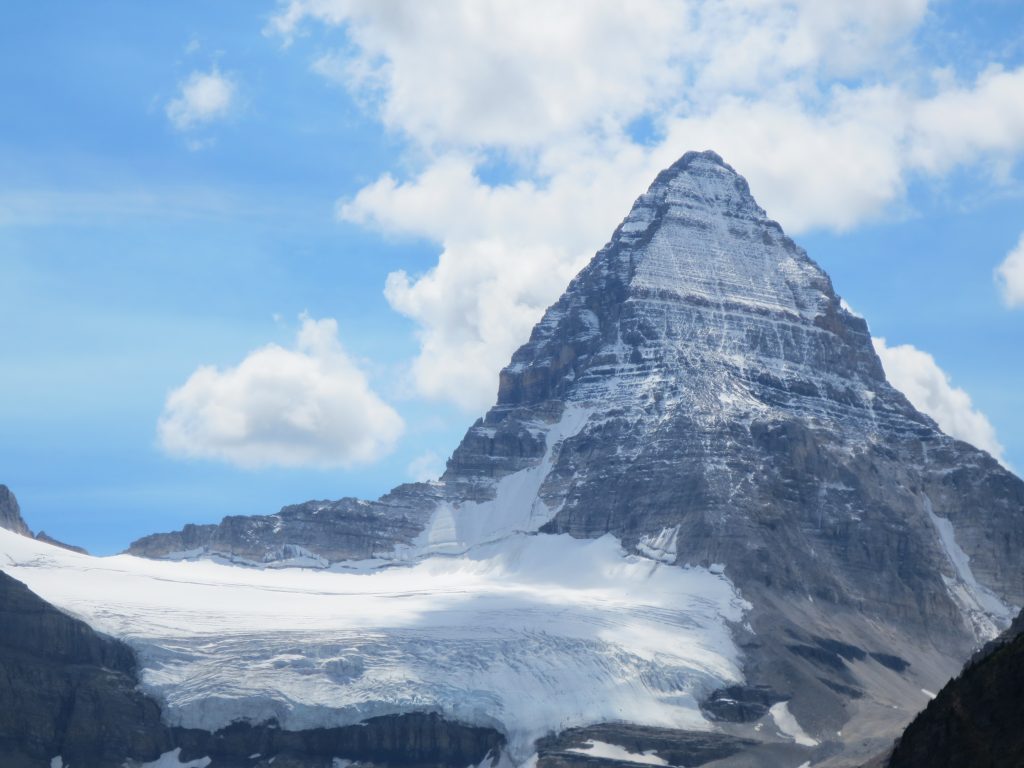
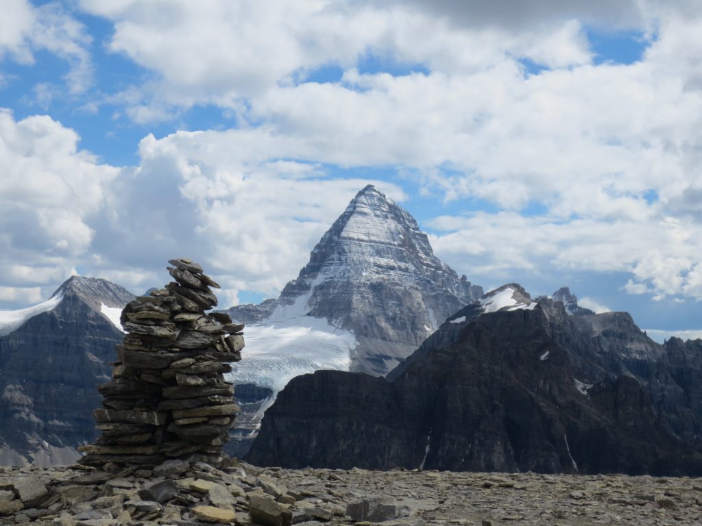
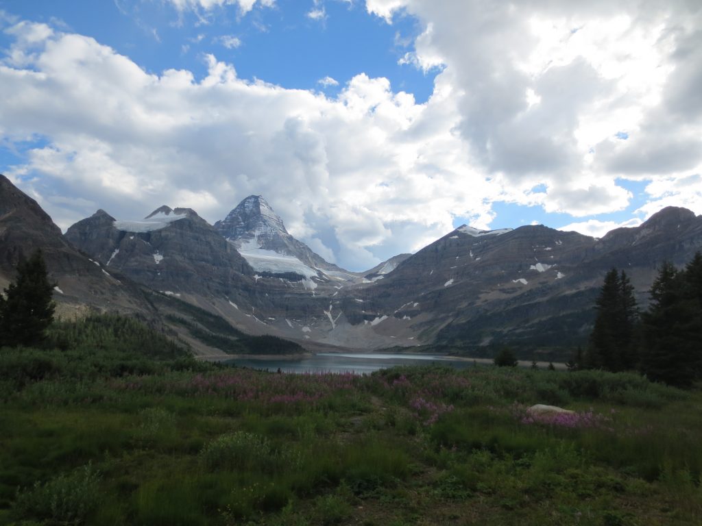
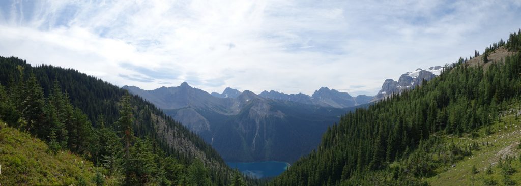
At the end of this valley you come up a small hill and get the first glimpse of Mount Assiniboine:

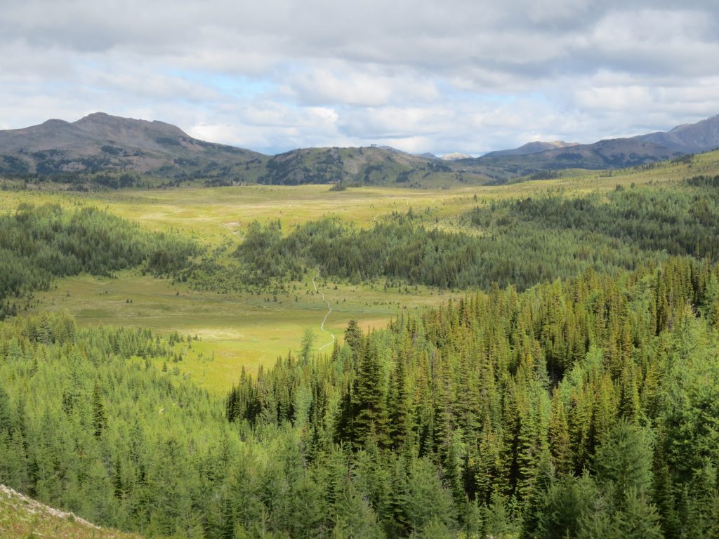
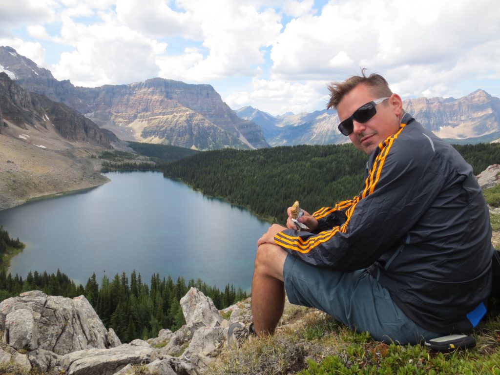
It was easy to get a second wind here, but the reality was there was still about 12km of hiking left before we would reach the Assiniboine area.  We hiked for a few more kilometers to Og Lake and decided to make some lunch.

Ry also ventured down to Og lake to refill our water packs.  I had brought my Katadyn water filter so as long as we were near stream or lake we would have lots of water.

We considered tenting here for the night, but after a good meal decided we could push on to Magog Lake Campground about 6km further ahead.  The hike from Og was flat and easy through the last valley.  The whole time you are rewarded with better and better views of Assiniboine.  By this time however, we were both exhausted and the day was starting to feel like a slog.  I was regretting packing 2 liters of beer and considered stopping for a drink, but it wouldnt feel right before we reached out destination.

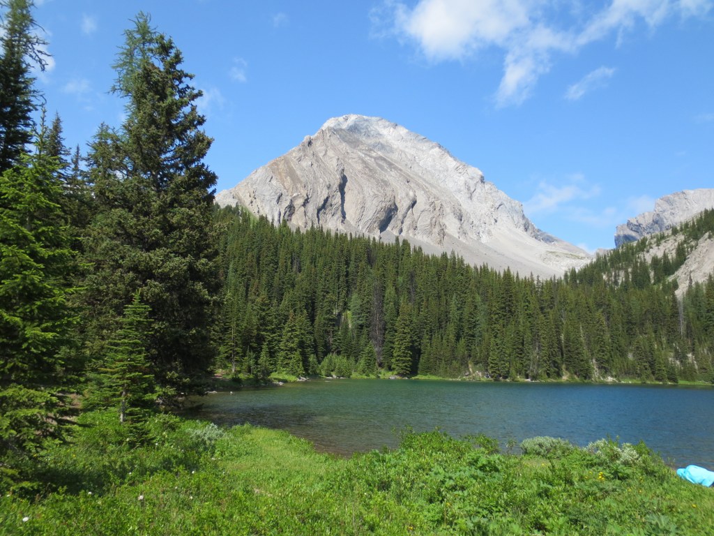
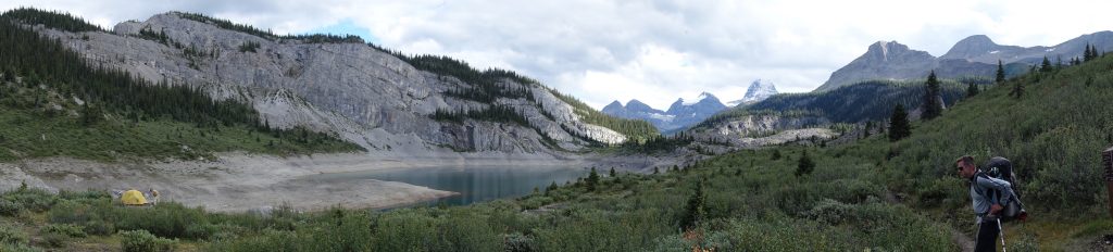
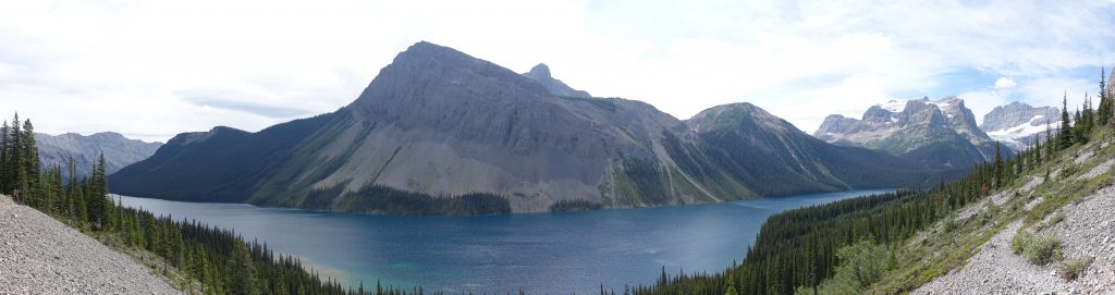
Upon reaching Magog Lake the views of the Assiniboine area were outstanding.

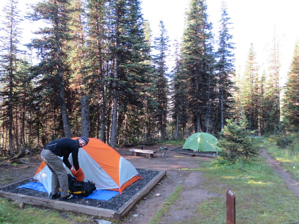
We reached the camp before dark and managed to get our tents up while there was still lots of light.  The campground was perfect, but would definitely fill up on busy weekends. 

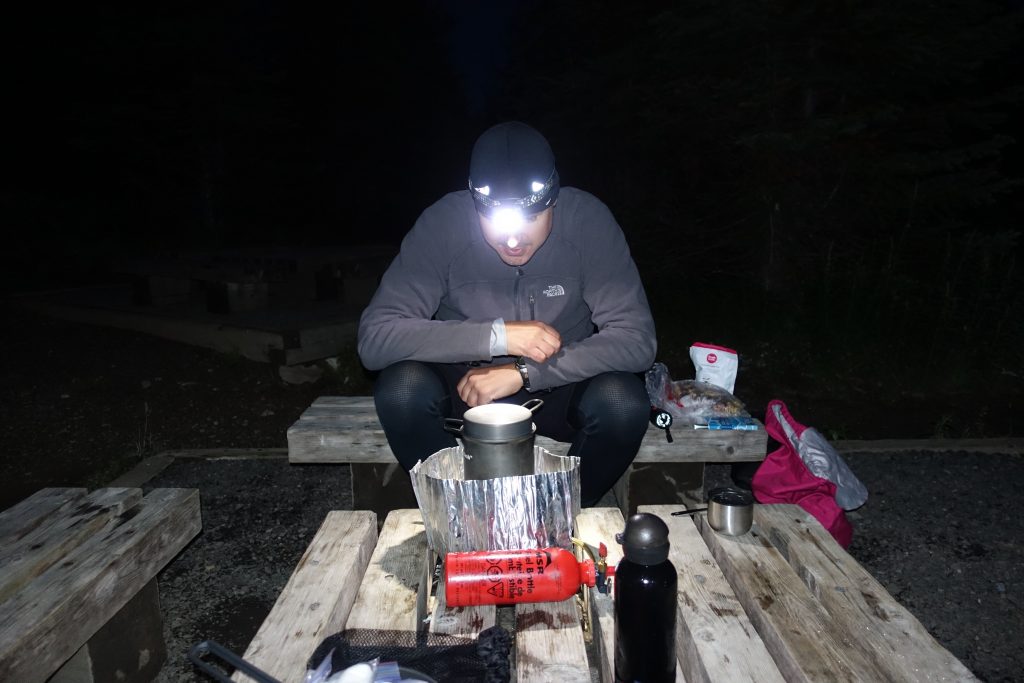
By the time we had our tents setup and ventured down to the cooking areas it was totally black out.  I opted to save the beers for tomorrow evening and we opted for a glass of scotch and a cigar instead. 

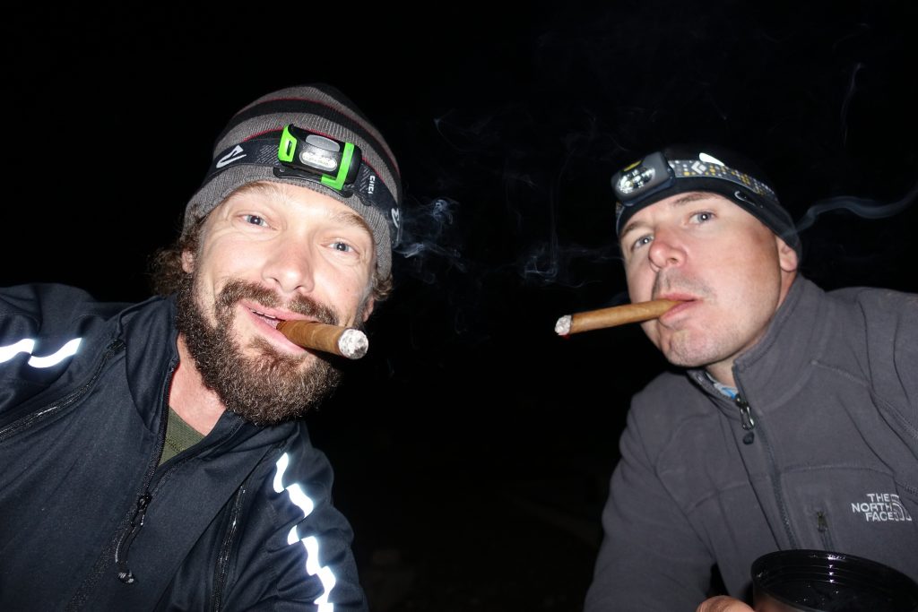
The nights really cool down that high in the mountains and it was really cold by the time we crashed.  The good thing about a long day is you fall asleep as soon as your head hits the pillow, regardless of the temperature.

Day 2: Nub Peak and around Magog Lake (30km)

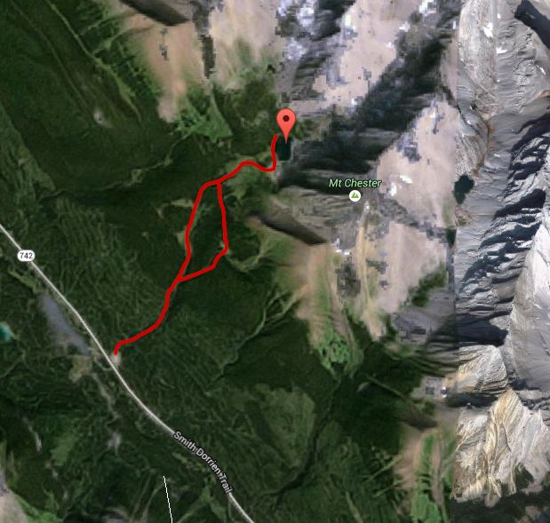
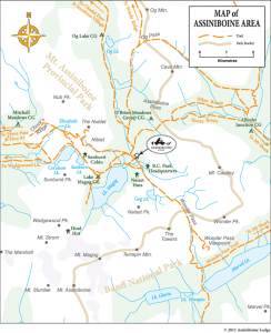
The following is a good map of the Assiniboine Area from the Assiniboine Lodge Site.

http://assiniboinelodge.com/general-info/maps-and-guide-books

We woke up to perfect blue skies and a great view of Mount Assiniboine from our campground.


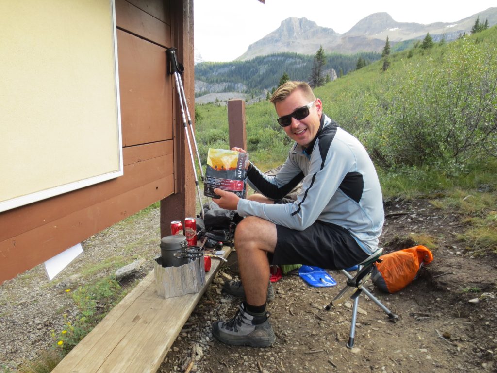
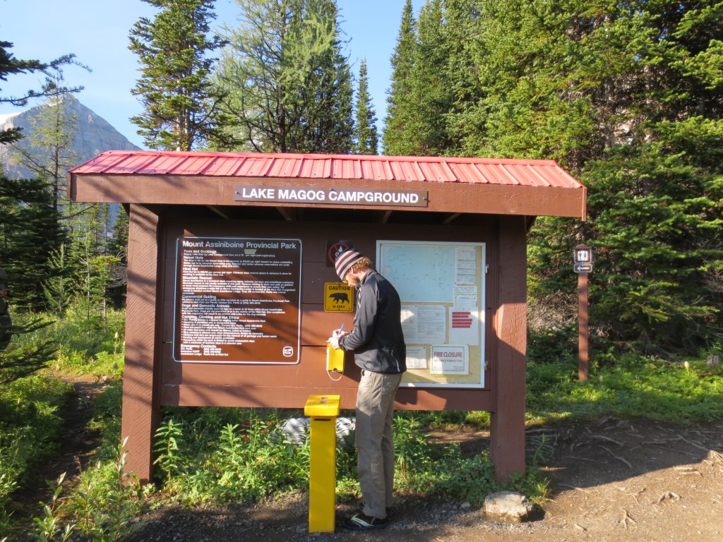
We went and filled out the proper paperwork (missed it the previous night) and had a hearty breakfast.

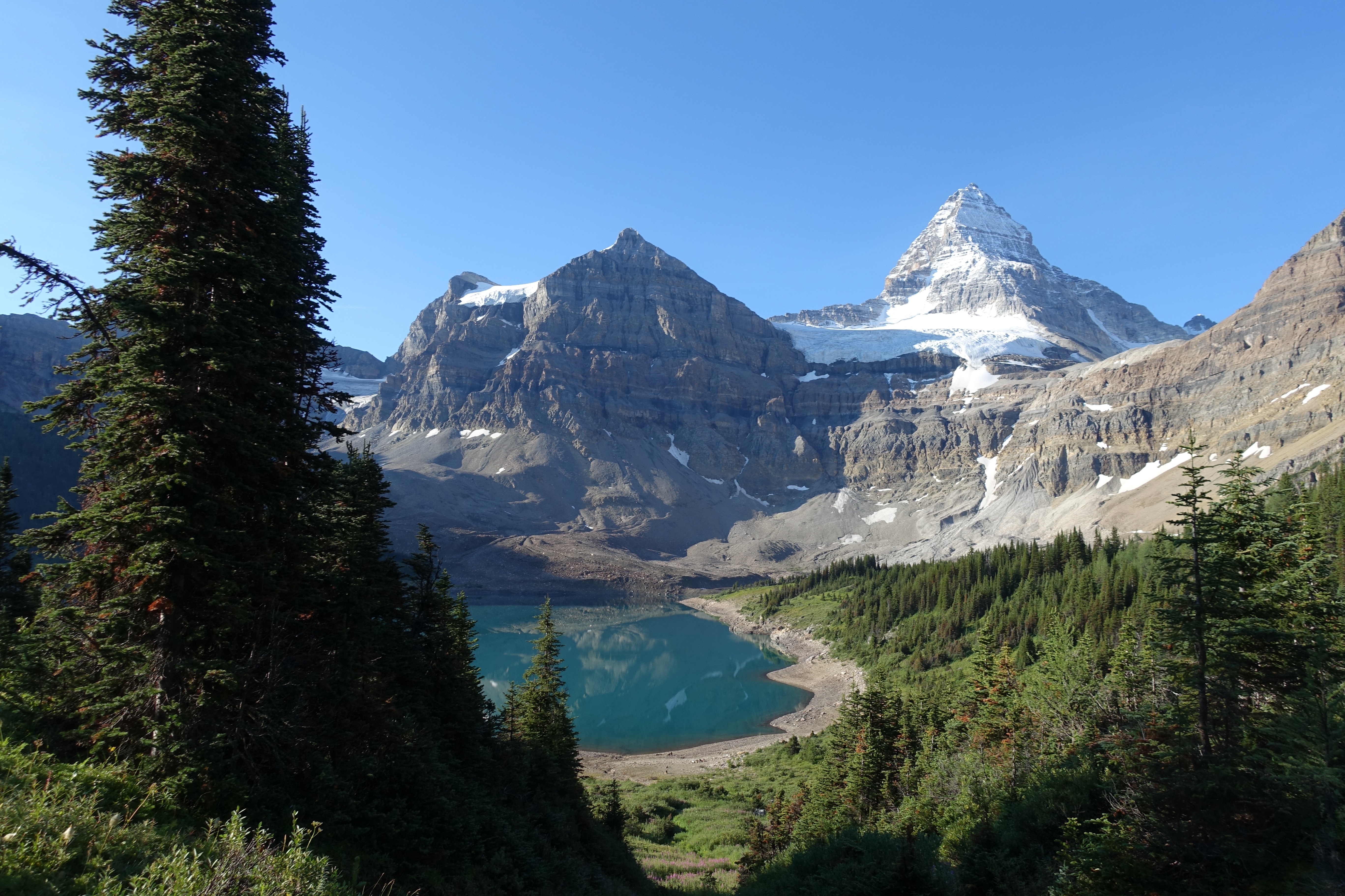
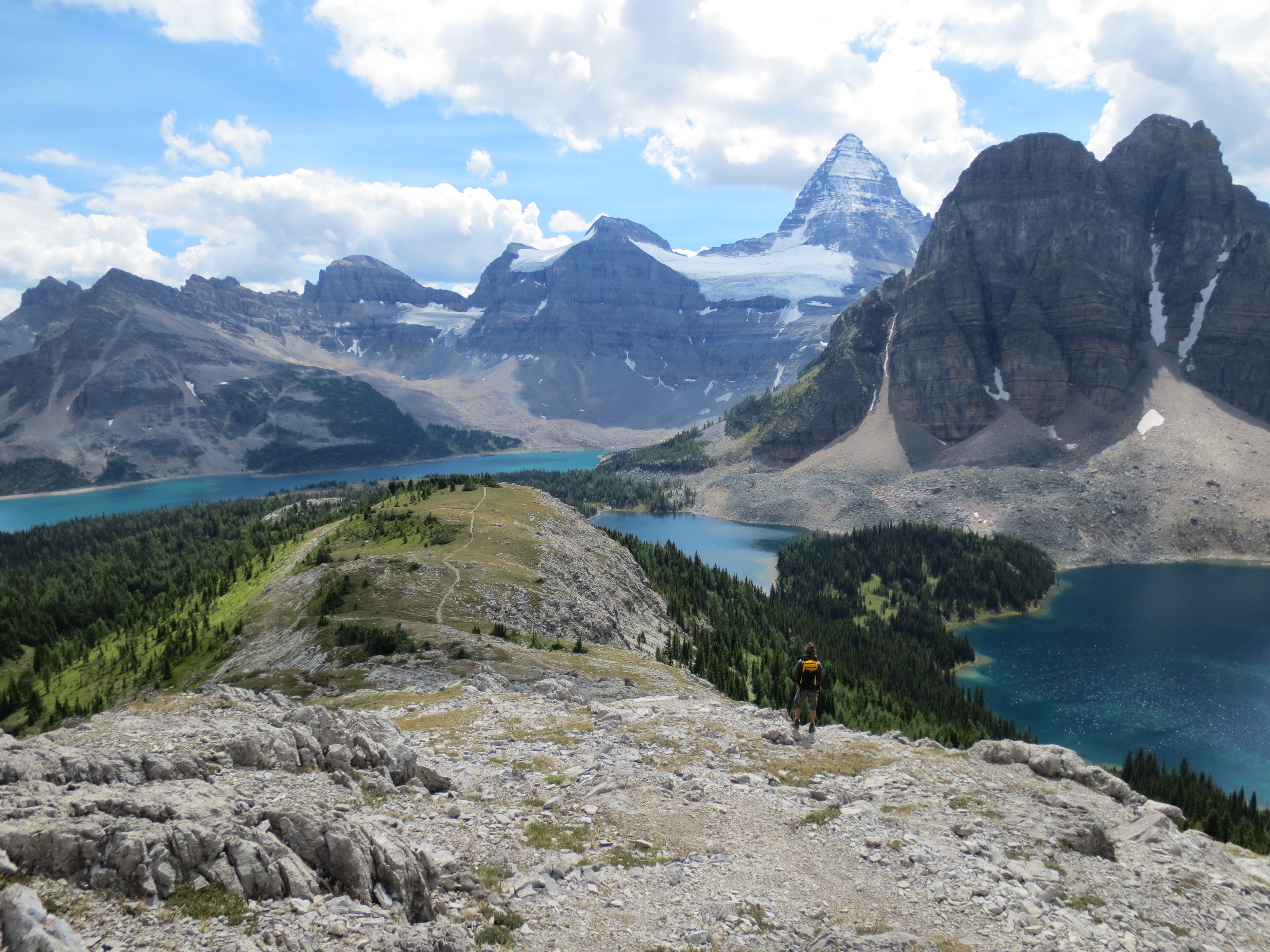
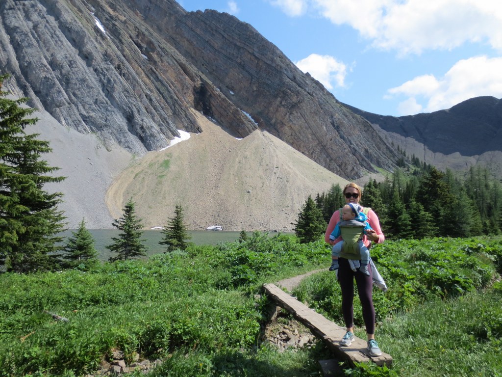
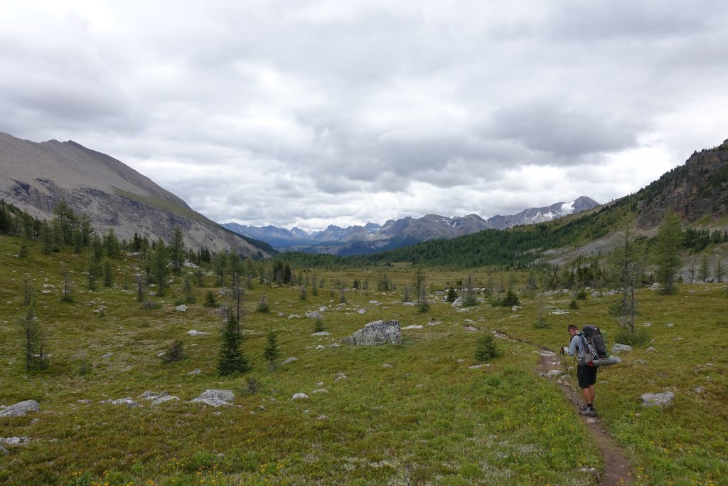
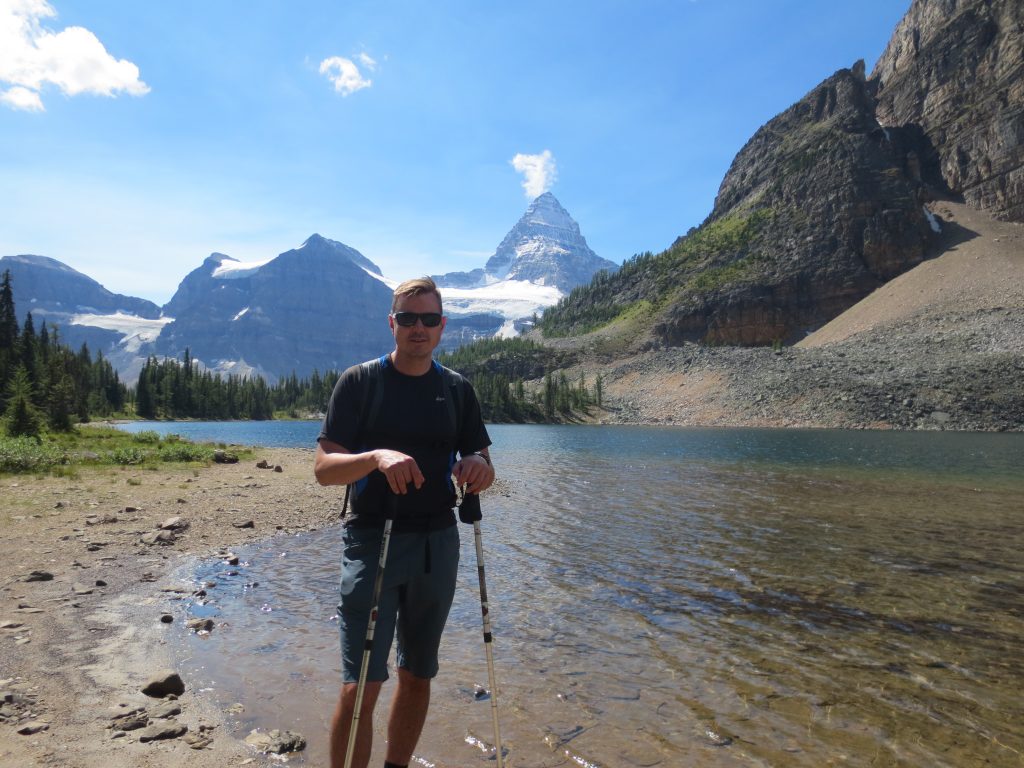
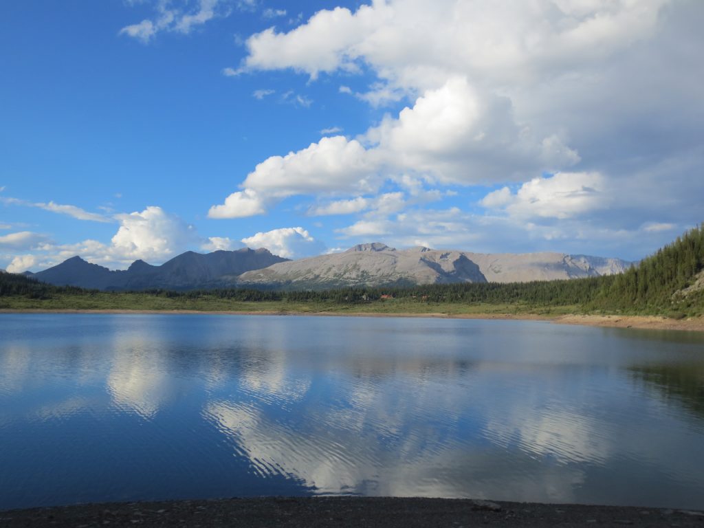
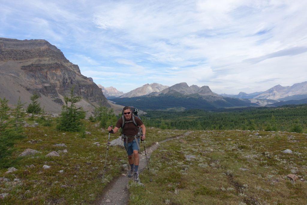
After breakfast we set off to hike up to Nub Peak.  It offers one of the best views of the lake and Mount Assiniboine, and is one of the most popular places to take pictures of the valley.  We hiked the long way up around lake Magog, and by Sunburst Lake and Cerulean Lake.

Along Sunburst Lake:

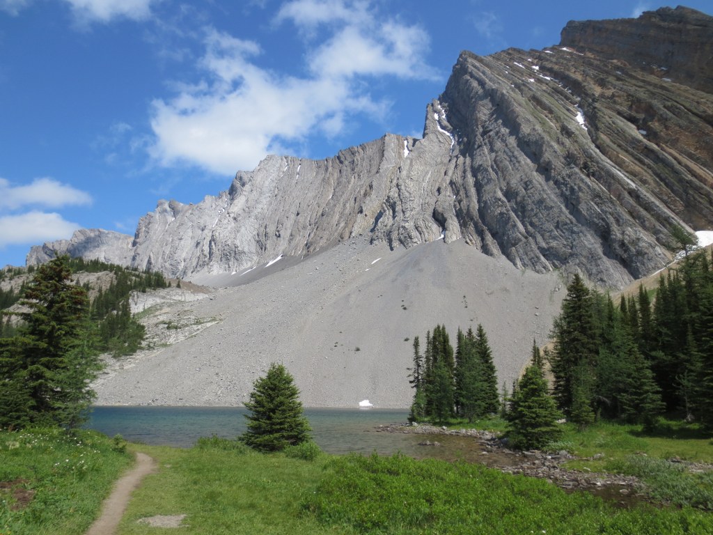
After Sunburst Lake the path winds up towards Nub Peak.  In the distance you can see Elizabeth Lake.  Upon reaching the Nublet, you can start to see a view of Assiniboine.

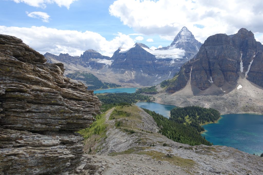
Looking down you can see the 3 lakes leading up to Mount Assiniboine.

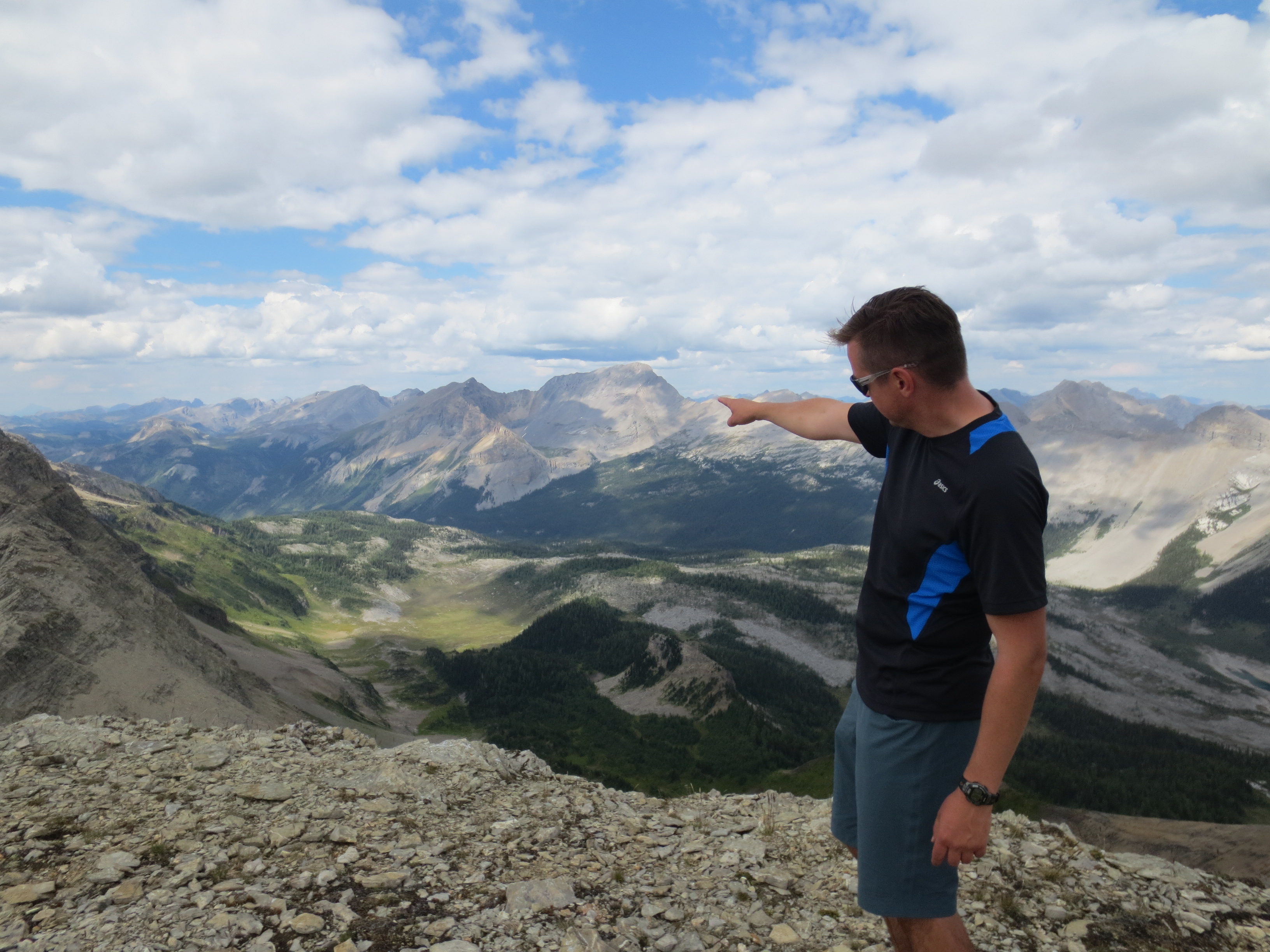
The peak of Mount Assiniboine is forbidding.  We stop for lunch and watch a helicopter circle over the summit for some time.  Later we learned it was a rescue operation.  A climber in his 60s had always wanted to summit Assiniboine, but after reaching the top he was unable to muster the energy to climb back down.  The helicopter was brought in to take him off the top with a harness.

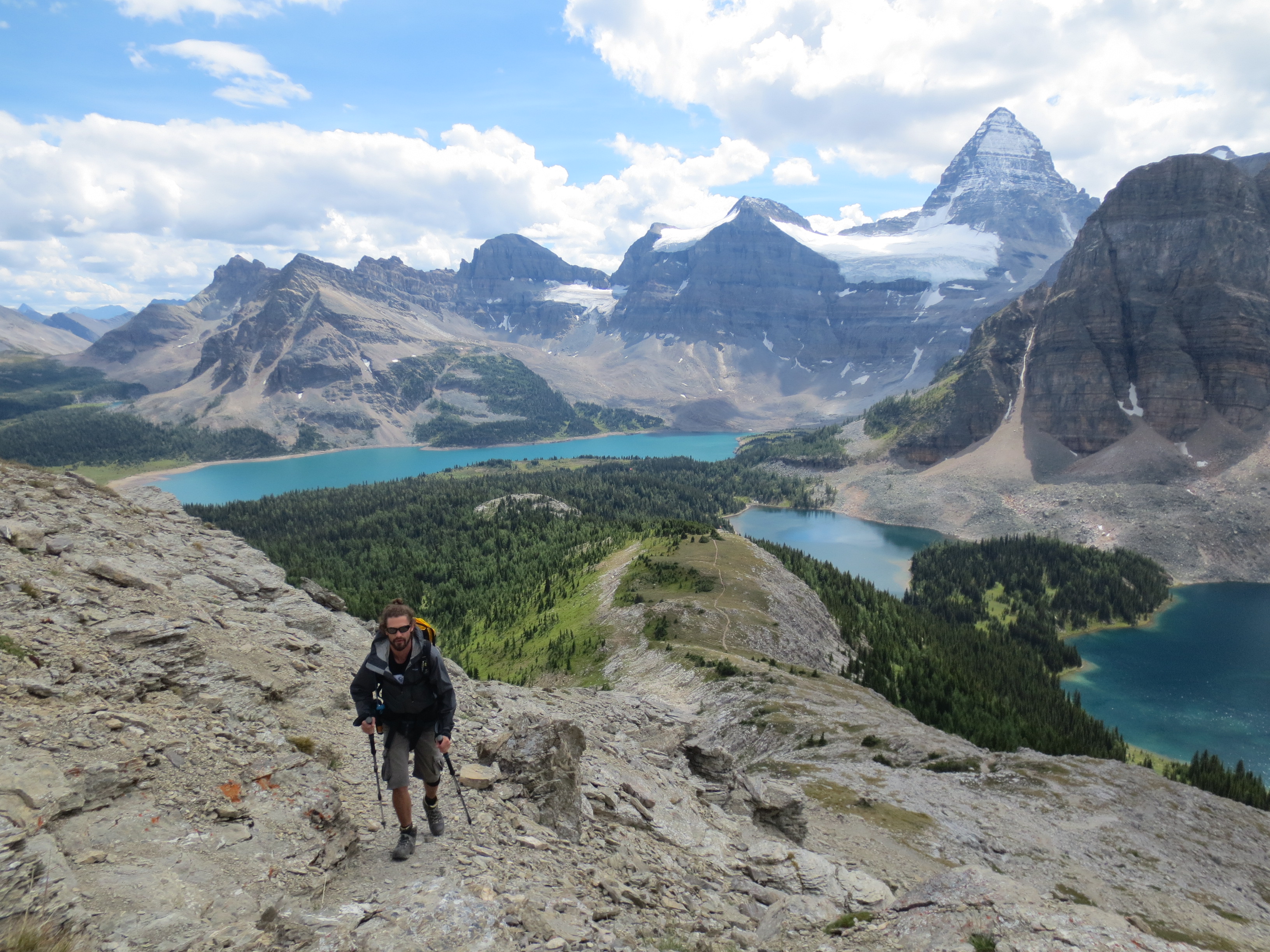
After a bite to eat, we decided to hike up to the Nublet.  It is about half way up Nub Peak.  As we go up the trail the views get better and better.
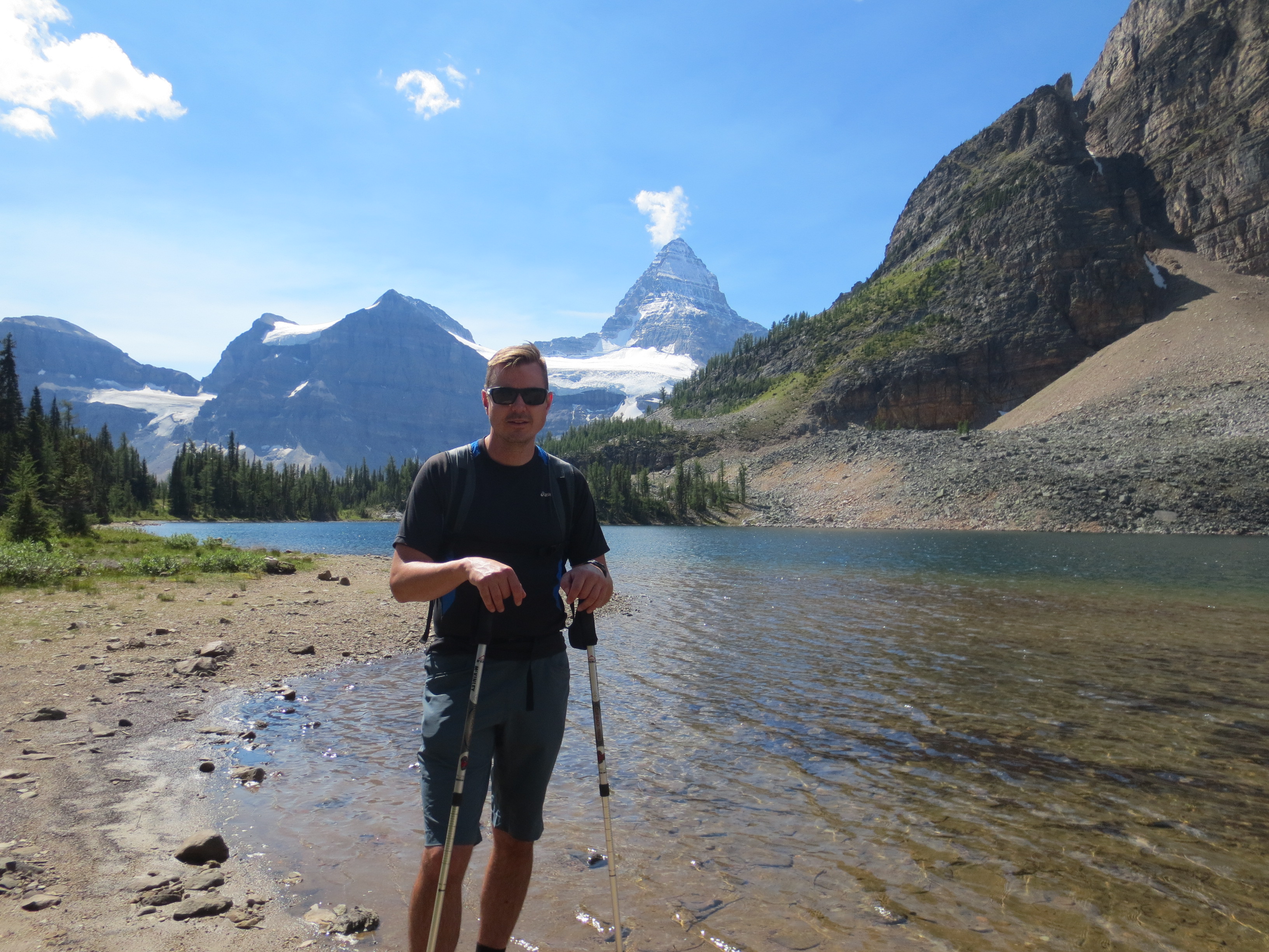
Our destination:

A look back at the Niblet:


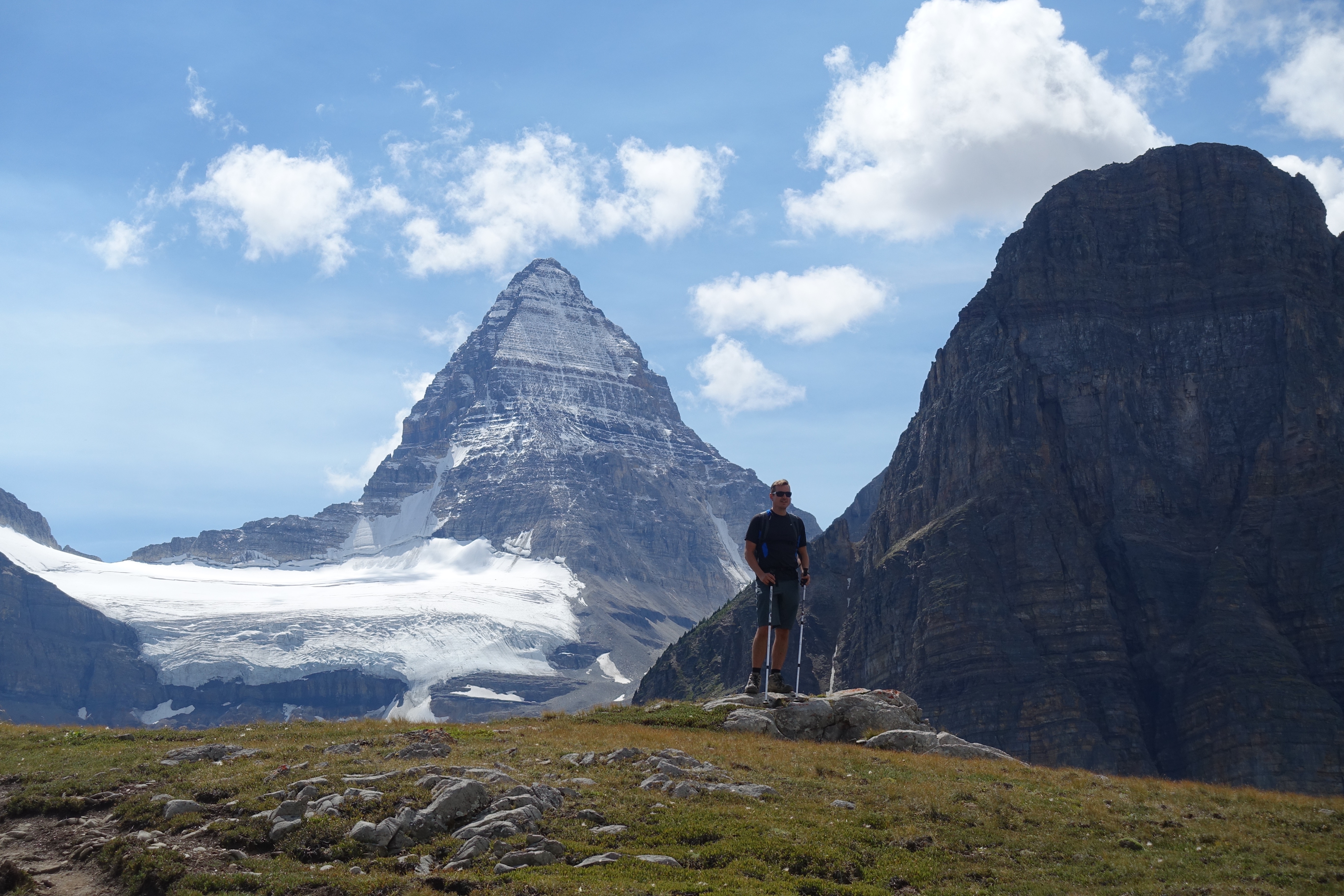
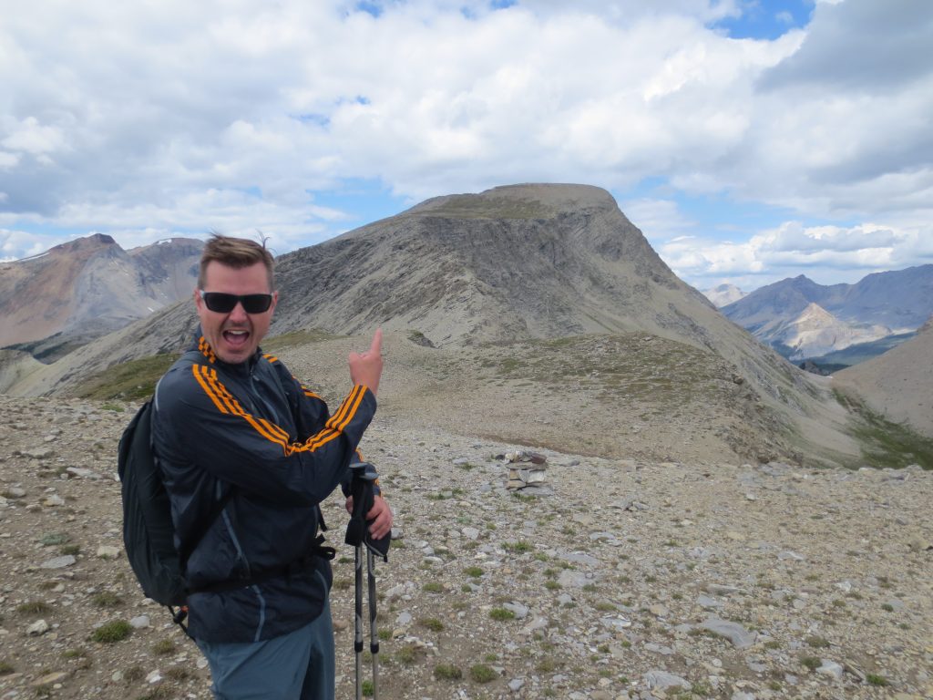
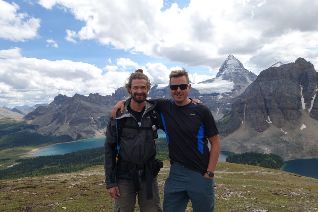
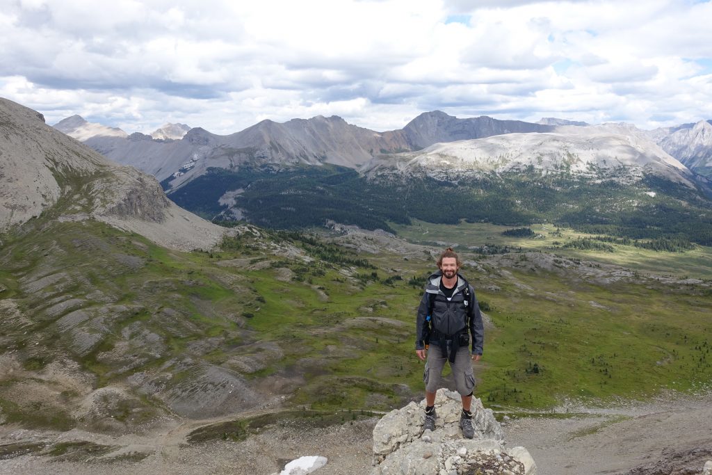
Made it to the Nublet.  Amazing views of the surrounding area.

One thing I’ll give Ryan is that he is not afraid of heights.  Climbing out onto outcrops to take a picture or check out a view gives me extreme anxiety.  Dammit Ry.

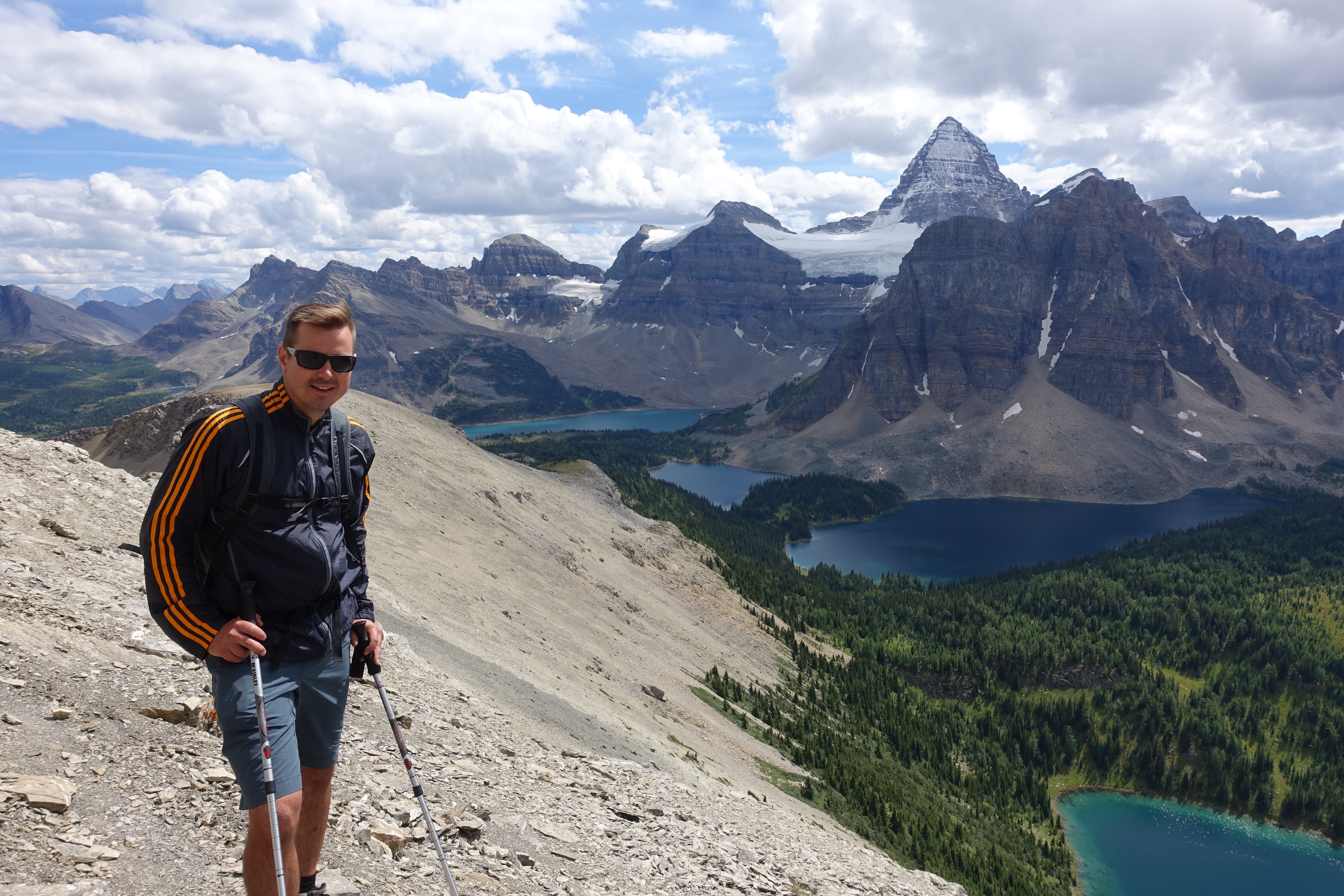
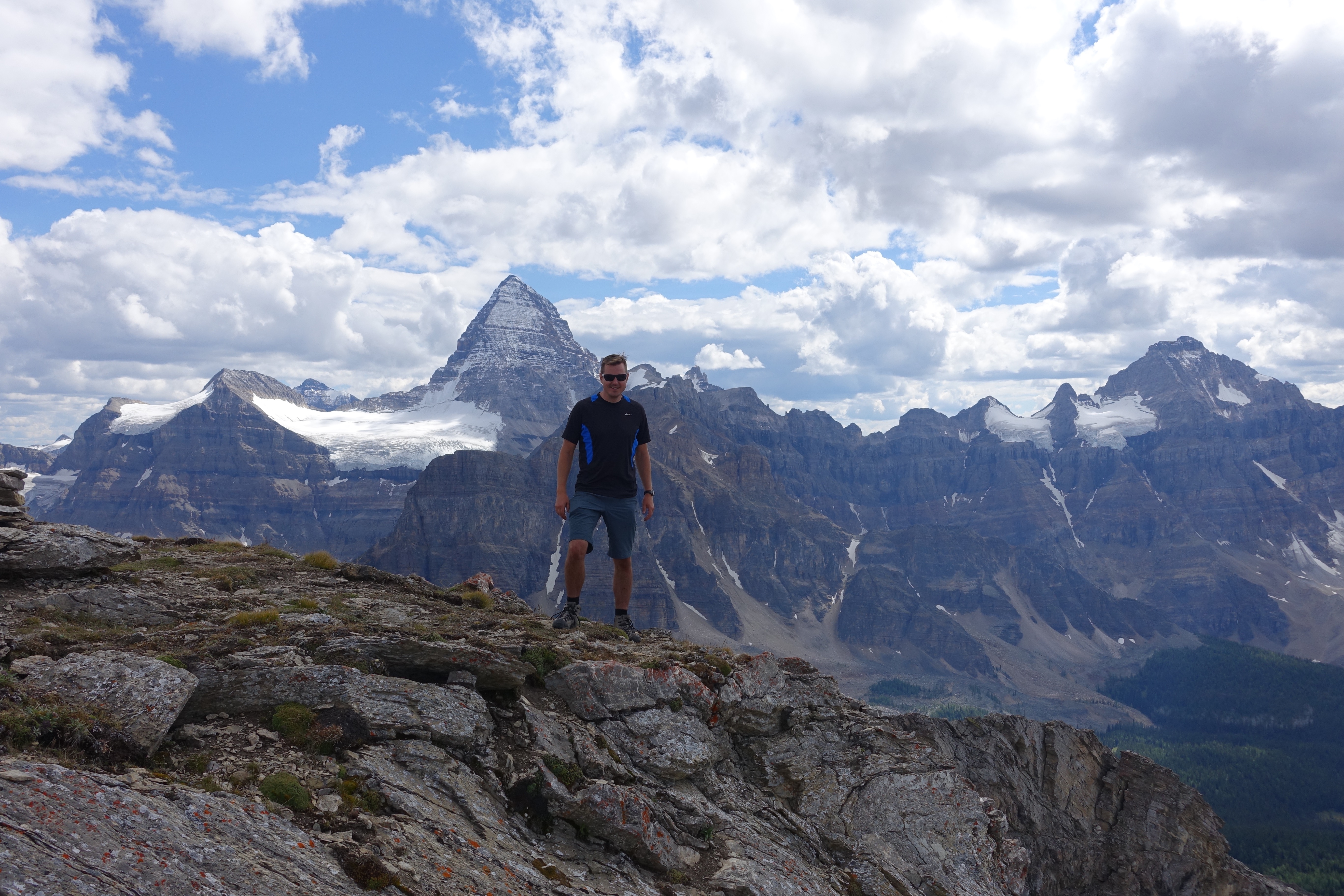
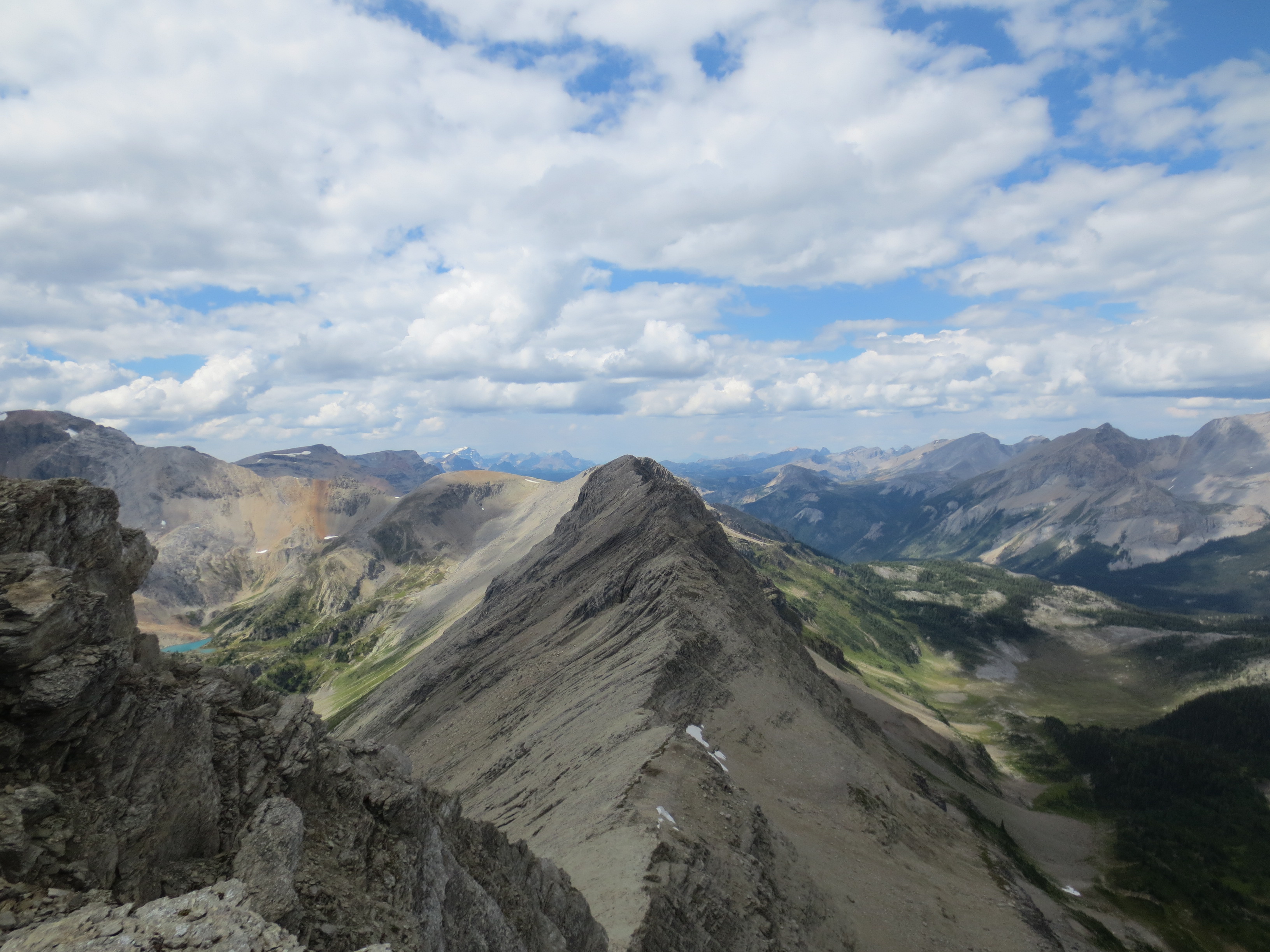
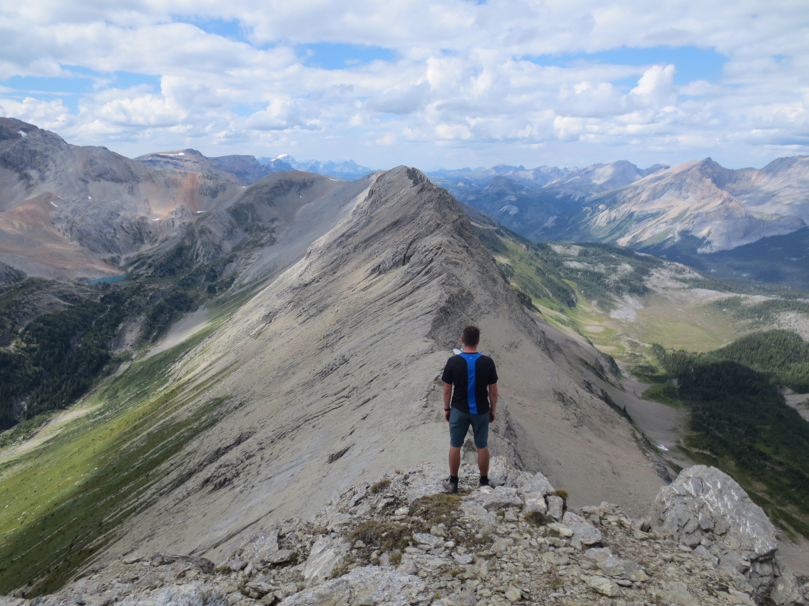
We kept going to reach Nub Peak.

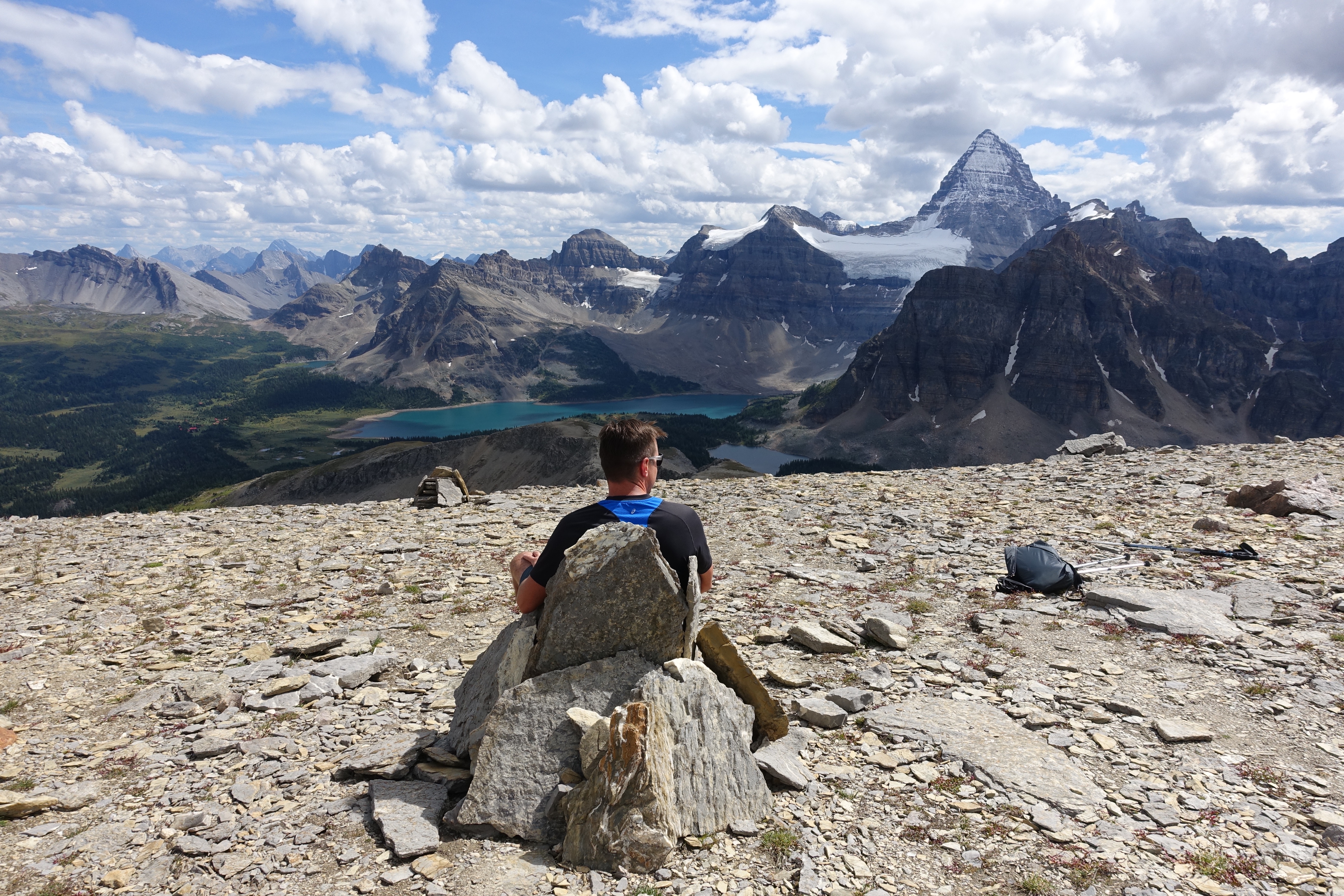
At the summit is a chair someone built in stone.

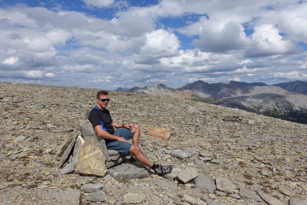
Its the perfect place to chill and checkout the surrounding area.  There are a number of small walls built out of stones, I suspect it can get windy up here at times.

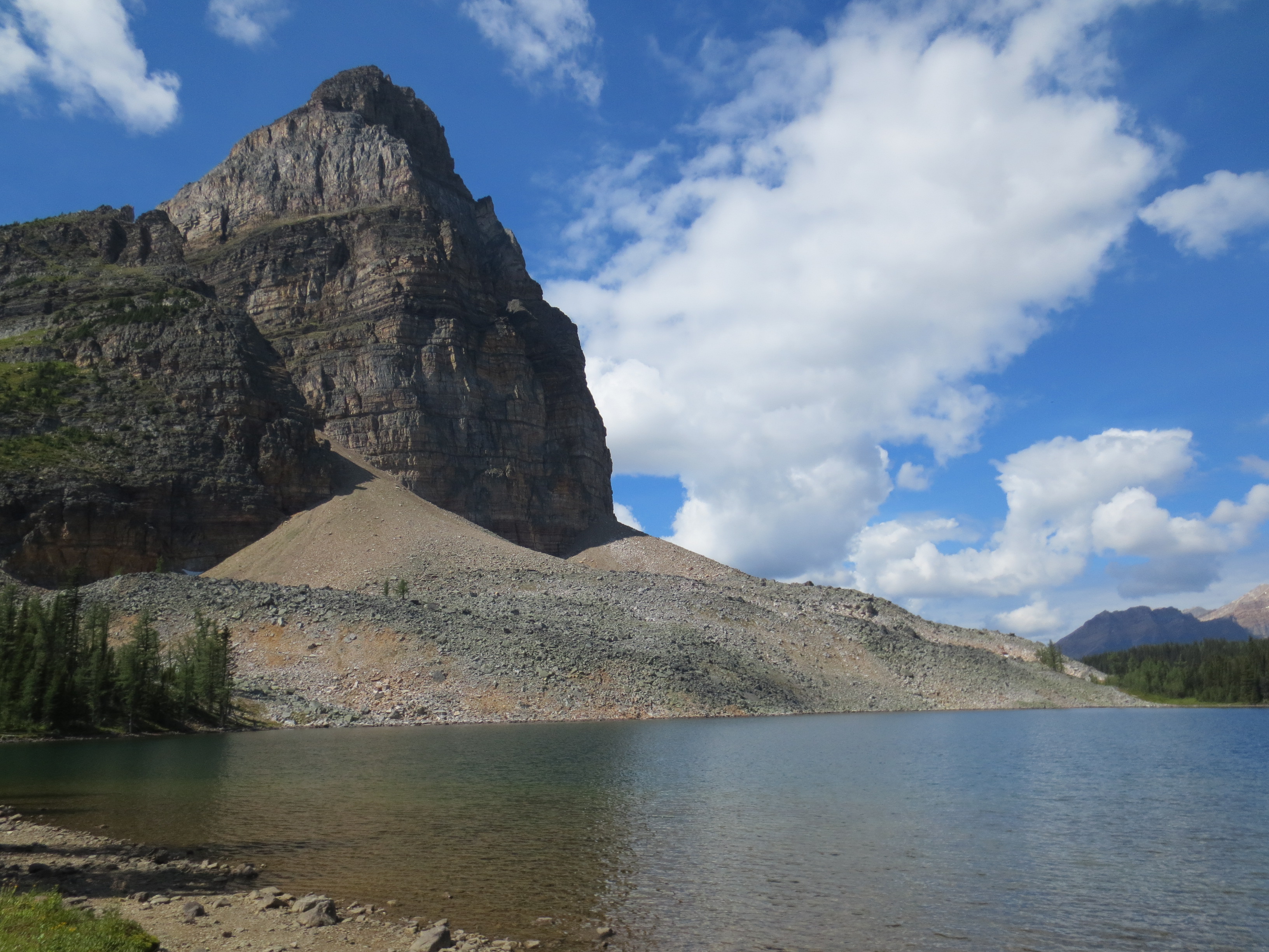
The ridge continuing on past Nub Peak, not climbable, at least I wasnt going to attempt it. 

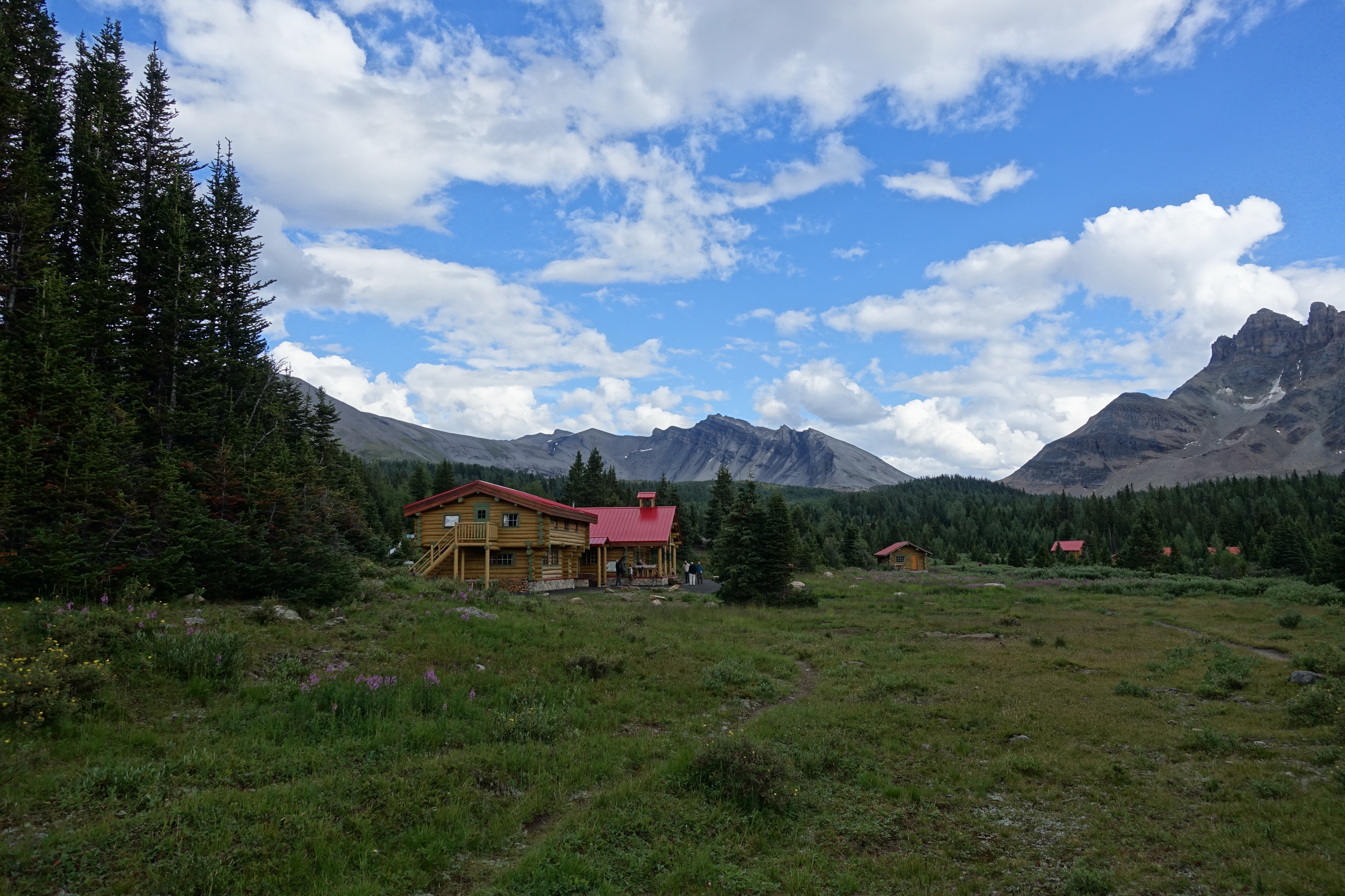
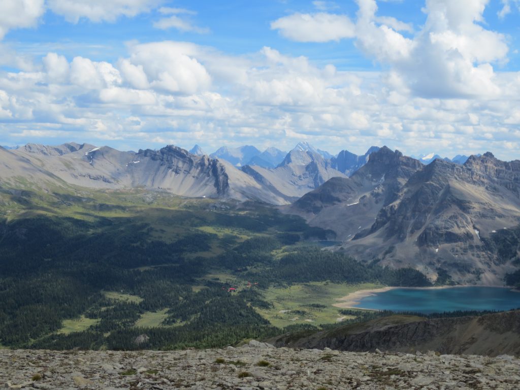
Looking down at Assiniboine Lodge with the red roof in the distance.

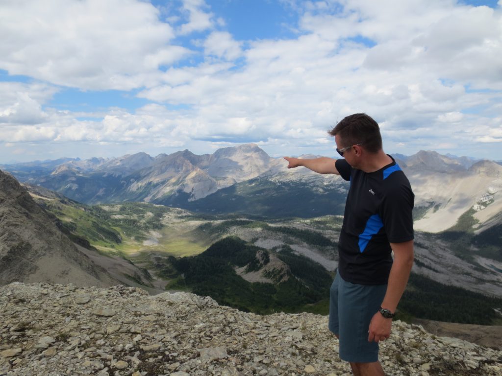
The valley we came in through the previous day.

End of the trail

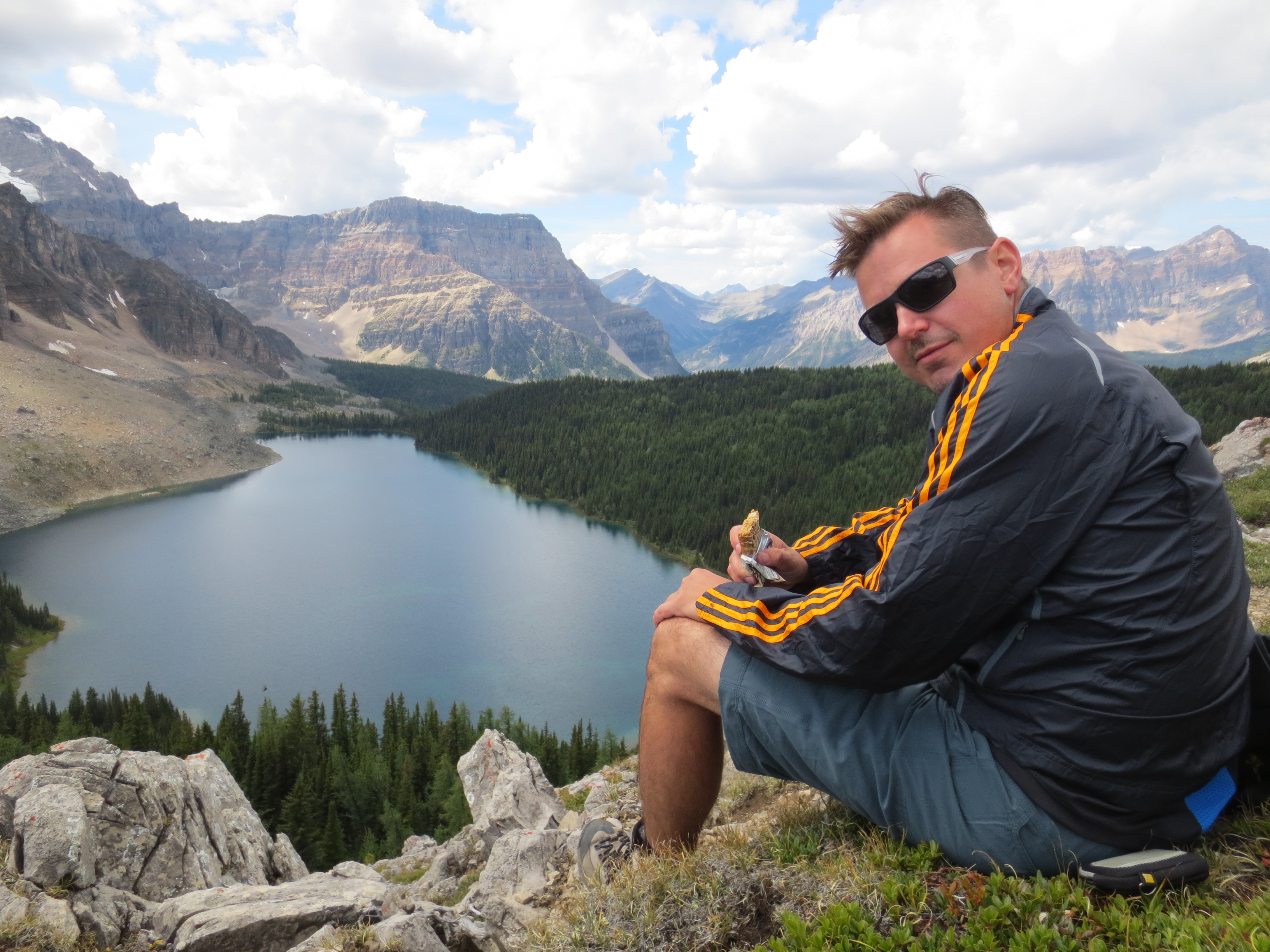
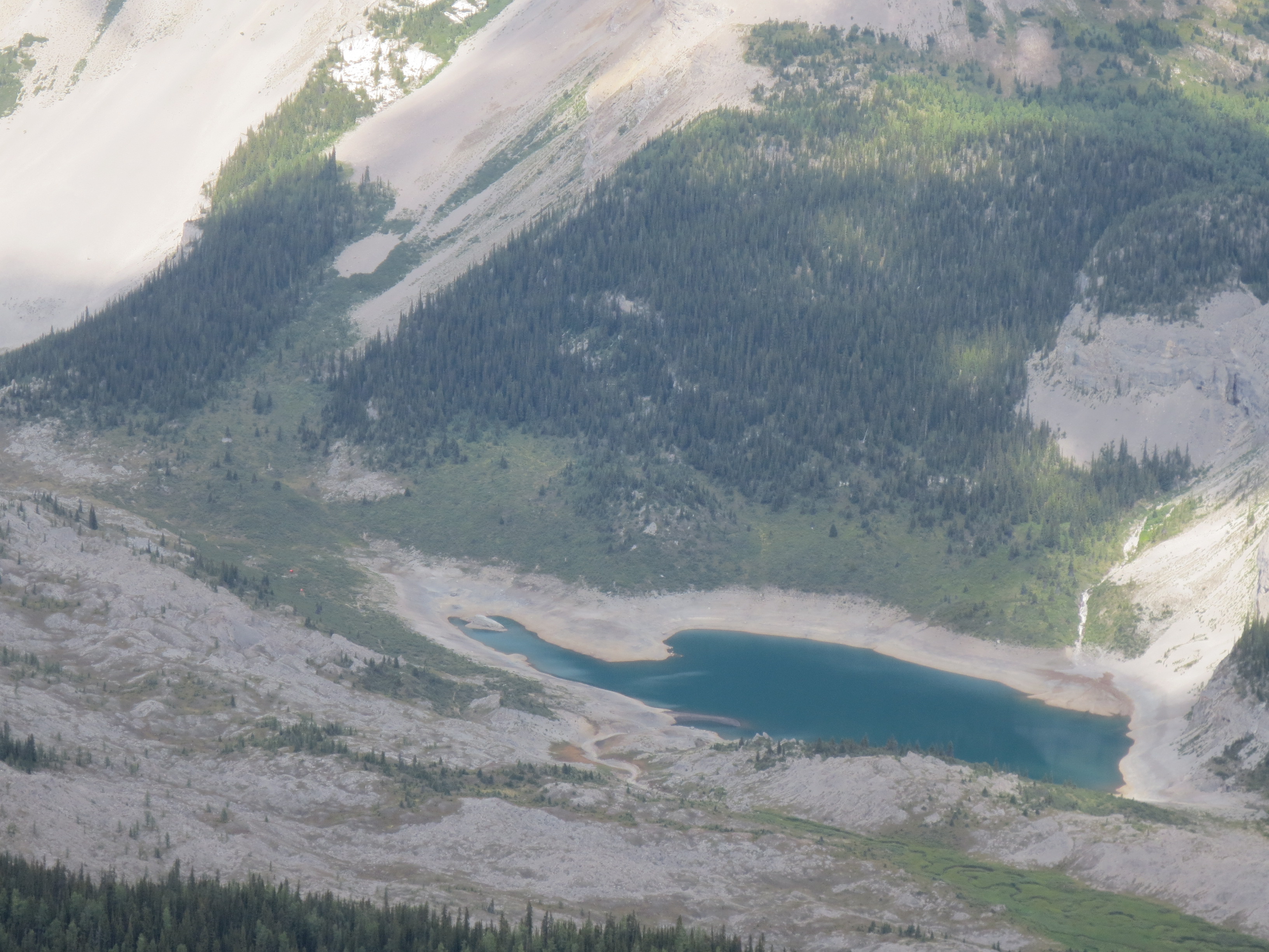
Looking down at Og Lake where we stopped for lunch on Day 1:

One of the many Inukshuks on the peak: 

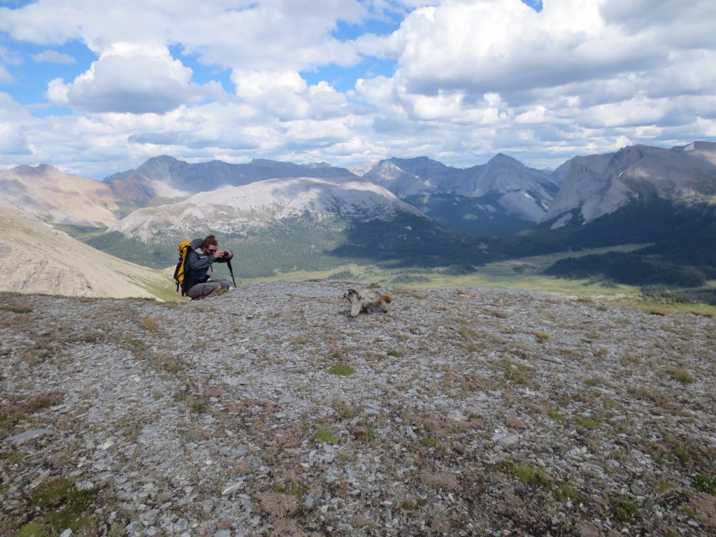
A marmot running around up top:

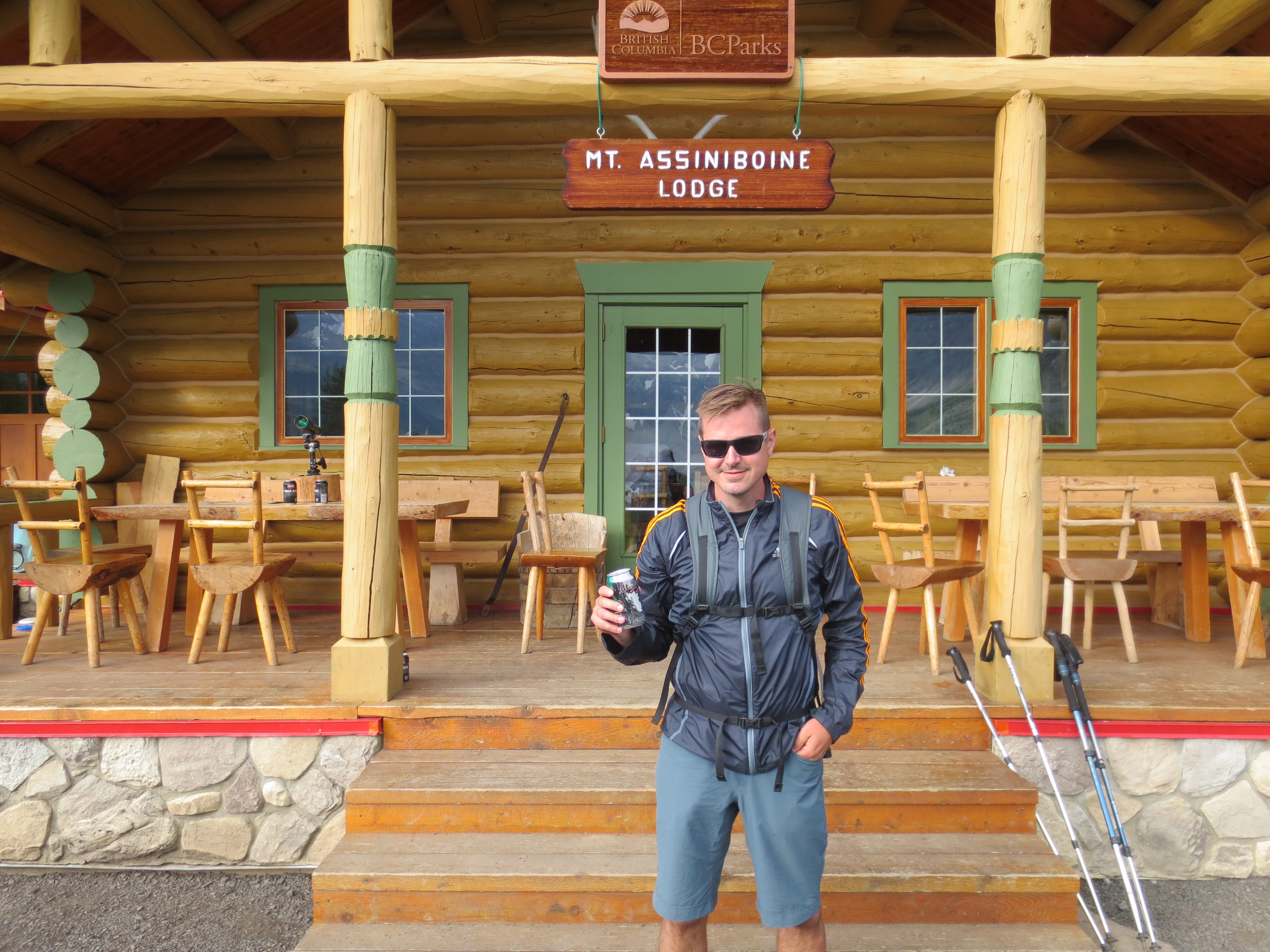
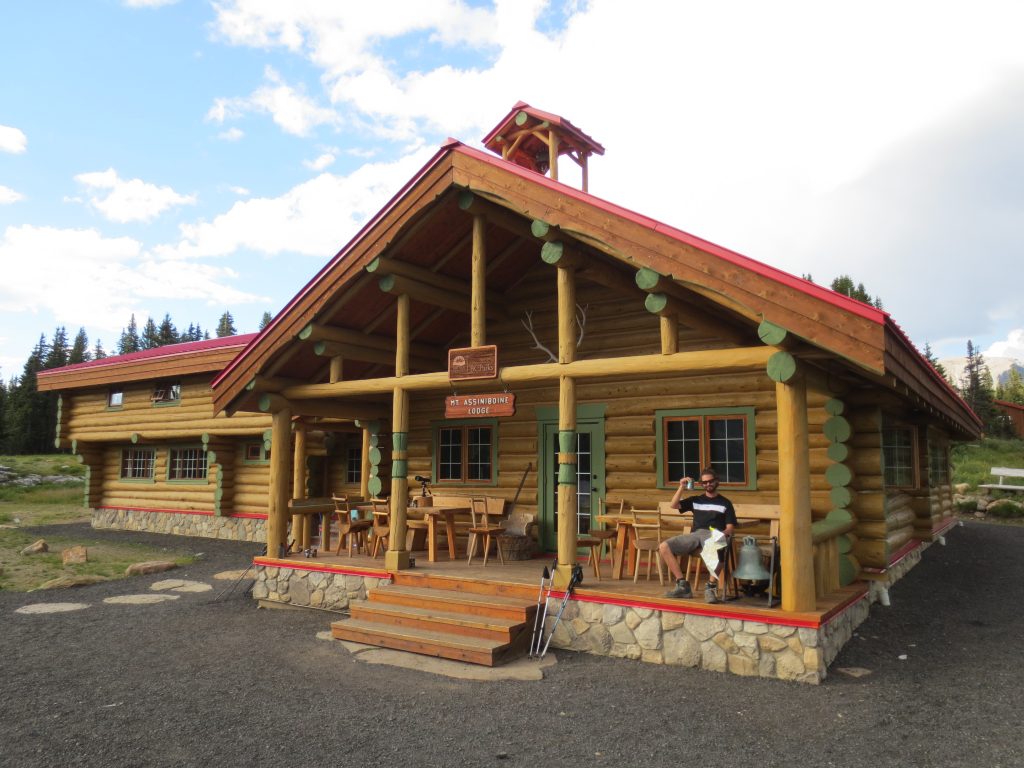
After some time on the peak we decided to head back down, the opposite side we came up.  This trail heads back to the Assiniboine Lodge.  Back at the Lodge we were exhausted and found out they sold beer, perfect way to end a great hike.  I started to feel silly lugging 2 super cans of beer up in my pack when we can just buy cold beer from the lodge.

Cold beer on the patio:

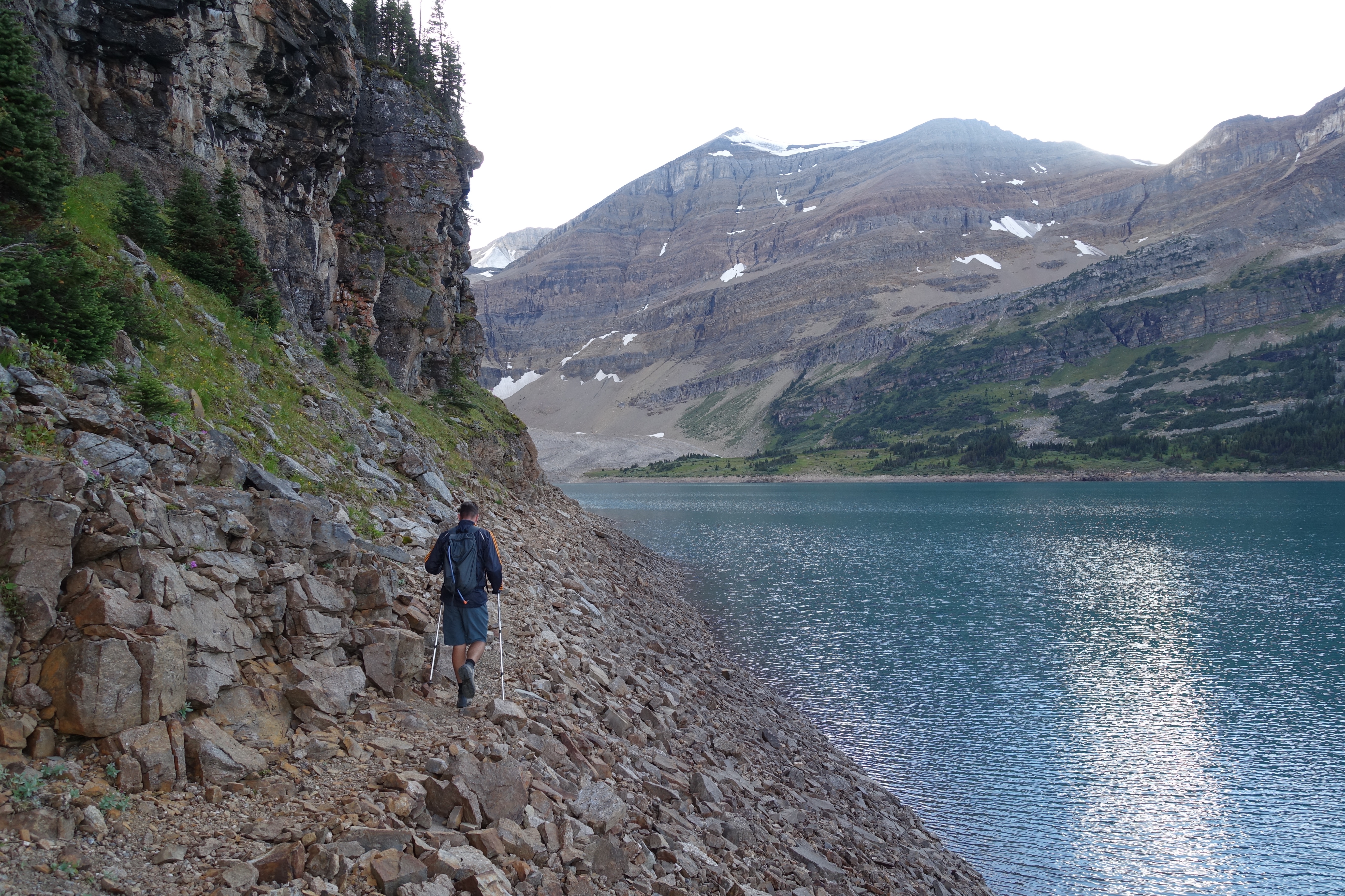
Heading out from the Lodge we decided to hike around the back side of the lake ie. the long way around, to get back to our camp site.  There was a line of the map indicating a trail, so I assumed it would be straight forward.

View out from the Lodge:

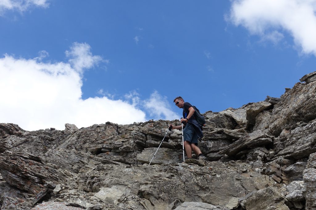
The trail started easy but quickly turned into boldering.  Normally it wouldn’t be a problem, but we were 25km into a day and just ready to get back to our camp and eat before it was dark.

View back across the lake towards the Lodge:

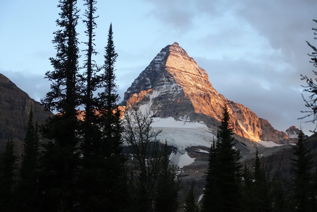
Sunset on Assiniboine


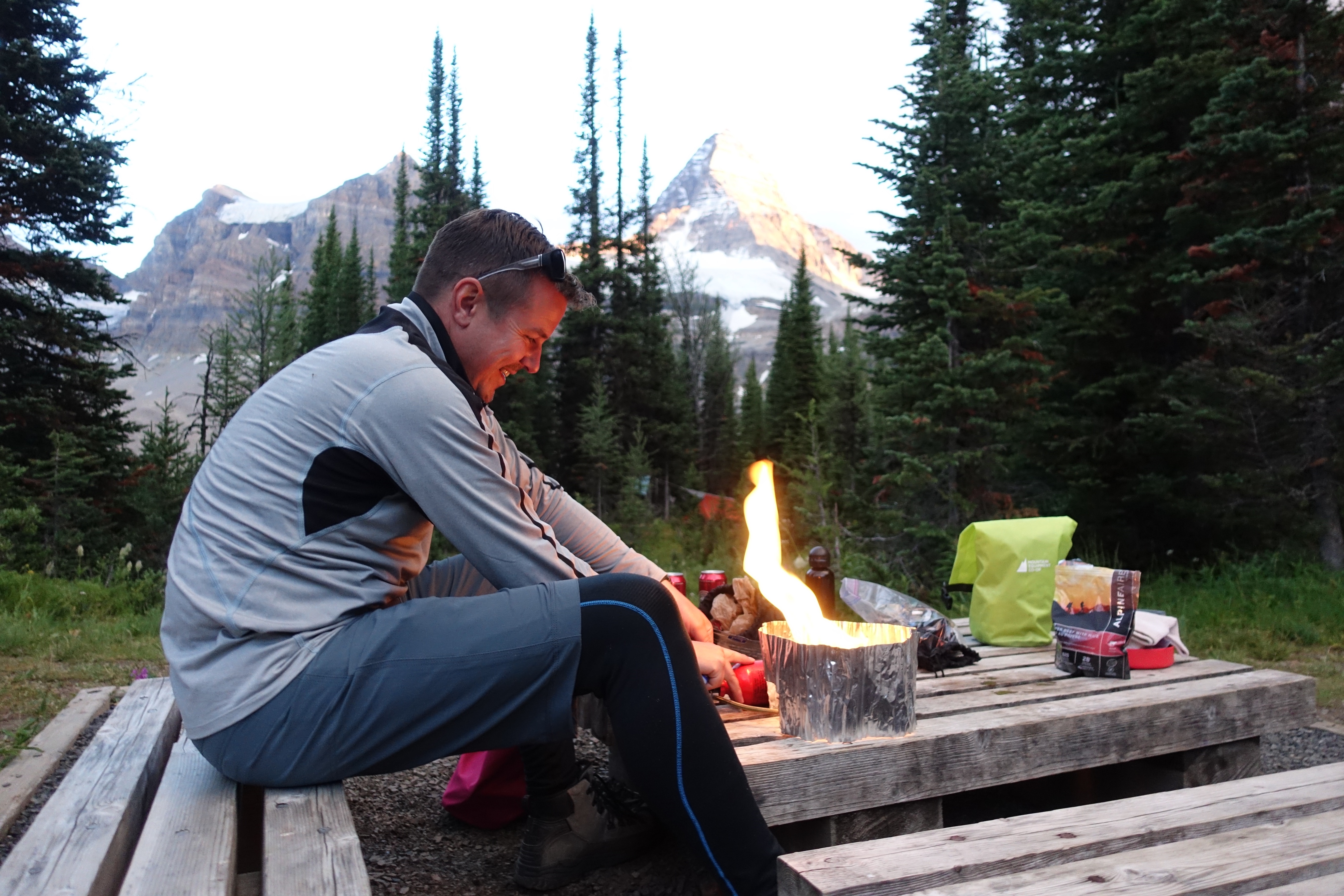
We got back to camp just as the sun was going down behind the horizon.  We were both famished and fired up the stoves to make some dinner.

I must say the beers we brought were good:

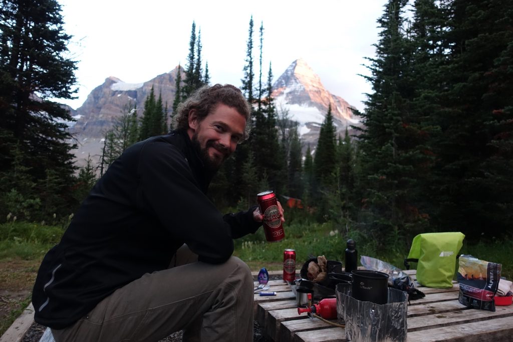
We crashed early, after dinner, beer and more scotch and I slept unbelievably sound.

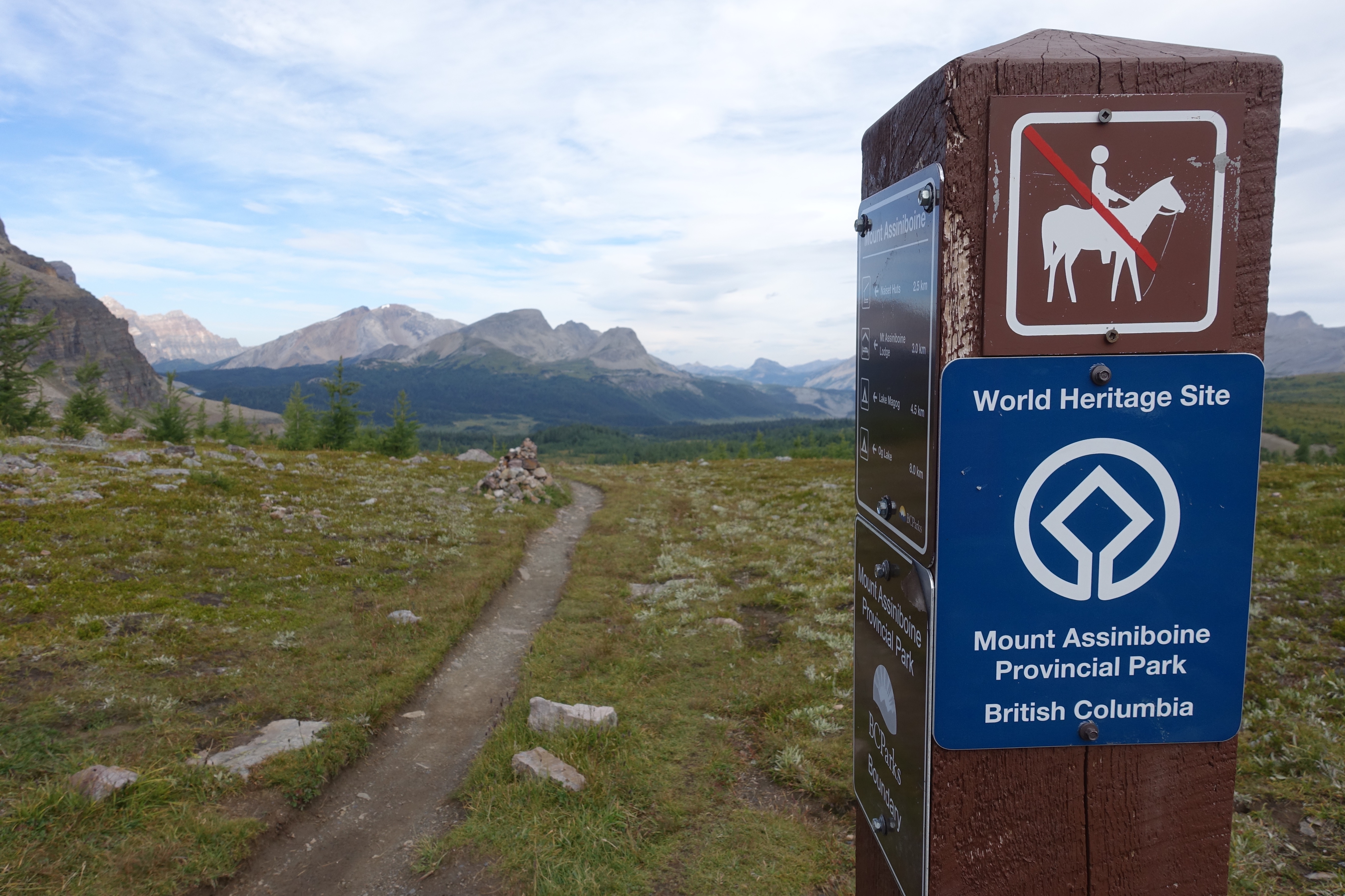
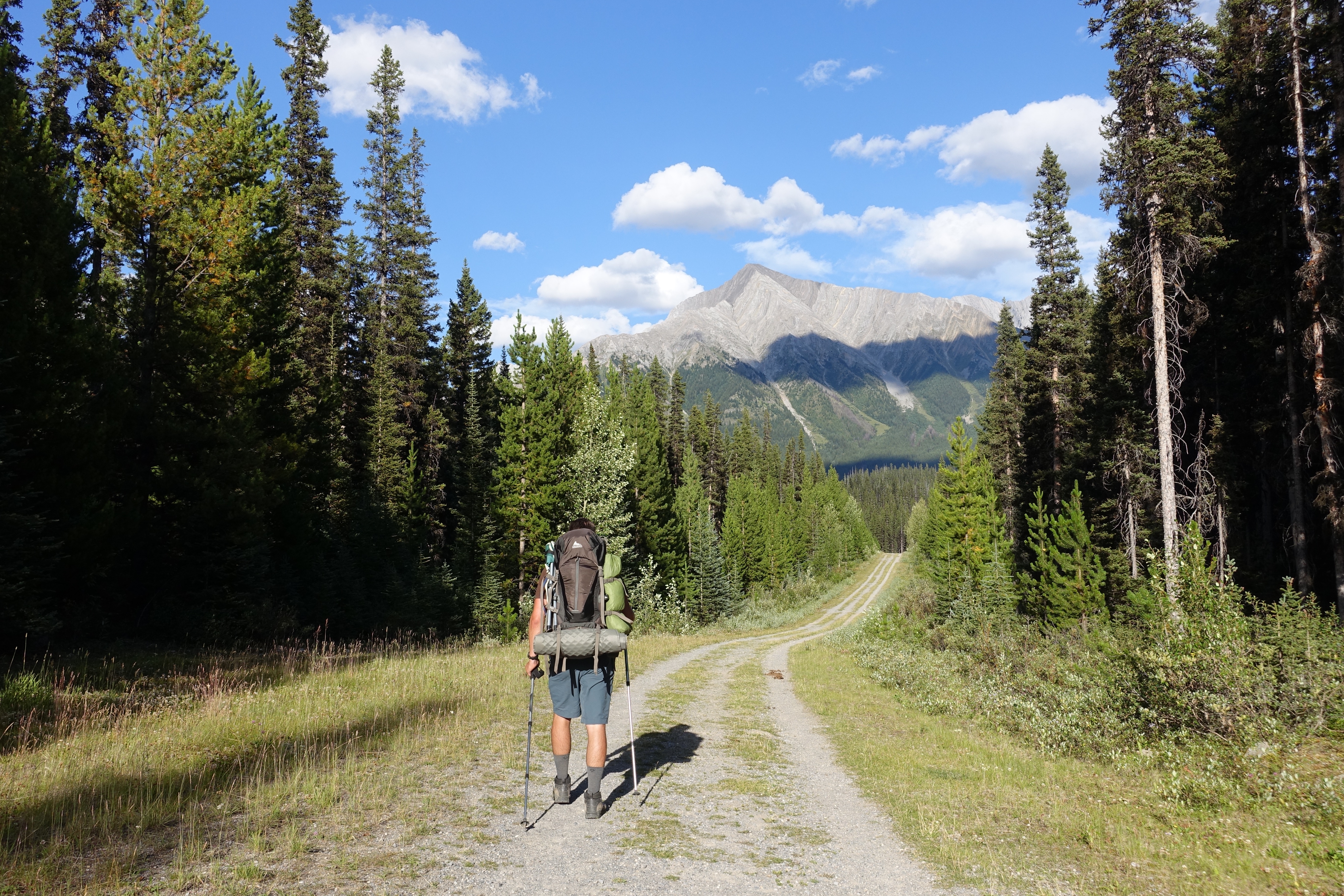
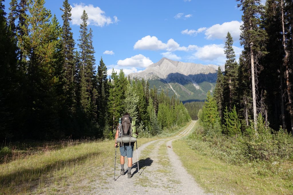
Day 3: Assiniboine to Shark Mountain (via Wonder Pass) – (30km)

We decided to take the longer, more scenic Wonder Pass route back to Mount Shark.  There is a more direct Horse Path, but a group of hikers we passed mentioned it was not nearly as scenic as Wonder Pass.  In hindsight it was a great decision.

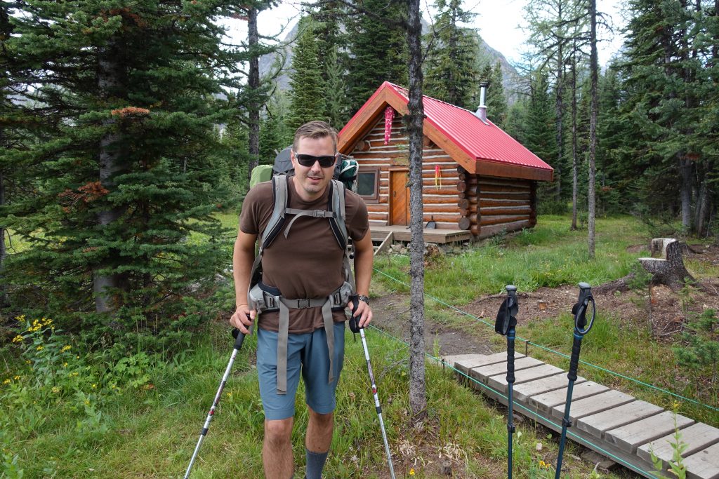
We got reasonable start in the morning and felt remarkably fine considering the past two days we had.  Although my pack was significantly lighter (no beer, less food), it didn’t actually feel any lighter.  We passed the Naiset Lodge, the only other Lodge in the area.  Where as the Assiniboine Lodge is very luxurious, the Naiset Lodge is as basic as it comes, just a stove and roof.  If I did another trip, especially in the winter I would love to stay here.

Hike up towards Wonder Pass.
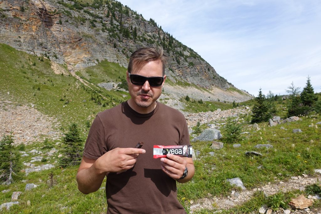
Fuel for the day.

Crossing back into Alberta.

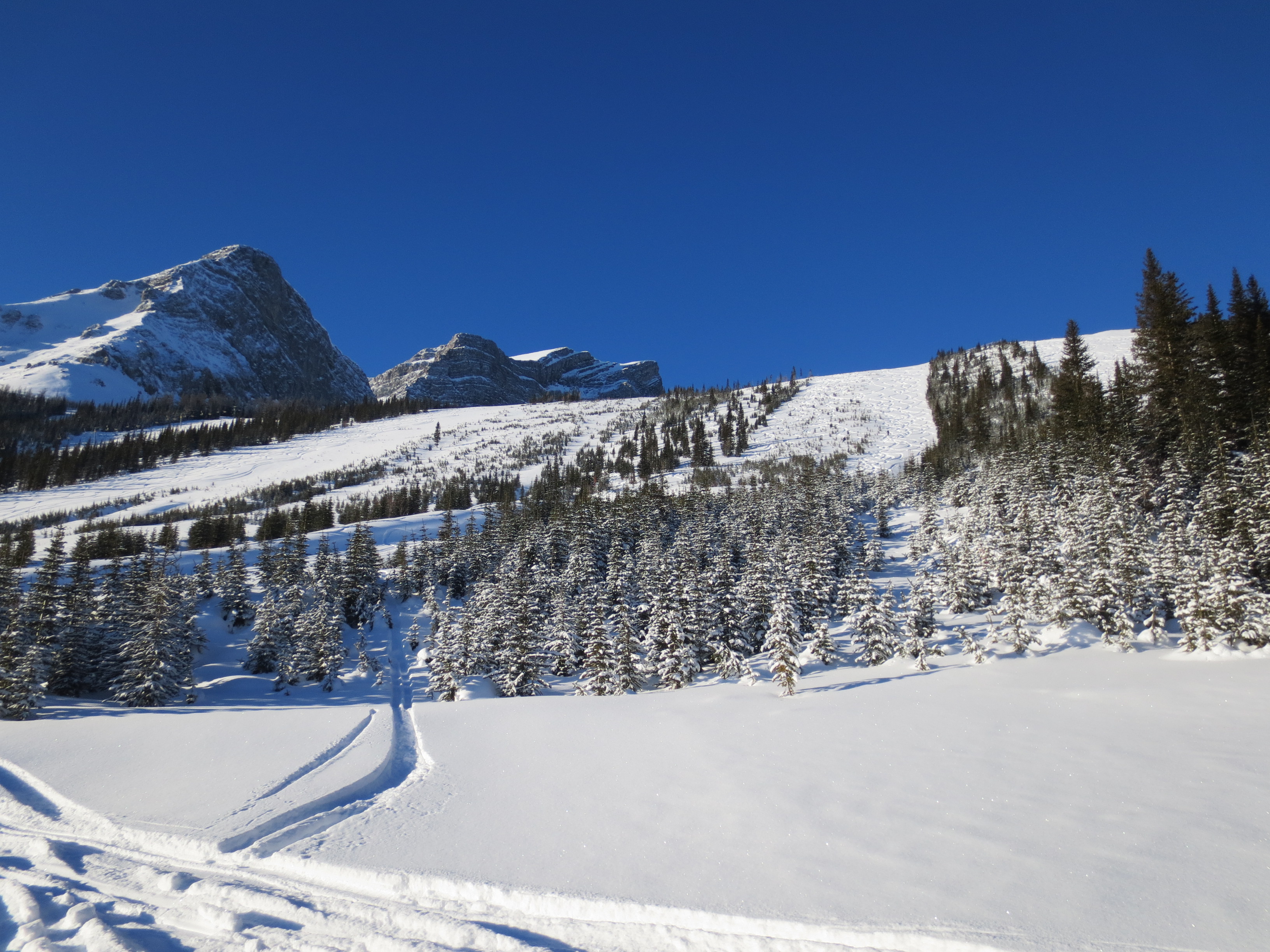
Valley leading down to Marvel Lake, one of the most scenic and amazing places we came across.

Its a large lake in a steep valley and the pictures just dont do it justice.

We came out at Bryant Creek and lost the trail.  We had to blaze our own trail, or at least follow what we assumed was the trail until we finally stumbled back onto the main trail.


We stopped at Big Springs Campground to refill our water and have lunch.  I had brought my water filter which makes it easy to fill up whenever you need (or whenever its accessible).  

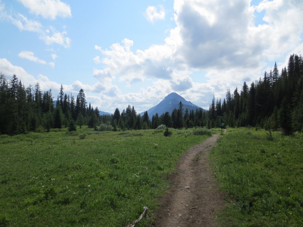
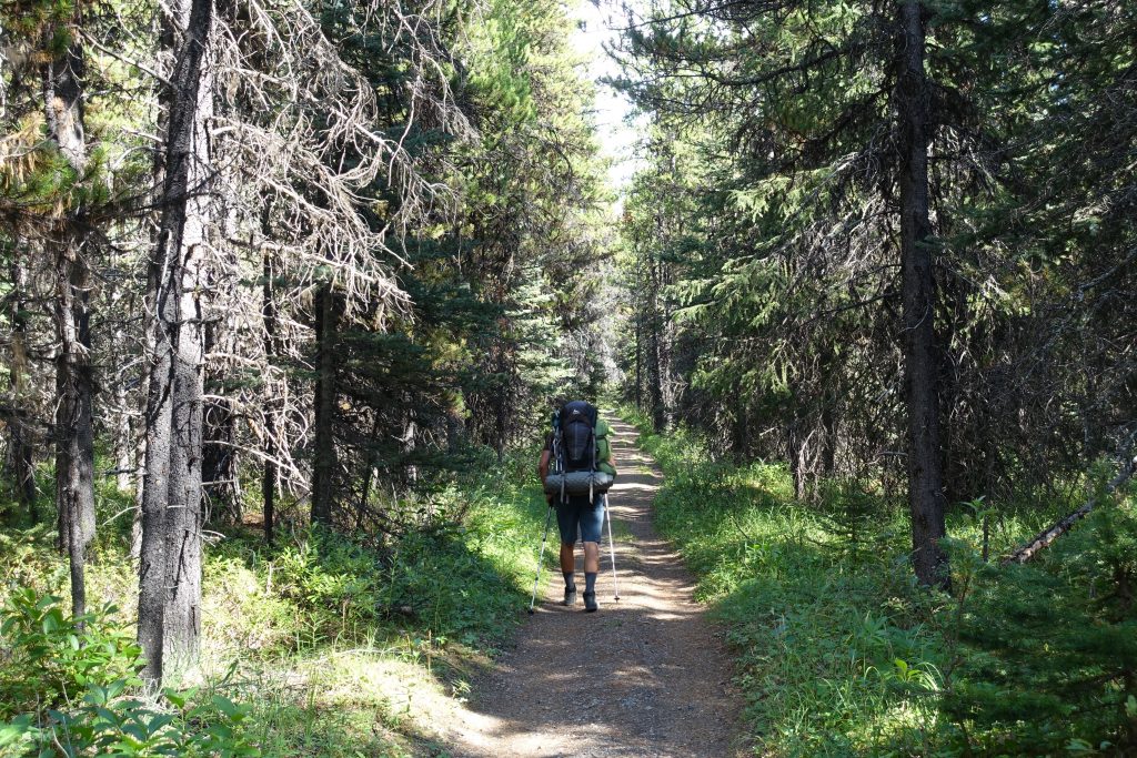
The trail from here was flat and forested. Not much for views, but super enjoyable, especially after the elevation we had scrambled in the past few days.

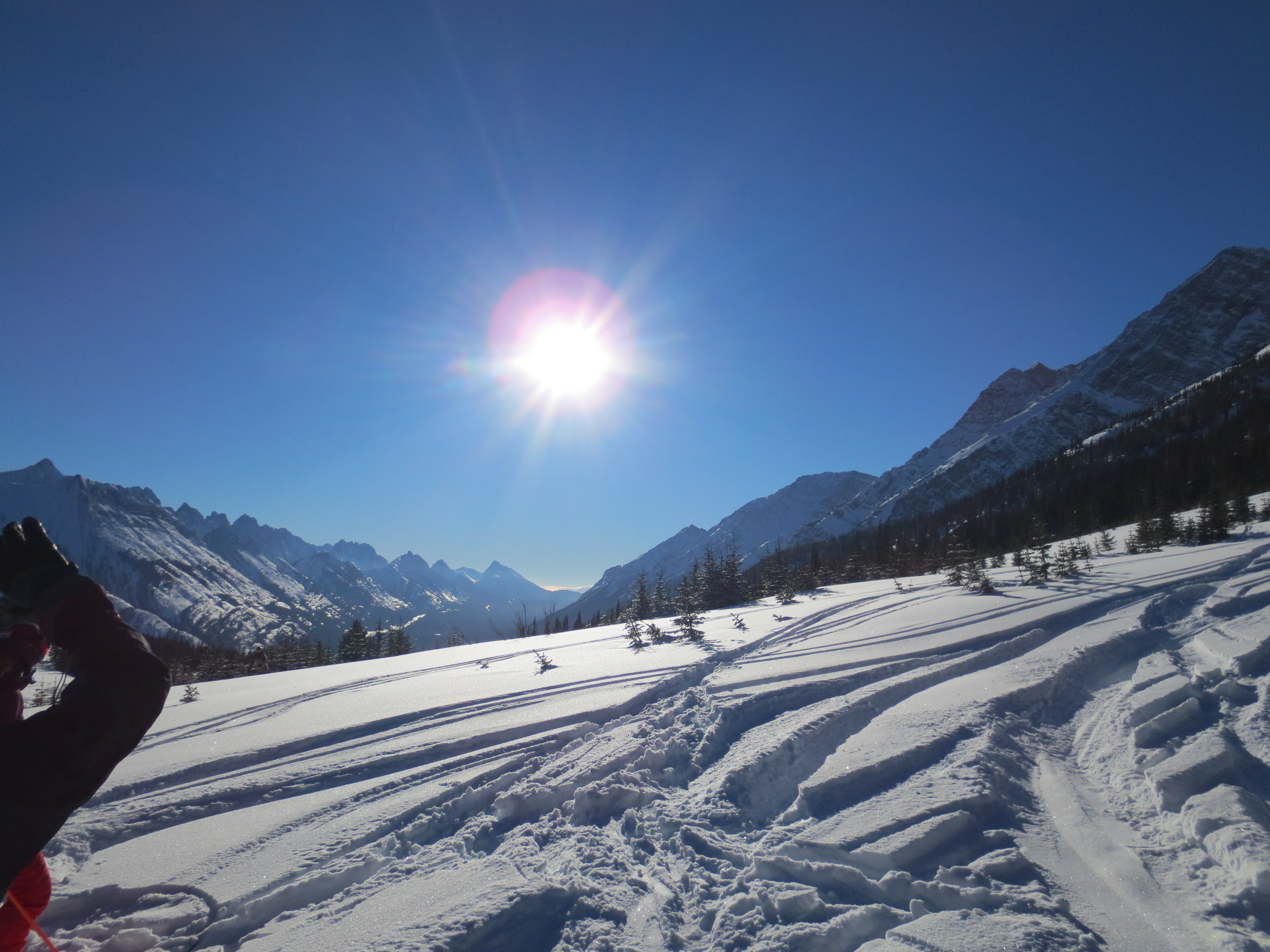
As you get closer to Mount Shark you start to see the Cross Country Ski trails and signs in the area.  I’ll definitely have to come back in the winter.

The home stretch:


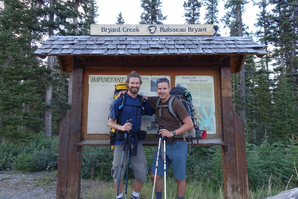
We made it!  What a trip, definietly one of the highlight hikes I’ve ever done.  Amazing weather, good company and stunning scenery.

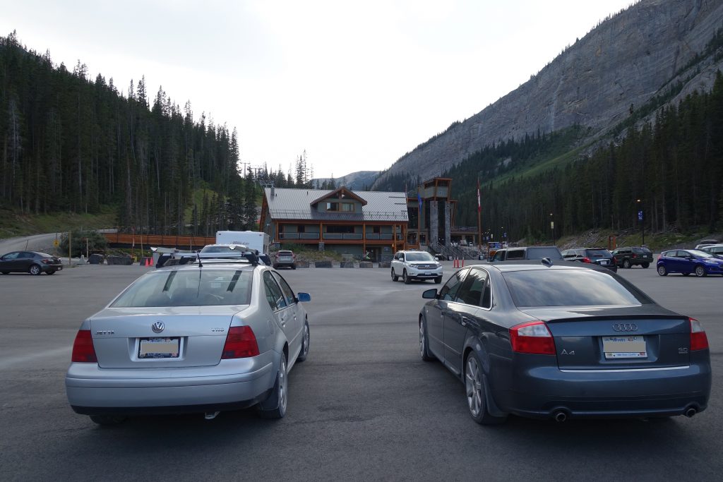
We drove back to pickup my car from the Sunshine Parking lot.  

Ryan and I head into Canmore for a beer and hearty meal.  I love this area and will definitely return.  I’m hoping to get out in the winter and ski from Mount Shark to Assiniboine Lodge.  Otherwise, I’d love to try to jog from Sunshine to Mount Shark in a day.  Time shall tell.


Where: Chester Lake, Alberta

Total Distance: 9.5 km

Having two kids really changes the types of adventures that fills your weekends, however, we decided as a family to test our stamina with a short yet rewarding hike up to Chester Lake.

One of us is excited

One of us is excited

The route is well marked and easy to follow.  The hike is a decent ascent up to Chester Lake, where we planned to have a picnic.

Chester Lake Hike

The route up is a wide easy trail and offers little views until you reach the top.


2015-07-05 Mount Chester 018_576x768 2015-07-05 Mount Chester 015_1024x768 2015-07-05 Mount Chester 010_1024x768


Once at the top the scenery is spectacular and well worth the “climb”:

2015-07-05 Mount Chester 028_1024x768

2015-07-05 Mount Chester 043_1024x768

2015-07-05 Mount Chester 067_1024x768

At the top is Chester Lake.  We were running short of time, but there is the option to hike around.  There is also a fork to head up to the elephant rocks.  We did not go, but it is highly recommended and only a few hundred meters further.

2015-07-05 Mount Chester 066_1024x768 2015-07-05 Mount Chester 065_1024x768

We stopped for a picnic and relaxed before heading back.

2015-07-05 Mount Chester 075_1024x768

2015-07-05 Mount Chester 055_1024x768 2015-07-05 Mount Chester 050_1024x768

Halfway was almost 4.5km, yet it took us 1 hour and 45 minutes due to the frequent stops with the little ones.

2015-07-05 Mount Chester 073_1024x768

2015-07-05 Mount Chester 084_1024x768 2015-07-05 Mount Chester 080_1024x768

The way down has an option to branch from the main trail, it is the same distance, but provides a bit of change from the route up.  Overall, it was a good hike for kids and well worth the trip.  The drive back to Calgary we stopped in Canmore and had dinner before driving home.

While riding my motorcycle up to Inuvik this summer I blew my radiator 10km into the Dempster highway. The thought of having to turn back and have this leg of my journey uncompleted was disappointing at best.

Last month when we attempted Northover Ridge we ran into heavy snowpack and had to turn back. For a month I had the same feeling of disappointment, call it OCD but with the snow season (in the mountains) fast approaching I didnt want to stew about it all winter. So, last weekend Ryan, Adam and I set out to attempt Northover again.

The plan was to get up early, complete the 35km circuit in a day, and drive back to Calgary. The weather forecast was sunny and cool, but heavy rain the past week was likely to translate to snow at higher elevations. Adam (who was on our original failed attemtpt), Ryan and I were before sunrise we were on the trial as the sun started to rise.

The water levels were significantly lower from last time:

Last time we were forced to wade through a raging creek, both pictures were taken from the same place one month apart, amazing what a month of warm weather does to the runoff.

Water Level in July

Water Level in August

The water level at Hidden Lake was also much lower, low enough we could easily walk along the shore rather than bushwack through the woods.  There is reason guide books say Northover is best hiked in August.  The last time I was up here the water line was well into the forest, that’s at least 20 feet higher.

Hidden Lake Trail

Hidden Lake at the base of the Aster Lake ascent


Hiking up to Aster Lake we reached the impeding snow pack that turned us back during the last attempt.  A stream of meltwater runs under the snowpack and carved a large cavern.  The snow pack was much smaller, but still offered the challenge of either walking over the cavern, or climbing around the pack and up a steep wall.  Now wanting to fall through the ice, we decided on climbing around.  If we had packs the climb around would have been extremely challenging.

Snow Pack from Last Year

Once on top of the Aster Lake headwall the view back towards Hidden Lake and Upper Kananaskis Lake was stunning.  We were about 3 hours into the hike and completed about 8.5km.

Hidden Lake with Upper Kananaskis Lake in the distance

It was another hour hike to Aster Lake where we were told by a group of campers that a mother Grizzly and her cub had come by 45 minutes earlier.

Trail up to Aster Lake

We loaded up on water at Aster and started the ascent across a scree field to the Northover base.


Scree Field up to Northover Summit

Even with 2 GPSs and 2 topo maps we made a navigational miscalculation.  Instead of taking the valley path towards Northover, we started climbing Warrior Mountain, this miscalculation would cost us a few hours, sliding down the back side of Warrior into the Northover Tarns and back up Northover.

Ridge Towards Warrior Mountain with Northover valley in the distance

It had snowed 10cm the previous night and we were stating to reach the snowline.

Aster Lake in the distance

Adam points towards Northover mountain, you can see the faint trail that heads up the side towards Northover ridge on the left.  The ridgeline is the border between Alberta and BC.

Northover Mountain in the distance with the ridgeline to the left

Sliding Down to Northover Tarns

Walking up the slopes to Northover Ridge

Looking back to Warrior mountain where we climbed mistakenly

View out to BC

Some hikers we passed were setting up camp at the Northover Tarns, you can see their tents setup on the below zoomin:

From the Tarns it was a few hour hike through slush to the top of the ridge.  It was discouraging to know we had already climbed this elevation back on Warrior, having to do it again on Northover.

The top was stunning with all the fresh snow, but a bit discouraging knowing we would have to traverse the ridge with wet slipperly snow covering the ridge.

Start of the Ridge

Looking into Purcell Range in BC

Looking into the BC side was green and heavily treed, the Alberta side was steep, rocky and void of anything but rock and snow.  Amazing how this ridgeline impacts the micro climates below.

Along the Ridge

For large sections the ridge flattens out and is easy to walk along.

The ridge is about 10km, towards the end you can start to see Three Isle Lake

Three Isle Lake in background

The Ridge starts to get much narrower, heavy packs or high winds would make this section extremely sketchy

Watch your footing, slipping off could easily be fatal

Down towards Three Isle

Down from the Ridge and into the valley towards Three Isle Lake.  My feet were soaked from the slush and the temperatures were dropping as the sun got low.

Three Isle Lake

Three Isle has a healthy stocked Trout population.  Last year we pulled a number of nice trout out of the lake. We only hiked to Three Isle and had large packs for a few nights camping, the ridge would be significantly more challenging with too much gear.

2011 with packs


Trout pulled from Three Isle


This year there was no time, but you could see them jumping.  Walking along the shore a curious trout actually jumped almost out of the lake at me as my shadow must have attracted him.  From here its downhill, but it was getting late, and we were getting tired.

Three Isle headwall

By the time we got back to the car it was dark and we were exhausted.  What should have been a 12 hour hike was 17 hours.

Last 2 hours in the dark

Overall the hike was well worth it, perfect weather.  Unfortunately none of us were too into any of the celebratory beers we left in the car.

With my calf muscle still in recovery, I thought it would be a good opportunity to do some cross training.  Trent has been gearing up for the Bow 80 mountain bike race, so he thought it would be a good confidence booster to bring me out for a ride and punish me.

One would think biking and jogging are similar, both using leg muscles with a dependency on cardiovascular fitness.  But biking muscles and jogging muscles are two very different things (at least in my non-expert experience).

After punishing me on Moose Mountain last week, leaving me with broken self esteem and a broken crank, I thought I would try to keep up this week.  Having Stampede far enough in the rear view mirror means I should at least start getting back to an acceptable level of fitness.

The results from last weeks ride

Trent, Doug, Rob and I decided to run the long loop, I was by far the slowest of the group, but I felt my fitness level coming back compared to last week.  I’m not sure what skill level is required to start wearing spandex, I hope I never get that good.

I thought I was taking video down the long declines, but it turns out the camera was just taking stills.  By the time I figured it out, most of the steep downhills were done.  As always I came back with a few bruises, going over the handle bars once, I’m thinking I need to trade the hardtail in for something with a better suited suspension.

Opps, not set to video mode

At the end of the ride Doug broke his BBQ and we had a few beers and burgers, good way to end the 22km ride.


Two days before leaving for Northover I decided to jog home from work as a warm-up and pulled my calf muscle.  So a day before I went in for some physio and ended up getting acupuncture.  I’ve never had acupuncture before, but figured I would do whatever it takes to be in game shape for the hike.  It ended up feeling great the entire hike, quite impressed.

With the forecast looking unpredictable, we headed out Friday after work and stopped off at the Stony Nakoda Casino for some carb loading.  Adam had 5 pieces of cake and washed it down with a beer, I knew at that point it was on.  Ashley and Lucy joined us for dinner then headed back to Calgary.

Carb Loading

Getting out to the mountain late meant there were no campsites left, so we decided to pitch a tent in a day use area knowing we would be up and out early the next morning.  Friday night it absolutely poured and the wind howled.  None of us got very good sleep and Glen left his hiking boots out in the rain.

The morning was cool and windy, but we decided to head out and see how far we can get.  The Traverse can be very dangerous if its wet or windy, so we knew turning back could be a possibility.  We made a big breakfast knowing it could be our last real meal until the evening.  Knowing that Bears like fish, we stuck to bacon and eggs for breakfast.  I haven’t ever seen Discovery channel footage of a Grizzly taking down a wild pig, so we figured it was safe to cook up.

Sunrise

Up at 5am


Breakfast

At 7:30 we hit the trail, within 20 minutes it was warm and in the trees the wind was dead.


There was a sign before heading out warning that some of the trail was flooded, with a 2 hour detour, after a couple hours in we came across the first stream crossing.  Usually this section crosses over a trickle of water, not even large enough for a bridge, but with all the rain and heavy snowpack in the mountains it was a fast moving river.

Flood

We hiked up to where the trail was flooded and found a section we thought we could cross.  We tested the depth and it was about waist deep so we decided to wade across.  The water was freezing and the current strong, but was by no means dangerous.  We saved a few hours by not hiking around, and it was a good opportunity to ice my calf muscle which was doing great.

Adam crossed first


We waded to an island in the middle, then Adam and Glen waded the last section which was much deeper, while I decided to walk the fallen log.  I made it without falling, but it could have been a bad decision if i slipped off.

Across the other side

We missed the fork in the trail due to the flooding and missed the turn to Hidden Lake.  We walked about 1km past before we realized it, but decided to take a small game trail shortcut instead of backtracking.  The trail around hidden lake was brutal, because the official trail was under water, the trail we took wasnt much better than bushwacking.  Every 20 meters was another fallen log(s) to climb over, the forest was thick and wet and mosquitoes were out.  Everyone was hoping we wouldn’t have to come back through this trail.

At the end was the climb to Aster Lake.

Water fall below Aster Lake

Hidden Lake with Upper Kananaskis Lake behind it.

We got up to the last crest before Aster Lake when we hit a few streams to cross, then a large Snow Field.  This year had heavy snow fall, and a cool spring which meant the trail was a few feet under snow.  With a steep grade of around 45 degrees we debated the best way to get across.  Adam, being the most capable climber decided to go across first and see if there was any way around.  We thought we could use the back wall to pull us up, but there was a 6 foot crevass between the snow and wall.  The snow had a waterfall running into it, and a water fall running out the bottom.  A slip and fall here meant you may slide down the snow and over the edge.  After exploring a few areas to get around we decided we would only meet more snow ahead and it wasnt worth the risk.

Adam crossing the drift


Adam with Northover Ridge in the distance

Looking up at the Traverse we saw black clouds and high winds.  Disappointed, but knowing there was cold beer back at the car, we decided to turn back.

By the time we got back to Upper Kananaskis, the sun was out and it was a perfect day, but the you could still see the black clouds over the ridge.

Happy

Not Happy

In the end we did about 25km, but never made it over the ridge. In another month (late August) the snow should be melted and we can attempt it again.

Orange was actual route

Before leaving next time we’ll make sure to check current trail reports and area advisories.

Northover Ridge in Kananaskis Country is a typically 3 day hike through some of the most scenic terrain in Kananaskis Country in Alberta.  Being guys we decided it would be a good idea to attempt this in one day.  I figured the 10 days of Stampede partying was perfect training for a 40ish km hike/climb.  At the least it would enable us to sweat out some of the beer that still lingered in our bloodstream.  Our plan is to pack light and move fast, many people have completed this in one day, so I’m expecting the same.

Our route is roughly mapped out below:

Northover Ridge Path heading towards 3Isle then over the ridge

There have been a number of Bear warnings for the area, so along with some basic survival gear we’ll be packing some bear spray.  We anticipate a 12-15 hour round trip, I’ll be bringing the Spot which will be our only method of communication.